
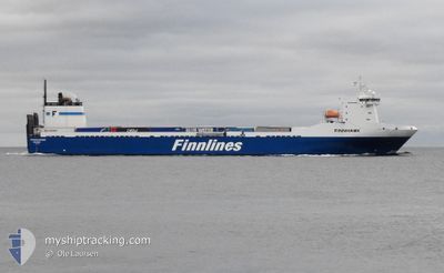
FINNHAWK
Ro-Ro Cargo
Current Trip
| Time Travelled | 1 day |
|---|---|
| Remaining Time | 15 h, 9 mins |
| Distance Travelled | 871.10 nm |
| Remaining Distance | 290.25 nm |
| AVG Speed | 17.9 Knots |
| MAX Speed | 20.4 Knots |
| AVG Wind | 15.2 knots |
| MAX Wind | 28 knots |
| MIN Temp | 2.4°C / 36.32°F |
| MAX Temp | 8.8°C / 47.84°F |
| Draught | 6.5 m |
| Position Received | 2 h, 44 m ago |
Current Position
| Longitude | 17.41032° |
|---|---|
| Latitude | 56.33561° |
| Status | Under way using engine |
| Speed | 18.8 Knots |
| Course | 51.3° |
| Area | Baltic Sea |
| Station | T-AIS |
| Position Received | 2 h, 44 m ago |
Info
Information
The current position of FINNHAWK is in Baltic Sea with coordinates 56.33561° / 17.41032° as reported on 2024-04-16 16:45 by AIS to our vessel tracker app. The vessel's current speed is 18.8 Knots and is heading at the port of HELSINKI. The estimated time of arrival as calculated by MyShipTracking vessel tracking app is 2024-04-17 10:39 LT
The vessel FINNHAWK (IMO: 9207895, MMSI: 230007000) is a Ro-Ro Cargo that was built in 2001 ( 23 years old ). It's sailing under the flag of [FI] Finland.
In this page you can find informations about the vessels current position, last detected port calls, and current voyage information. If the vessels is not in coverage by AIS you will find the latest position.
The current position of FINNHAWK is detected by our AIS receivers and we are not responsible for the reliability of the data. The last position was recorded while the vessel was in Coverage by the Ais receivers of our vessel tracking app.
The current draught of FINNHAWK as reported by AIS is 6.5 meters
Weather
| Temperature | 3.7°C / 38.66°F |
|---|---|
| Wind Speed | 14 knots |
| Direction | 8° N |
| Pressure | 1000.4 hPa |
| Humidity | 84.7 % |
| Cloud Coverage | 21 % |
Featured Company
Last Port Calls
| Port | Arrival | Departure | Time In Port |
|---|---|---|---|
| 2024-04-14 09:35 | 2024-04-14 20:36 | 11 h | |
| 2024-04-09 03:02 | 2024-04-11 11:08 | 2 d | |
| 2024-03-14 08:20 | 2024-04-06 06:06 | 22 d | |
| 2024-03-10 08:20 | 2024-03-11 09:16 | 1 d | |
| 2024-03-07 03:03 | 2024-03-07 16:49 | 13 h | |
| 2024-03-02 15:08 | 2024-03-03 20:10 | 1 d | |
| 2024-02-28 10:48 | 2024-02-28 23:18 | 12 h | |
| 2024-02-24 17:45 | 2024-02-25 10:23 | 16 h | |
| 2024-02-21 11:54 | 2024-02-22 02:06 | 14 h | |
| 2024-02-14 13:01 | 2024-02-18 11:29 | 3 d |
Most Visited Ports (Last year)
| Port | Arrivals | |
|---|---|---|
| 44 | ||
| 43 | ||
| 1 | ||
| 1 | ||
| 1 |
Last Trips
| Origin | Departure | Destination | Arrival | Distance | |
|---|---|---|---|---|---|
| 2024-04-11 14:08 | 2024-04-14 10:35 | 1189.57 nm | |||
| 2024-04-06 07:06 | 2024-04-09 06:02 | 1182.01 nm | |||
| 2024-03-11 11:16 | 2024-03-14 08:20 | 1174.71 nm | |||
| 2024-03-07 16:49 | 2024-03-10 10:20 | 1173.53 nm | |||
| 2024-03-03 22:10 | 2024-03-07 03:03 | 1184.69 nm | |||
| 2024-02-28 23:18 | 2024-03-02 17:08 | 1175.73 nm | |||
| 2024-02-25 12:23 | 2024-02-28 10:48 | 1174.92 nm | |||
| 2024-02-22 02:06 | 2024-02-24 19:45 | 1173.38 nm | |||
| 2024-02-18 13:29 | 2024-02-21 11:54 | 1173.31 nm | |||
| 2024-02-11 20:37 | 2024-02-14 15:01 | 1174.80 nm |
Events
| Time | Event | Details | Position / Dest | Info |
|---|---|---|---|---|
| 2024-04-16 16:52 | Status Changed | Default Under way using engine |
56.35551 / 17.45540
HELSINKI
|
Speed: 18.8 kn Course: 51.3° |
| 2024-04-16 16:45 | OUT of Coverage |
56.33561 / 17.41032
Baltic Sea
HELSINKI
|
Speed: 18.8 kn Course: 51.3° |
|
| 2024-04-16 12:16 | Change Sea Area | Swedish part of the Baltic Sea Danish part of the Kattegat |
55.62691 / 15.36491
Baltic Sea
HELSINKI
|
Speed: 17.9 kn Course: 66.1° |
| 2024-04-16 09:37 | Change Sea Area | Danish part of the Kattegat Swedish part of the Baltic Sea |
55.19557 / 14.31583
Kattegat
HELSINKI
|
Speed: 17.2 kn Course: 77.8° |
| 2024-04-16 06:25 | Change Sea Area | Swedish part of the Baltic Sea Danish part of the Baltic Sea |
55.29280 / 12.65715
Baltic Sea
HELSINKI
|
Speed: 18.2 kn Course: 119.3° |
| 2024-04-16 06:20 | Change Sea Area | Danish part of the Baltic Sea Danish part of the Kattegat |
55.31313 / 12.63357
Baltic Sea
HELSINKI
|
Speed: 18.6 kn Course: 171.9° |
| 2024-04-16 06:16 | Change Sea Area | Danish part of the Kattegat Swedish part of the Kattegat |
55.33403 / 12.63706
Kattegat
HELSINKI
|
Speed: 18.5 kn Course: 189.8° |
| 2024-04-16 05:50 | Change Sea Area | Swedish part of the Kattegat Danish part of the Kattegat |
55.45983 / 12.67718
Kattegat
HELSINKI
|
Speed: 16.7 kn Course: 191° |
| 2024-04-16 04:01 | Change Sea Area | Danish part of the Kattegat Swedish part of the Kattegat |
55.93024 / 12.64923
Kattegat
HELSINKI
|
Speed: 19.7 kn Course: 193.1° |
| 2024-04-16 03:44 | Change Sea Area | Swedish part of the Kattegat Danish part of the Kattegat |
56.01721 / 12.66093
Kattegat
HELSINKI
|
Speed: 18.5 kn Course: 162.2° |