
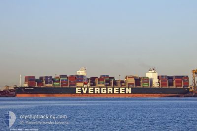
EVER FAME
Cargo D
Current Trip
| Time Travelled | 6 days |
|---|---|
| Remaining Time | --- |
| Distance Travelled | 3087.79 nm |
| Remaining Distance | --- |
| AVG Speed | 18.3 Knopen |
| MAX Speed | 22.8 Knopen |
| AVG Wind | 13.2 knots |
| MAX Wind | 29 knots |
| MIN Temp | 12.9°C / 55.22°F |
| MAX Temp | 22.6°C / 72.68°F |
| Diepgang | 11.4 M |
| Positie ontvangen | 5 d geleden |
Current Position
| Lengtegraad | --- |
|---|---|
| Breedtegraat | --- |
| Status | Under way using engine |
| Snelheid | 18.8 Knopen |
| Koers | 270.2° |
| Gebied | North Pacific Ocean |
| Station | T-AIS |
| Positie ontvangen | 5 d geleden |
Info
Information
The current position of EVER FAME is in North Pacific Ocean with coordinates 39.83355° / -126.82359° as reported on 2024-09-28 03:39 by AIS to our vessel tracker app. The vessel's current speed is 18.8 Knopen and is heading at the port of KAOHSIUNG. The estimated time of arrival as calculated by MyShipTracking vessel tracking app is 2024-10-11 01:00 LT
The vessel EVER FAME (IMO: 9850800, MMSI: 373712000) is a Cargo D It's sailing under the flag of [PA] Panama.
In this page you can find informations about the vessels current position, last detected port calls, and current voyage information. If the vessels is not in coverage by AIS you will find the latest position.
The current position of EVER FAME is detected by our AIS receivers and we are not responsible for the reliability of the data. The last position was recorded while the vessel was in Coverage by the Ais receivers of our vessel tracking app.
The current draught of EVER FAME as reported by AIS is 11.4 meters
Weather
| Temperature | 12.9°C / 55.22°F |
|---|---|
| Wind Speed | 12 knots |
| Direction | 329° NNW |
| Pressure | 1030.3 hPa |
| Humidity | 71.3 % |
| Cloud Coverage | 6 % |
Featured Company
Last Port Calls
| Port | Arrival | Departure | Time In Port |
|---|---|---|---|
| 2024-09-25 05:33 | 2024-09-27 05:19 | 1 d | |
| 2024-09-19 03:33 | 2024-09-23 18:54 | 4 d | |
| 2024-09-01 16:58 | 2024-09-03 00:09 | 1 d | |
| 2024-08-29 00:08 | 2024-08-30 23:24 | 1 d | |
| 2024-08-20 10:17 | 2024-08-21 07:37 | 21 h |
Last Trips
| Origin | Departure | Destination | Arrival | Distance | |
|---|---|---|---|---|---|
| 2024-09-23 18:54 | 2024-09-25 05:33 | 386.03 nm | |||
| 2024-09-03 00:09 | 2024-09-19 03:33 | 6415.42 nm | |||
| 2024-08-30 23:24 | 2024-09-01 16:58 | 349.84 nm | |||
| 2024-08-21 07:37 | 2024-08-29 00:08 | 2159.89 nm | |||
| 2024-07-18 19:22 | 2024-08-20 10:17 | 12413.06 nm |
Events
| Tijd | Evenement | Details | Positie / Bestemming | Info |
|---|---|---|---|---|
| 2024-09-28 03:47 | Status Changed | Default Under way using engine |
39.83396 / -126.87615
KAOHSIUNG
|
Snelheid: 18.8 kn Koers: 270.2° |
| 2024-09-28 03:39 | Buitenbereik |
39.83355 / -126.82359
North Pacific Ocean
KAOHSIUNG
|
Snelheid: 18.8 kn Koers: 270.2° |
|
| 2024-09-28 03:26 | Status Changed | Under way using engine Default |
39.83319 / -126.73342
KAOHSIUNG
|
Snelheid: 19.2 kn Koers: 270° |
| 2024-09-28 03:11 | Binnenbereik |
39.83324 / -126.74808
North Pacific Ocean
KAOHSIUNG
|
Snelheid: 18.8 kn Koers: 270.8° |
|
| 2024-09-27 20:38 | Status Changed | Default Under way using engine |
38.99506 / -124.49484
KAOHSIUNG
|
Snelheid: 19.6 kn Koers: 322.7° |
| 2024-09-27 20:32 | Buitenbereik |
38.96661 / -124.46733
North Pacific Ocean
KAOHSIUNG
|
Snelheid: 19.6 kn Koers: 322.7° |
|
| 2024-09-27 12:19 | Vertrekhaven |
|
37.80577 / -122.34538
KAOHSIUNG
|
Snelheid: 3.9 kn Koers: 238° |
| 2024-09-27 12:17 | Start beweging |
37.80726 / -122.34281
[US] OAKLAND
|
Snelheid: 3.1 kn Koers: 238° |
|
| 2024-09-27 12:09 | Status Changed | Under way using engine Moored |
37.80752 / -122.34018
[US] OAKLAND
|
Snelheid: Koers: 236° |
| 2024-09-27 11:13 | Draught Changed | 11.4 11 |
37.80751 / -122.34016
[US] OAKLAND
|
Snelheid: Koers: 236° |