
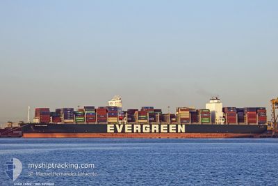
EVER FAME
Cargo D
Current Trip
| Trip Time | 2 days |
|---|---|
| Trip Distance | 567.63 nm |
| AVG Speed | 14.2 Knots |
| MAX Speed | 17.9 Knots |
| Dybgang | 10.4 m |
| AVG Wind | 10.9 knots |
| MAX Wind | 21.3 knots |
| MIN Temp | 2.3°C / 36.14°F |
| MAX Temp | 7°C / 44.6°F |
| Position Modtaget | 4 d siden |
Current Position
| Longitude | --- |
|---|---|
| Latitude | --- |
| Status | Under way using engine |
| Fart | 7.8 Knots |
| Kurs | 338.9° |
| Område | Japan Sea |
| Station | T-AIS |
| Position Modtaget | 4 d siden |
Info
Information
The current position of EVER FAME is in Japan Sea with coordinates 34.97468° / 128.81457° as reported on 2025-02-23 07:57 by AIS to our vessel tracker app. The vessel's current speed is 7.8 Knots and is currently inside the port of QINGDAO.
The vessel EVER FAME (IMO: 9850800, MMSI: 373712000) is a Cargo D It's sailing under the flag of [PA] Panama.
In this page you can find informations about the vessels current position, last detected port calls, and current voyage information. If the vessels is not in coverage by AIS you will find the latest position.
The current position of EVER FAME is detected by our AIS receivers and we are not responsible for the reliability of the data. The last position was recorded while the vessel was in Coverage by the Ais receivers of our vessel tracking app.
The current draught of EVER FAME as reported by AIS is 10.4 meters
Weather
| Temperature | 5.6°C / 42.08°F |
|---|---|
| Wind Speed | 6 knots |
| Direction | 156° SSE |
| Pressure | 1019.5 hPa |
| Humidity | 92.9 % |
| Cloud Coverage | --- |
Featured Company
Last Port Calls
| Port | Arrival | Departure | Time In Port |
|---|---|---|---|
| 2025-02-26 22:17 | |||
| 2025-02-23 09:09 | 2025-02-24 03:42 | 18 h | |
| 2025-02-07 16:23 | 2025-02-10 02:07 | 2 d | |
| 2025-01-30 22:06 | 2025-02-05 03:25 | 5 d | |
| 2025-01-15 02:33 | 2025-01-16 14:53 | 1 d | |
| 2025-01-09 00:16 | 2025-01-10 16:24 | 1 d | |
| 2024-12-13 01:32 | 2024-12-15 07:33 | 2 d | |
| 2024-12-06 23:07 | 2024-12-08 08:03 | 1 d | |
| 2024-12-03 14:19 | 2024-12-04 13:17 | 22 h | |
| 2024-12-01 07:12 |
Last Trips
| Origin | Departure | Destination | Arrival | Distance | |
|---|---|---|---|---|---|
| 2025-02-24 12:42 | 2025-02-27 06:17 | 567.63 nm | |||
| 2025-02-09 18:07 | 2025-02-23 18:09 | 5068.43 nm | |||
| 2025-02-04 19:25 | 2025-02-07 08:23 | 421.20 nm | |||
| 2025-01-16 22:53 | 2025-01-30 14:06 | 5834.63 nm | |||
| 2025-01-11 00:24 | 2025-01-15 10:33 | 659.76 nm | |||
| 2024-12-15 02:33 | 2025-01-09 08:16 | 9453.41 nm | |||
| 2024-12-08 03:03 | 2024-12-12 20:32 | 1975.19 nm | |||
| 2024-12-04 08:17 | 2024-12-06 18:07 | 385.80 nm | |||
| 2024-12-01 02:12 | 2024-12-03 09:19 | 900.94 nm |
Events
| Tid | Hændelsen | Detaljer | Position / Dest | Info |
|---|---|---|---|---|
| 2025-02-26 23:42 | STOP Sejllads |
36.01078 / 120.20895
[CN] QINGDAO
|
Fart: Kurs: 222° |
|
| 2025-02-26 22:17 | Skibe i havn |
|
36.02262 / 120.35804
[CN] QINGDAO
|
Fart: 7.7 kn Kurs: 282° |
| 2025-02-26 18:53 | START Sejllads |
35.73439 / 121.00268
KRPUS
|
Fart: 4.8 kn Kurs: 229° |
|
| 2025-02-25 16:25 | STOP Sejllads |
35.73588 / 121.00702
KRPUS
|
Fart: 0.1 kn Kurs: 292° |
|
| 2025-02-24 03:42 | Afsejlet fra sidste havn |
|
35.03431 / 128.78178
KRPUS
|
Fart: 7.9 kn Kurs: 200° |
| 2025-02-24 03:17 | START Sejllads |
35.07180 / 128.80461
[KR] BUSAN NEW PORT
|
Fart: 3.8 kn Kurs: 270° |
|
| 2025-02-23 09:09 | STOP Sejllads |
35.06754 / 128.80827
[KR] BUSAN NEW PORT
|
Fart: Kurs: 80° |
|
| 2025-02-23 09:09 | Skibe i havn |
|
35.06754 / 128.80827
[KR] BUSAN NEW PORT
|
Fart: 0.6 kn Kurs: 79° |
| 2025-02-23 08:00 | Status er ændret | Default Under way using engine |
34.98139 / 128.81168
KRPUS
|
Fart: 7.8 kn Kurs: 338.9° |
| 2025-02-23 07:57 | Udenfor Dækning |
34.97468 / 128.81457
Japan Sea
KRPUS
|
Fart: 7.8 kn Kurs: 338.9° |