

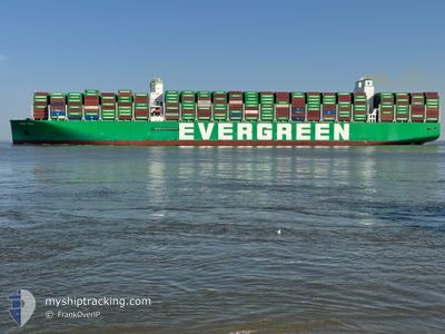
EVER ARIA
Cargo D

Current Trip
| Time Travelled | 20 days |
|---|---|
| Remaining Time | 2 days |
| Distance Travelled | 9466.38 nm |
| Remaining Distance | 1428.48 nm |
| AVG Speed | 18.4 Knopen |
| MAX Speed | 23 Knopen |
| AVG Wind | 10.9 knots |
| MAX Wind | 28.5 knots |
| MIN Temp | 7°C / 44.6°F |
| MAX Temp | 29°C / 84.2°F |
| Diepgang | 12.7 M |
| Positie ontvangen | 4 d geleden |
Current Position
| Lengtegraad | --- |
|---|---|
| Breedtegraat | --- |
| Status | Under way using engine |
| Snelheid | 18.9 Knopen |
| Koers | 63.7° |
| Gebied | Indian Ocean |
| Station | T-AIS |
| Positie ontvangen | 4 d geleden |
Information
The current position of EVER ARIA is in Indian Ocean with coordinates -31.04347° / 36.27739° as reported on 2025-03-23 15:14 by AIS to our vessel tracker app. The vessel's current speed is 18.9 Knopen and is heading at the port of COLOMBO. The estimated time of arrival as calculated by MyShipTracking vessel tracking app is 2025-03-31 09:40 LT
The vessel EVER ARIA (IMO: 9909132, MMSI: 352001747) is a Cargo D It's sailing under the flag of [PA] Panama.
In this page you can find informations about the vessels current position, last detected port calls, and current voyage information. If the vessels is not in coverage by AIS you will find the latest position.
The current position of EVER ARIA is detected by our AIS receivers and we are not responsible for the reliability of the data. The last position was recorded while the vessel was in Coverage by the Ais receivers of our vessel tracking app.
The current draught of EVER ARIA as reported by AIS is 12.7 meters
Weather
| Temperature | 28.9°C / 84.02°F |
|---|---|
| Wind Speed | 11 knots |
| Direction | 93° E |
| Pressure | 1011.3 hPa |
| Humidity | 74.4 % |
| Cloud Coverage | 61 % |


Featured Company
Last Port Calls
| Port | Arrival | Departure | Time In Port |
|---|---|---|---|
| 2025-03-03 19:35 | 2025-03-07 08:35 | 3 d | |
| 2025-02-20 21:24 | 2025-02-25 16:47 | 4 d | |
| 2025-01-12 17:26 | 2025-01-13 08:40 | 15 h | |
| 2025-01-07 17:05 | 2025-01-09 02:21 | 1 d | |
| 2025-01-05 12:10 | 2025-01-06 05:53 | 17 h | |
| 2025-01-01 14:53 | 2025-01-02 14:36 | 23 h |
Last Trips
| Origin | Departure | Destination | Arrival | Distance | |
|---|---|---|---|---|---|
| 2025-02-25 16:47 | 2025-03-03 19:35 | 567.74 nm | |||
| 2025-01-13 08:40 | 2025-02-20 21:24 | 11865.57 nm | |||
| 2025-01-09 02:21 | 2025-01-12 17:26 | 1468.11 nm | |||
| 2025-01-06 05:53 | 2025-01-07 17:05 | 458.79 nm | |||
| 2025-01-02 14:36 | 2025-01-05 12:10 | 487.30 nm | |||
| 2024-12-30 15:56 | 2025-01-01 14:53 | 463.79 nm |
Events
| Tijd | Evenement | Details | Positie / Bestemming | Info |
|---|---|---|---|---|
| 2025-03-23 15:19 | Status Changed | Default Under way using engine |
-31.03152 / 36.30542
DEHAM > LKCMB
|
Snelheid: 18.9 kn Koers: 63.7° |
| 2025-03-23 15:14 | Buitenbereik |
-31.04347 / 36.27739
Indian Ocean
DEHAM > LKCMB
|
Snelheid: 18.9 kn Koers: 63.7° |
|
| 2025-03-23 15:06 | Status Changed | Under way using engine Default |
-31.06394 / 36.22935
DEHAM > LKCMB
|
Snelheid: 19.1 kn Koers: 65° |
| 2025-03-23 14:59 | Status Changed | Default Under way using engine |
-31.07800 / 36.19540
DEHAM > LKCMB
|
Snelheid: 19 kn Koers: 64.4° |
| 2025-03-23 14:35 | Status Changed | Under way using engine Default |
-31.13397 / 36.06033
DEHAM > LKCMB
|
Snelheid: 19.3 kn Koers: 65° |
| 2025-03-23 14:24 | Status Changed | Default Under way using engine |
-31.16004 / 35.99768
DEHAM > LKCMB
|
Snelheid: 19.1 kn Koers: 62.7° |
| 2025-03-23 13:25 | Status Changed | Under way using engine Default |
-31.30274 / 35.67666
DEHAM > LKCMB
|
Snelheid: 18.8 kn Koers: 63° |
| 2025-03-23 13:19 | Status Changed | Default Under way using engine |
-31.31777 / 35.64250
DEHAM > LKCMB
|
Snelheid: 18.6 kn Koers: 63.3° |
| 2025-03-23 13:00 | Status Changed | Under way using engine Default |
-31.36324 / 35.53801
DEHAM > LKCMB
|
Snelheid: 18.8 kn Koers: 63° |
| 2025-03-23 12:52 | Status Changed | Default Under way using engine |
-31.38231 / 35.49308
DEHAM > LKCMB
|
Snelheid: 19 kn Koers: 65.5° |