
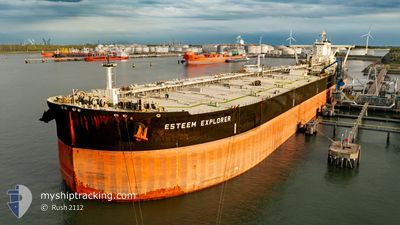
ESTEEM EXPLORER
Tanker
Current Trip
| Time Travelled | 10 days |
|---|---|
| Remaining Time | --- |
| Distance Travelled | 2845.62 nm |
| Remaining Distance | --- |
| AVG Speed | 11.8 Knopen |
| MAX Speed | 15.9 Knopen |
| AVG Wind | 14.4 knots |
| MAX Wind | 36.3 knots |
| MIN Temp | 19.4°C / 66.92°F |
| MAX Temp | 29.3°C / 84.74°F |
| Diepgang | 18.7 M |
| Positie ontvangen | 4 d geleden |
Current Position
| Lengtegraad | -78.35681° |
|---|---|
| Breedtegraat | 27.68134° |
| Status | Under way using engine |
| Snelheid | 10.3 Knopen |
| Koers | 81° |
| Gebied | North Atlantic Ocean |
| Station | T-AIS |
| Positie ontvangen | 4 d geleden |
Info
Information
The current position of ESTEEM EXPLORER is in North Atlantic Ocean with coordinates 27.68134° / -78.35681° as reported on 2024-05-31 16:26 by AIS to our vessel tracker app. The vessel's current speed is 10.3 Knopen and is heading at the port of ROTTERDAM. The estimated time of arrival as calculated by MyShipTracking vessel tracking app is 2024-06-14 19:00 LT
The vessel ESTEEM EXPLORER (IMO: 9855484, MMSI: 355051000) is a Tanker It's sailing under the flag of [PA] Panama.
In this page you can find informations about the vessels current position, last detected port calls, and current voyage information. If the vessels is not in coverage by AIS you will find the latest position.
The current position of ESTEEM EXPLORER is detected by our AIS receivers and we are not responsible for the reliability of the data. The last position was recorded while the vessel was in Coverage by the Ais receivers of our vessel tracking app.
The current draught of ESTEEM EXPLORER as reported by AIS is 18.7 meters
Weather
| Temperature | 24°C / 75.2°F |
|---|---|
| Wind Speed | 32 knots |
| Direction | 209° SSW |
| Pressure | 1008.3 hPa |
| Humidity | 86.3 % |
| Cloud Coverage | 100 % |
Featured Company
Last Port Calls
| Port | Arrival | Departure | Time In Port |
|---|---|---|---|
| 2024-05-23 14:14 | 2024-05-25 07:30 | 1 d | |
| 2024-04-26 15:15 | 2024-04-27 16:57 | 1 d | |
| 2024-04-24 03:42 | 2024-04-26 14:51 | 2 d | |
| 2024-04-02 09:19 |
Most Visited Ports (Last year)
| Port | Arrivals | |
|---|---|---|
| 3 | ||
| 2 | ||
| 1 | ||
| 1 |
Last Trips
| Origin | Departure | Destination | Arrival | Distance | |
|---|---|---|---|---|---|
| 2024-04-27 16:57 | 2024-05-23 14:14 | 5515.40 nm | |||
| 2024-04-26 14:51 | 2024-04-26 15:15 | 1.95 nm | |||
| 2024-04-02 09:19 | 2024-04-24 03:42 | 5766.22 nm |
Events
| Tijd | Evenement | Details | Positie / Bestemming | Info |
|---|---|---|---|---|
| 2024-05-31 16:42 | Status Changed | Default Under way using engine |
27.68864 / -78.30491
NL RTM
|
Snelheid: 10.3 kn Koers: 81° |
| 2024-05-31 16:26 | Buitenbereik |
27.68134 / -78.35681
North Atlantic Ocean
NL RTM
|
Snelheid: 10.3 kn Koers: 81° |
|
| 2024-05-31 16:01 | Status Changed | Under way using engine Default |
27.66649 / -78.43686
NL RTM
|
Snelheid: 10.4 kn Koers: 78° |
| 2024-05-31 16:01 | Binnenbereik |
27.66649 / -78.43686
North Atlantic Ocean
NL RTM
|
Snelheid: 10.3 kn Koers: 75.9° |
|
| 2024-05-31 10:06 | Status Changed | Default Under way using engine |
27.05287 / -79.34373
NL RTM
|
Snelheid: 12.8 kn Koers: 7° |
| 2024-05-31 10:01 | Buitenbereik |
27.03673 / -79.34613
North Atlantic Ocean
NL RTM
|
Snelheid: 12.8 kn Koers: 7° |
|
| 2024-05-31 09:48 | Status Changed | Under way using engine Default |
26.99011 / -79.35288
NL RTM
|
Snelheid: 12.8 kn Koers: 4° |
| 2024-05-31 09:48 | Binnenbereik |
26.99011 / -79.35288
North Atlantic Ocean
NL RTM
|
Snelheid: 12.8 kn Koers: 7° |
|
| 2024-05-31 07:36 | Status Changed | Default Under way using engine |
26.51479 / -79.40352
NL RTM
|
Snelheid: 13.2 kn Koers: 3.1° |
| 2024-05-31 07:24 | Buitenbereik |
26.47086 / -79.40684
North Atlantic Ocean
NL RTM
|
Snelheid: 13.2 kn Koers: 3.1° |