
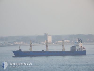
ESL AMERICA
General Cargo
Current Trip
NG PHC
| Time Travelled | 1 day |
|---|---|
| Remaining Time | --- |
| Distance Travelled | 420.74 nm |
| Remaining Distance | --- |
| AVG Speed | 14.2 Knopen |
| MAX Speed | 17 Knopen |
| AVG Wind | 6.8 knots |
| MAX Wind | 15.9 knots |
| MIN Temp | 11.4°C / 52.52°F |
| MAX Temp | 12.7°C / 54.86°F |
| Diepgang | 8.3 M |
| Positie ontvangen | 23 h, 34 m geleden |
Current Position
| Lengtegraad | -0.92620° |
|---|---|
| Breedtegraat | 50.35935° |
| Status | Under way using engine |
| Snelheid | 10.5 Knopen |
| Koers | 251.7° |
| Gebied | English Channel |
| Station | T-AIS |
| Positie ontvangen | 23 h, 34 m geleden |
Info
Information
The current position of ESL AMERICA is in English Channel with coordinates 50.35935° / -0.92620° as reported on 2024-05-06 20:28 by AIS to our vessel tracker app. The vessel's current speed is 10.5 Knopen
The vessel ESL AMERICA (IMO: 9347035, MMSI: 212558000) is a General Cargo that was built in 2006 ( 18 Jaar oud ). It's sailing under the flag of [CY] Cyprus.
In this page you can find informations about the vessels current position, last detected port calls, and current voyage information. If the vessels is not in coverage by AIS you will find the latest position.
The current position of ESL AMERICA is detected by our AIS receivers and we are not responsible for the reliability of the data. The last position was recorded while the vessel was in Coverage by the Ais receivers of our vessel tracking app.
The current draught of ESL AMERICA as reported by AIS is 8.3 meters
Weather
| Temperature | 13.2°C / 55.76°F |
|---|---|
| Wind Speed | 7 knots |
| Direction | 358° N |
| Pressure | 1027.2 hPa |
| Humidity | 84.6 % |
| Cloud Coverage | 19 % |
Featured Company
Last Port Calls
| Port | Arrival | Departure | Time In Port |
|---|---|---|---|
| 2024-05-02 16:27 | 2024-05-06 02:48 | 3 d | |
| 2024-04-29 16:55 | 2024-05-01 09:33 | 1 d | |
| 2024-04-25 18:06 | 2024-04-28 12:30 | 2 d | |
| 2024-04-18 07:24 | |||
| 2024-04-06 15:17 | 2024-04-17 05:15 | 10 d | |
| 2024-03-29 12:01 | 2024-04-05 14:41 | 7 d | |
| 2024-03-10 09:40 | |||
| 2024-03-04 04:57 |
Last Trips
| Origin | Departure | Destination | Arrival | Distance | |
|---|---|---|---|---|---|
| 2024-05-01 11:33 | 2024-05-02 18:27 | 402.95 nm | |||
| 2024-04-28 13:30 | 2024-04-29 18:55 | 377.68 nm | |||
| 2024-04-17 07:15 | 2024-04-18 10:24 | 182.60 nm | |||
| 2024-04-05 16:41 | 2024-04-06 17:17 | 0.70 nm | |||
| 2024-03-10 11:40 | 2024-03-29 13:01 | 4373.16 nm |
Events
| Tijd | Evenement | Details | Positie / Bestemming | Info |
|---|---|---|---|---|
| 2024-05-06 20:35 | Status Changed | Default Under way using engine |
50.35298 / -.95650
NG PHC
|
Snelheid: 10.5 kn Koers: 251.7° |
| 2024-05-06 20:28 | Buitenbereik |
50.35935 / -.92620
English Channel
NG PHC
|
Snelheid: 10.5 kn Koers: 251.7° |
|
| 2024-05-06 19:21 | Status Changed | Under way using engine Default |
50.41435 / -.64450
NG PHC
|
Snelheid: 9.9 kn Koers: 256° |
| 2024-05-06 19:10 | Status Changed | Default Under way using engine |
50.42147 / -.60103
NG PHC
|
Snelheid: 10 kn Koers: 255.7° |
| 2024-05-06 16:17 | Status Changed | Under way using engine Default |
50.58273 / .26550
NG PHC
|
Snelheid: 14.1 kn Koers: 253° |
| 2024-05-06 16:16 | Status Changed | Default Under way using engine |
50.58437 / .27377
NG PHC
|
Snelheid: 14.2 kn Koers: 252.6° |
| 2024-05-06 16:09 | Status Changed | Under way using engine Default |
50.59213 / .31298
NG PHC
|
Snelheid: 14.6 kn Koers: 252° |
| 2024-05-06 16:09 | Binnenbereik |
50.59213 / .31298
English Channel
NG PHC
|
Snelheid: 14.2 kn Koers: 252.6° |
|
| 2024-05-06 15:13 | Status Changed | Default Under way using engine |
50.66908 / .65113
NG PHC
|
Snelheid: 14.2 kn Koers: 228.1° |
| 2024-05-06 14:58 | Buitenbereik |
50.70192 / .72865
English Channel
NG PHC
|
Snelheid: 14.2 kn Koers: 228.1° |