

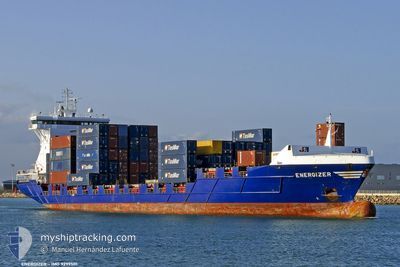
ENERGIZER
Container Ship

Current Trip
| Trip Time | 2 days |
|---|---|
| Trip Distance | 519.29 nm |
| AVG Speed | 12.8 Knopen |
| MAX Speed | 16.8 Knopen |
| Diepgang | 7.1 M |
| AVG Wind | 15.1 knots |
| MAX Wind | 29 knots |
| MIN Temp | 5.5°C / 41.9°F |
| MAX Temp | 8.2°C / 46.76°F |
| Positie ontvangen | 2 m geleden |
Current Position
| Lengtegraad | --- |
|---|---|
| Breedtegraat | --- |
| Status | Moored |
| Snelheid | |
| Koers | 332° |
| Gebied | North Sea |
| Station | T-AIS |
| Positie ontvangen | 2 m geleden |
Information
The current position of ENERGIZER is in North Sea with coordinates 51.87874° / 4.41306° as reported on 2025-03-07 12:10 by AIS to our vessel tracker app. The vessel's current speed is 0 Knopen and is currently inside the port of ROTTERDAM WAALHAVEN.
The vessel ENERGIZER (IMO: 9299501, MMSI: 245088000) is a Container Ship that was built in 2004 ( 21 Jaar oud ). It's sailing under the flag of [NL] Netherlands.
In this page you can find informations about the vessels current position, last detected port calls, and current voyage information. If the vessels is not in coverage by AIS you will find the latest position.
The current position of ENERGIZER is detected by our AIS receivers and we are not responsible for the reliability of the data. The last position was recorded while the vessel was in Coverage by the Ais receivers of our vessel tracking app.
The current draught of ENERGIZER as reported by AIS is 7.1 meters
Weather
| Temperature | 16°C / 60.8°F |
|---|---|
| Wind Speed | 8 knots |
| Direction | 179° S |
| Pressure | 1016.1 hPa |
| Humidity | 51.4 % |
| Cloud Coverage | 6 % |


Featured Company
Last Port Calls
| Port | Arrival | Departure | Time In Port |
|---|---|---|---|
| 2025-03-06 05:52 | |||
| 2025-03-03 02:28 | 2025-03-03 14:27 | 11 h | |
| 2025-03-02 11:34 | 2025-03-02 20:23 | 8 h | |
| 2025-03-01 19:24 | 2025-03-02 06:21 | 10 h | |
| 2025-02-27 18:56 | 2025-02-28 08:48 | 13 h | |
| 2025-02-26 11:38 | 2025-02-27 17:17 | 1 d | |
| 2025-02-26 09:01 | 2025-02-26 11:33 | 2 h | |
| 2025-02-25 23:20 | 2025-02-26 07:26 | 8 h | |
| 2025-02-24 06:10 | 2025-02-24 12:40 | 6 h | |
| 2025-02-23 12:02 | 2025-02-23 22:32 | 10 h |
Most Visited Ports (Last year)
| Port | Arrivals | |
|---|---|---|
| 66 | ||
| 62 | ||
| 31 | ||
| 26 | ||
| 20 | ||
| 6 |
Last Trips
| Origin | Departure | Destination | Arrival | Distance | |
|---|---|---|---|---|---|
| 2025-03-03 15:27 | 2025-03-06 06:52 | 519.29 nm | |||
| 2025-03-02 21:23 | 2025-03-03 03:28 | 57.48 nm | |||
| 2025-03-02 07:21 | 2025-03-02 12:34 | 71.20 nm | |||
| 2025-02-28 09:48 | 2025-03-01 20:24 | 557.39 nm | |||
| 2025-02-27 18:17 | 2025-02-27 19:56 | 16.04 nm | |||
| 2025-02-26 12:33 | 2025-02-26 12:38 | 1.15 nm | |||
| 2025-02-26 08:26 | 2025-02-26 10:01 | 17.00 nm | |||
| 2025-02-24 13:40 | 2025-02-26 00:20 | 530.13 nm | |||
| 2025-02-23 23:32 | 2025-02-24 07:10 | 58.90 nm | |||
| 2025-02-23 06:30 | 2025-02-23 13:02 | 91.97 nm |
Events
| Tijd | Evenement | Details | Positie / Bestemming | Info |
|---|---|---|---|---|
| 2025-03-07 11:07 | Status Changed | Moored Default |
51.87877 / 4.41307
[NL] ROTTERDAM WAALHAVEN
|
Snelheid: Koers: 332° |
| 2025-03-07 11:04 | Status Changed | Default Moored |
51.87877 / 4.41307
[NL] ROTTERDAM WAALHAVEN
|
Snelheid: Koers: 332° |
| 2025-03-06 21:24 | ETA Changed | 2025/03/05 03:20 2025/03/05 03:15 |
51.87915 / 4.41738
[NL] ROTTERDAM WAALHAVEN
|
Snelheid: Koers: 290° |
| 2025-03-06 13:34 | Status Changed | Moored Under way using engine |
51.87921 / 4.41741
[NL] ROTTERDAM WAALHAVEN
|
Snelheid: Koers: 289° |
| 2025-03-06 05:56 | Stop beweging |
51.87929 / 4.41758
[NL] ROTTERDAM WAALHAVEN
|
Snelheid: 0.3 kn Koers: 286° |
|
| 2025-03-06 05:52 | Aankomsthaven |
|
51.87915 / 4.41835
[NL] ROTTERDAM WAALHAVEN
|
Snelheid: 0.6 kn Koers: 286° |
| 2025-03-06 03:39 | Status Changed | Under way using engine At anchor |
51.99400 / 3.95132
NLRTM
|
Snelheid: 13.6 kn Koers: 80.1° |
| 2025-03-06 02:54 | Start beweging | 10.2 nm, North West of OUDDORP |
51.93826 / 3.78028
NLRTM
|
Snelheid: 5.9 kn Koers: 30.2° |
| 2025-03-06 02:35 | ETA Changed | 2025/03/05 03:15 2025/03/05 03:10 |
51.93507 / 3.77691
NLRTM
|
Snelheid: Koers: 96° |
| 2025-03-05 23:06 | Status Changed | At anchor Default |
51.93447 / 3.77811
NLRTM
|
Snelheid: Koers: 55° |