
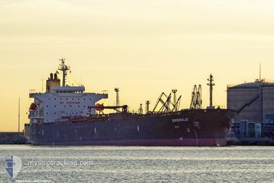
EMERALD
Oil Products Tanker
Current Trip
| Time Travelled | 1 day |
|---|---|
| Remaining Time | 6 h, 13 mins |
| Distance Travelled | 420.40 nm |
| Remaining Distance | 80.43 nm |
| AVG Speed | 12.4 Knopen |
| MAX Speed | 13.2 Knopen |
| AVG Wind | 9.3 knots |
| MAX Wind | 16.9 knots |
| MIN Temp | 18.2°C / 64.76°F |
| MAX Temp | 21.2°C / 70.16°F |
| Diepgang | 10.7 M |
| Positie ontvangen | 1 m geleden |
Current Position
| Lengtegraad | 23.67175° |
|---|---|
| Breedtegraat | 36.77757° |
| Status | Under way using engine |
| Snelheid | 12.9 Knopen |
| Koers | 37° |
| Gebied | Aegean Sea |
| Station | T-AIS |
| Positie ontvangen | 1 m geleden |
Info
Information
The current position of EMERALD is in Aegean Sea with coordinates 36.77757° / 23.67175° as reported on 2024-05-29 08:11 by AIS to our vessel tracker app. The vessel's current speed is 12.9 Knopen and is heading at the port of ELEFSIS. The estimated time of arrival as calculated by MyShipTracking vessel tracking app is 2024-05-29 14:25 LT
The vessel EMERALD (IMO: 9391945, MMSI: 248033000) is a Oil Products Tanker that was built in 2009 ( 15 Jaar oud ). It's sailing under the flag of [MT] Malta.
In this page you can find informations about the vessels current position, last detected port calls, and current voyage information. If the vessels is not in coverage by AIS you will find the latest position.
The current position of EMERALD is detected by our AIS receivers and we are not responsible for the reliability of the data. The last position was recorded while the vessel was in Coverage by the Ais receivers of our vessel tracking app.
The current draught of EMERALD as reported by AIS is 10.7 meters
Weather
| Temperature | 20.5°C / 68.9°F |
|---|---|
| Wind Speed | 3 knots |
| Direction | 234° SW |
| Pressure | 1013.3 hPa |
| Humidity | 65.7 % |
| Cloud Coverage | --- |
Featured Company
Last Port Calls
| Port | Arrival | Departure | Time In Port |
|---|---|---|---|
| 2024-05-27 16:37 | 2024-05-27 22:49 | 6 h | |
| 2024-05-26 10:25 | 2024-05-27 15:41 | 1 d | |
| 2024-05-17 11:15 | 2024-05-20 17:52 | 3 d | |
| 2024-05-13 16:24 | 2024-05-14 13:56 | 21 h | |
| 2024-05-06 13:48 | 2024-05-08 04:42 | 1 d | |
| 2024-04-30 06:57 | 2024-05-01 18:20 | 1 d | |
| 2024-04-22 00:07 | 2024-04-24 12:34 | 2 d | |
| 2024-04-12 21:29 | 2024-04-14 14:35 | 1 d | |
| 2024-04-06 05:57 | 2024-04-07 06:53 | 1 d | |
| 2024-03-21 02:29 | 2024-03-25 02:53 | 4 d |
Most Visited Ports (Last year)
| Port | Arrivals | |
|---|---|---|
| 13 | ||
| 6 | ||
| 4 | ||
| 4 | ||
| 3 | ||
| 3 |
Last Trips
| Origin | Departure | Destination | Arrival | Distance | |
|---|---|---|---|---|---|
| 2024-05-27 17:41 | 2024-05-27 18:37 | 7.08 nm | |||
| 2024-05-20 19:52 | 2024-05-26 12:25 | 897.24 nm | |||
| 2024-05-14 15:56 | 2024-05-17 13:15 | 830.27 nm | |||
| 2024-05-08 06:42 | 2024-05-13 18:24 | 193.58 nm | |||
| 2024-05-01 20:20 | 2024-05-06 15:48 | 112.80 nm | |||
| 2024-04-24 15:34 | 2024-04-30 08:57 | 870.26 nm | |||
| 2024-04-14 17:35 | 2024-04-22 03:07 | 495.24 nm | |||
| 2024-04-07 08:53 | 2024-04-13 00:29 | 573.22 nm | |||
| 2024-03-25 03:53 | 2024-04-06 07:57 | 1215.77 nm | |||
| 2024-03-14 08:15 | 2024-03-21 03:29 | 1864.37 nm |
Events
| Tijd | Evenement | Details | Positie / Bestemming | Info |
|---|---|---|---|---|
| 2024-05-29 07:50 | Status Changed | Under way using engine Default |
36.71587 / 23.61263
GRELE
|
Snelheid: 12 kn Koers: 39° |
| 2024-05-29 07:45 | Status Changed | Default Under way using engine |
36.70167 / 23.59833
GRELE
|
Snelheid: 12.8 kn Koers: 39° |
| 2024-05-29 06:34 | Status Changed | Under way using engine Default |
36.50293 / 23.40535
GRELE
|
Snelheid: 12.7 kn Koers: 37° |
| 2024-05-29 06:09 | Status Changed | Default Under way using engine |
36.43413 / 23.33865
GRELE
|
Snelheid: 12.2 kn Koers: 39° |
| 2024-05-29 05:30 | Wijzig zee gebeid | Greek part of the Aegean Sea Italian part of the Ionian Sea |
36.38575 / 23.18542
Aegean Sea
GRELE
|
Snelheid: 12.6 kn Koers: 92° |
| 2024-05-29 05:29 | Status Changed | Under way using engine Default |
36.38587 / 23.18252
GRELE
|
Snelheid: 12 kn Koers: 96° |
| 2024-05-29 05:29 | Binnenbereik |
36.38575 / 23.18542
Aegean Sea
GRELE
|
Snelheid: 12.6 kn Koers: 92° |
|
| 2024-05-28 02:24 | Status Changed | Default Under way using engine |
37.06348 / 16.14648
GRELE
|
Snelheid: 12.4 kn Koers: 98° |
| 2024-05-28 02:21 | Status Changed | Under way using engine Default |
37.06565 / 16.13165
GRELE
|
Snelheid: 12.5 kn Koers: 98° |
| 2024-05-28 02:21 | Buitenbereik |
37.06565 / 16.13165
Ionian Sea
GRELE
|
Snelheid: 12.4 kn Koers: 98° |