

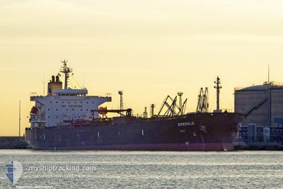
EMERALD
Oil Products Tanker

Current Trip
| Time Travelled | 8 days |
|---|---|
| Remaining Time | --- |
| Distance Travelled | 274.41 nm |
| Remaining Distance | --- |
| AVG Speed | 8.7 Noeuds |
| MAX Speed | 14.2 Noeuds |
| AVG Wind | 13.6 knots |
| MAX Wind | 23.8 knots |
| MIN Temp | 4.1°C / 39.38°F |
| MAX Temp | 18.6°C / 65.48°F |
| Tirant d eau | 7.7 m |
| Position reçue | 2 m depuis |
Current Position
| Longitude | --- |
|---|---|
| Latitude | --- |
| Etat | At anchor |
| Vitesse | 0.3 Noeuds |
| Parcours | 122° |
| Zone | Ionian Sea |
| Station | T-AIS |
| Position reçue | 2 m depuis |
Information
The current position of EMERALD is in Ionian Sea with coordinates 40.44617° / 17.18830° as reported on 2025-03-24 15:17 by AIS to our vessel tracker app. The vessel's current speed is 0.3 Noeuds
The vessel EMERALD (IMO: 9391945, MMSI: 248033000) is a Oil Products Tanker that was built in 2009 ( 16 Age ). It's sailing under the flag of [MT] Malta.
In this page you can find informations about the vessels current position, last detected port calls, and current voyage information. If the vessels is not in coverage by AIS you will find the latest position.
The current position of EMERALD is detected by our AIS receivers and we are not responsible for the reliability of the data. The last position was recorded while the vessel was in Coverage by the Ais receivers of our vessel tracking app.
The current draught of EMERALD as reported by AIS is 7.7 meters
Weather
| Temperature | 16.2°C / 61.16°F |
|---|---|
| Wind Speed | 18 knots |
| Direction | 154° SSE |
| Pressure | 1013.8 hPa |
| Humidity | 86.1 % |
| Cloud Coverage | 100 % |


Featured Company
Last Port Calls
| Port | Arrival | Departure | Time In Port |
|---|---|---|---|
| 2025-03-15 16:30 | 2025-03-15 20:30 | 4 h | |
| 2025-03-12 18:36 | 2025-03-15 08:27 | 2 d | |
| 2025-02-25 00:43 | 2025-03-01 18:48 | 4 d | |
| 2025-02-19 09:55 | 2025-02-21 22:26 | 2 d | |
| 2025-02-12 20:30 | 2025-02-15 05:30 | 2 d | |
| 2025-02-07 10:06 | 2025-02-09 03:44 | 1 d | |
| 2025-01-31 18:32 | 2025-02-02 07:31 | 1 d | |
| 2025-01-22 18:51 | 2025-01-24 11:14 | 1 d |
Most Visited Ports (Last year)
| Port | Arrivals | |
|---|---|---|
| 4 | ||
| 3 | ||
| 3 | ||
| 3 | ||
| 2 | ||
| 2 |
Last Trips
| Origin | Departure | Destination | Arrival | Distance | |
|---|---|---|---|---|---|
| 2025-03-15 08:27 | 2025-03-15 16:30 | 109.19 nm | |||
| 2025-03-01 18:48 | 2025-03-12 18:36 | 2481.93 nm | |||
| 2025-02-21 22:26 | 2025-02-25 00:43 | 228.84 nm | |||
| 2025-02-15 05:30 | 2025-02-19 09:55 | 773.54 nm | |||
| 2025-02-09 03:44 | 2025-02-12 20:30 | 1153.11 nm | |||
| 2025-02-02 07:31 | 2025-02-07 10:06 | 267.66 nm | |||
| 2025-01-24 11:14 | 2025-01-31 18:32 | 1709.18 nm | |||
| 2024-12-28 12:47 | 2025-01-22 18:51 | 3293.78 nm |
Events
| Heure | Evenement | Détails | Position/ Destination | Info |
|---|---|---|---|---|
| 2025-03-21 23:35 | Etat Changé | At anchor Default |
40.44423 / 17.19003
ITTAR
|
Vitesse: Parcours: 128° |
| 2025-03-21 23:33 | Etat Changé | Default At anchor |
40.44423 / 17.19005
ITTAR
|
Vitesse: Parcours: 131° |
| 2025-03-21 14:59 | Etat Changé | At anchor Default |
40.44468 / 17.19137
ITTAR
|
Vitesse: Parcours: 172° |
| 2025-03-21 14:57 | Etat Changé | Default At anchor |
40.44472 / 17.19135
ITTAR
|
Vitesse: Parcours: 175° |
| 2025-03-16 15:34 | Arret | 2.46 nm, South of TARANTO |
40.44600 / 17.19310
ITTAR
|
Vitesse: 0.3 kn Parcours: 218° |
| 2025-03-16 15:13 | Etat Changé | At anchor Under way using engine |
40.44295 / 17.19103
ITTAR
|
Vitesse: 0.7 kn Parcours: 359° |
| 2025-03-16 14:23 | Démarrage | 5.95 nm, South of TARANTO |
40.39215 / 17.12910
ITTAR
|
Vitesse: 3.1 kn Parcours: 101° |
| 2025-03-16 13:17 | Arret | 6.24 nm, South West of TARANTO |
40.39478 / 17.10718
ITTAR
|
Vitesse: 0.3 kn Parcours: 205° |
| 2025-03-16 11:59 | Etat Changé | Under way using engine Default |
40.16825 / 17.17740
ITTAR
|
Vitesse: 14.1 kn Parcours: 348° |
| 2025-03-16 11:35 | Etat Changé | Default Under way using engine |
40.07385 / 17.20077
ITTAR
|
Vitesse: 13.9 kn Parcours: 353° |