
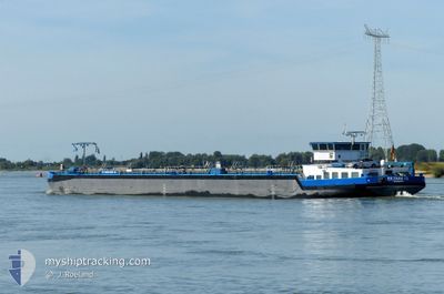
EILTANK 72
Tanker
Current Trip
AMSTERDAM J V R
| Time Travelled | 22 days |
|---|---|
| Remaining Time | --- |
| Distance Travelled | 7.26 nm |
| Remaining Distance | --- |
| AVG Speed | 5.7 Knopen |
| MAX Speed | 8.2 Knopen |
| AVG Wind | 11.6 knots |
| MAX Wind | 24 knots |
| MIN Temp | 2.8°C / 37.04°F |
| MAX Temp | 14.4°C / 57.92°F |
| Diepgang | 1.6 M |
| Positie ontvangen | 20 d geleden |
Current Position
| Lengtegraad | --- |
|---|---|
| Breedtegraat | --- |
| Status | Moored |
| Snelheid | |
| Koers | --- |
| Gebied | Mediterranean Sea - Western Basin |
| Station | T-AIS |
| Positie ontvangen | 20 d geleden |
Info
Information
The current position of EILTANK 72 is in Mediterranean Sea - Western Basin with coordinates 43.42623° / 4.75967° as reported on 2025-01-28 15:12 by AIS to our vessel tracker app. The vessel's current speed is 0 Knopen
The vessel EILTANK 72 (MMSI: 211735640) is a Tanker It's sailing under the flag of [DE] Germany.
In this page you can find informations about the vessels current position, last detected port calls, and current voyage information. If the vessels is not in coverage by AIS you will find the latest position.
The current position of EILTANK 72 is detected by our AIS receivers and we are not responsible for the reliability of the data. The last position was recorded while the vessel was in Coverage by the Ais receivers of our vessel tracking app.
The current draught of EILTANK 72 as reported by AIS is 1.6 meters
Weather
| Temperature | 11.2°C / 52.16°F |
|---|---|
| Wind Speed | 8 knots |
| Direction | 134° SE |
| Pressure | 1019.4 hPa |
| Humidity | 87.6 % |
| Cloud Coverage | 100 % |
Featured Company
Last Port Calls
| Port | Arrival | Departure | Time In Port |
|---|---|---|---|
| 2025-01-26 07:50 | |||
| 2025-01-14 13:33 | |||
| 2024-12-18 08:27 | 2025-01-14 10:17 | 27 d | |
| 2024-12-06 11:37 | 2024-12-11 12:55 | 5 d | |
| 2024-12-01 10:58 | 2024-12-06 11:09 | 5 d | |
| 2024-12-01 10:03 | 2024-12-01 10:39 | 35 m | |
| 2024-12-01 09:23 |
Last Trips
| Origin | Departure | Destination | Arrival | Distance | |
|---|---|---|---|---|---|
| 2025-01-14 11:17 | 2025-01-14 14:33 | 25.49 nm | |||
| 2024-12-11 13:55 | 2024-12-18 09:27 | 2.35 nm | |||
| 2024-12-06 12:09 | 2024-12-06 12:37 | 2.61 nm | |||
| 2024-12-01 11:39 | 2024-12-01 11:58 | 2.14 nm | |||
| 2024-12-01 10:23 | 2024-12-01 11:03 | 6.38 nm |
Events
| Tijd | Evenement | Details | Positie / Bestemming | Info |
|---|---|---|---|---|
| 2025-02-11 17:52 | Start beweging | 0.46 nm, North West of SALIN DE GIRAUD |
43.42536 / 4.73784
AMSTERDAM J V R
|
Snelheid: 7.5 kn Koers: 311° |
| 2025-02-08 22:47 | Stop beweging | 0.41 nm, North East of SALIN DE GIRAUD |
43.42248 / 4.75146
AMSTERDAM J V R
|
Snelheid: 0.1 kn Koers: -1° |
| 2025-02-08 22:35 | Start beweging | 0.57 nm, North East of SALIN DE GIRAUD |
43.42289 / 4.75543
AMSTERDAM J V R
|
Snelheid: 30 kn Koers: 79° |