
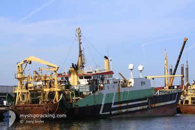
DIRK DIRK
Trawler
Current Trip
| Trip Time | 15 days |
|---|---|
| Trip Distance | 1064.63 nm |
| AVG Speed | 10 Knopen |
| MAX Speed | 14.4 Knopen |
| Diepgang | 6.5 M |
| AVG Wind | 15.4 knots |
| MAX Wind | 23 knots |
| MIN Temp | 7.9°C / 46.22°F |
| MAX Temp | 16.1°C / 60.98°F |
| Positie ontvangen | 4 m geleden |
Current Position
| Lengtegraad | 8.58424° |
|---|---|
| Breedtegraat | 53.50713° |
| Status | Moored |
| Snelheid | |
| Koers | 169° |
| Gebied | North Sea |
| Station | T-AIS |
| Positie ontvangen | 4 m geleden |
Info
Information
The current position of DIRK DIRK is in North Sea with coordinates 53.50713° / 8.58424° as reported on 2024-05-16 16:29 by AIS to our vessel tracker app. The vessel's current speed is 0 Knopen and is currently inside the port of BREMERHAVEN.
The vessel DIRK DIRK (IMO: 8209171, MMSI: 244030073) is a Trawler that was built in 1983 ( 41 Jaar oud ). It's sailing under the flag of [NL] Netherlands.
In this page you can find informations about the vessels current position, last detected port calls, and current voyage information. If the vessels is not in coverage by AIS you will find the latest position.
The current position of DIRK DIRK is detected by our AIS receivers and we are not responsible for the reliability of the data. The last position was recorded while the vessel was in Coverage by the Ais receivers of our vessel tracking app.
The current draught of DIRK DIRK as reported by AIS is 6.5 meters
Weather
| Temperature | 19.1°C / 66.38°F |
|---|---|
| Wind Speed | 12 knots |
| Direction | 118° ESE |
| Pressure | 1006.3 hPa |
| Humidity | 67.8 % |
| Cloud Coverage | 71 % |
Featured Company
Last Port Calls
| Port | Arrival | Departure | Time In Port |
|---|---|---|---|
| 2024-05-16 04:01 | |||
| 2024-04-26 18:13 | 2024-04-30 15:43 | 3 d | |
| 2024-03-13 12:06 | 2024-04-05 16:48 | 23 d | |
| 2024-03-10 10:00 | 2024-03-12 16:59 | 2 d |
Most Visited Ports (Last year)
| Port | Arrivals | |
|---|---|---|
| 14 | ||
| 5 |
Last Trips
| Origin | Departure | Destination | Arrival | Distance | |
|---|---|---|---|---|---|
| 2024-04-30 17:43 | 2024-05-16 06:01 | 1064.63 nm | |||
| 2024-04-05 18:48 | 2024-04-26 20:13 | 1065.63 nm | |||
| 2024-03-12 17:59 | 2024-03-13 13:06 | 221.98 nm | |||
| 2024-02-23 18:06 | 2024-03-10 11:00 | 1024.08 nm |
Events
| Tijd | Evenement | Details | Positie / Bestemming | Info |
|---|---|---|---|---|
| 2024-05-16 05:47 | Status Changed | Moored Under way using engine |
53.50711 / 8.58420
[DE] BREMERHAVEN
|
Snelheid: Koers: 169° |
| 2024-05-16 05:37 | Stop beweging |
53.50741 / 8.58362
[DE] BREMERHAVEN
|
Snelheid: 0.2 kn Koers: 165° |
|
| 2024-05-16 05:09 | Start beweging |
53.52942 / 8.57697
[DE] BREMERHAVEN
|
Snelheid: 3.1 kn Koers: 204° |
|
| 2024-05-16 04:48 | Stop beweging |
53.53237 / 8.57821
[DE] BREMERHAVEN
|
Snelheid: 0.2 kn Koers: 182° |
|
| 2024-05-16 04:01 | Aankomsthaven |
|
53.60350 / 8.50053
[DE] BREMERHAVEN
|
Snelheid: 11 kn Koers: 142.3° |
| 2024-05-15 19:28 | Binnenbereik |
54.21615 / 7.39485
North Sea
|
Snelheid: 4.6 kn Koers: 149.3° |
|
| 2024-05-15 12:14 | Buitenbereik |
54.79613 / 5.66725
North Sea
|
Snelheid: 11.9 kn Koers: 119.9° |
|
| 2024-05-15 03:29 | Gevonden in zee | German part of the North Sea |
55.84904 / 3.39664
North Sea
|
Snelheid: 12.1 kn Koers: 133.5° |
| 2024-05-15 02:01 | Destination Changed | BREMERHAVEN FISHING GROUNDS |
56.04437 / 3.01652
BREMERHAVEN
|
Snelheid: 12 kn Koers: 133.2° |
| 2024-05-15 01:08 | Binnenbereik |
56.15663 / 2.79812
North Sea
|
Snelheid: 11.7 kn Koers: 133.1° |