
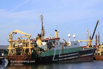
DIRK DIRK
Trawler
Current Trip
| Time Travelled | 2 days |
|---|---|
| Remaining Time | 2 days |
| Distance Travelled | 334.15 nm |
| Remaining Distance | 158.39 nm |
| AVG Speed | 5.4 Noeuds |
| MAX Speed | 12.8 Noeuds |
| AVG Wind | 28.5 knots |
| MAX Wind | 39 knots |
| MIN Temp | 5.1°C / 41.18°F |
| MAX Temp | 15.1°C / 59.18°F |
| Tirant d eau | 6.5 m |
| Position reçue | 1 m depuis |
Current Position
| Longitude | --- |
|---|---|
| Latitude | --- |
| Etat | Engaged in Fishing |
| Vitesse | 2.9 Noeuds |
| Parcours | 228° |
| Zone | North Sea |
| Station | T-AIS |
| Position reçue | 1 m depuis |
Info
Information
The current position of DIRK DIRK is in North Sea with coordinates 51.12268° / 1.87127° as reported on 2024-11-24 09:06 by AIS to our vessel tracker app. The vessel's current speed is 2.9 Noeuds and is heading at the port of DEN HELDER. The estimated time of arrival as calculated by MyShipTracking vessel tracking app is 2024-11-26 14:26 LT
The vessel DIRK DIRK (IMO: 8209171, MMSI: 244030073) is a Trawler that was built in 1983 ( 41 Age ). It's sailing under the flag of [NL] Netherlands.
In this page you can find informations about the vessels current position, last detected port calls, and current voyage information. If the vessels is not in coverage by AIS you will find the latest position.
The current position of DIRK DIRK is detected by our AIS receivers and we are not responsible for the reliability of the data. The last position was recorded while the vessel was in Coverage by the Ais receivers of our vessel tracking app.
The current draught of DIRK DIRK as reported by AIS is 6.5 meters
Weather
| Temperature | 14.2°C / 57.56°F |
|---|---|
| Wind Speed | 37 knots |
| Direction | 200° SSW |
| Pressure | 1000.9 hPa |
| Humidity | 69.4 % |
| Cloud Coverage | 100 % |
Featured Company
Most Visited Ports (Last year)
| Port | Arrivals | |
|---|---|---|
| 17 | ||
| 5 | ||
| 1 |
Last Trips
| Origin | Departure | Destination | Arrival | Distance | |
|---|---|---|---|---|---|
| 2024-11-09 14:21 | 2024-11-20 06:39 | 1621.47 nm | |||
| 2024-11-08 10:48 | 2024-11-08 17:30 | 32.83 nm | |||
| 2024-10-28 16:16 | 2024-10-28 18:44 | 11.49 nm | |||
| 2024-09-18 06:06 | 2024-09-18 08:18 | 13.13 nm | |||
| 2024-08-21 19:10 | 2024-09-04 16:34 | 1384.79 nm |
Events
| Heure | Evenement | Détails | Position/ Destination | Info |
|---|---|---|---|---|
| 2024-11-23 20:38 | Changement de zone | French part of the North Sea United Kingdom part of the North Sea |
51.15172 / 1.81512
North Sea
|
Vitesse: 10.5 kn Parcours: 70.2° |
| 2024-11-23 06:55 | Démarrage | 17.54 nm, North East of RAMSGATE |
51.50854 / 1.78543
FISHING GROUNDS
|
Vitesse: 3.3 kn Parcours: 325° |
| 2024-11-23 06:28 | Arret | 18.16 nm, North East of RAMSGATE |
51.51093 / 1.80336
FISHING GROUNDS
|
Vitesse: 0.3 kn Parcours: 225° |
| 2024-11-22 08:57 | Etat Changé | Engaged in Fishing Under way using engine |
51.70651 / 1.96200
FISHING GROUNDS
|
Vitesse: 10.8 kn Parcours: 250.5° |
| 2024-11-22 06:48 | Dans la zone couverte |
51.97447 / 2.24348
North Sea
|
Vitesse: 8.4 kn Parcours: 200.2° |
|
| 2024-11-22 03:07 | Hors de la zone couverte |
52.04760 / 2.33357
North Sea
|
Vitesse: 4.6 kn Parcours: 191.3° |
|
| 2024-11-22 03:07 | Changement de zone | United Kingdom part of the North Sea Dutch part of the North Sea |
52.04760 / 2.33357
North Sea
|
Vitesse: 4.6 kn Parcours: 191.3° |
| 2024-11-22 03:06 | Dans la zone couverte |
52.04760 / 2.33357
North Sea
|
Vitesse: 4.6 kn Parcours: 191.3° |
|
| 2024-11-21 20:36 | Hors de la zone couverte |
52.52199 / 4.08018
North Sea
|
Vitesse: 12.7 kn Parcours: 272.8° |
|
| 2024-11-21 19:36 | Changement de destination | FISHING GROUNDS IJMUIDEN |
52.49014 / 4.42195
FISHING GROUNDS
|
Vitesse: 12.2 kn Parcours: 278.8° |