
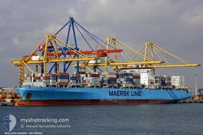
DIMITRIS Y
Container Ship
Current Trip
| Time Travelled | 6 h, 20 mins |
|---|---|
| Remaining Time | --- |
| Distance Travelled | 62.30 nm |
| Remaining Distance | 163.12 nm |
| AVG Speed | 11.6 Knopen |
| MAX Speed | 13.1 Knopen |
| AVG Wind | 8.4 knots |
| MAX Wind | 11 knots |
| MIN Temp | 24.4°C / 75.92°F |
| MAX Temp | 26.9°C / 80.42°F |
| Diepgang | 14.2 M |
| Positie ontvangen | 6 d geleden |
Current Position
| Lengtegraad | --- |
|---|---|
| Breedtegraat | --- |
| Status | Under way using engine |
| Snelheid | 15.4 Knopen |
| Koers | 306.5° |
| Gebied | Laccadive Sea |
| Station | T-AIS |
| Positie ontvangen | 6 d geleden |
Info
Information
The current position of DIMITRIS Y is in Laccadive Sea with coordinates 8.23792° / 76.53308° as reported on 2024-11-18 23:28 by AIS to our vessel tracker app. The vessel's current speed is 15.4 Knopen and is heading at the port of PIPAVAV. The estimated time of arrival as calculated by MyShipTracking vessel tracking app is 2024-11-21 14:00 LT
The vessel DIMITRIS Y (IMO: 9189354, MMSI: 636016979) is a Container Ship that was built in 2000 ( 24 Jaar oud ). It's sailing under the flag of [LR] Liberia.
In this page you can find informations about the vessels current position, last detected port calls, and current voyage information. If the vessels is not in coverage by AIS you will find the latest position.
The current position of DIMITRIS Y is detected by our AIS receivers and we are not responsible for the reliability of the data. The last position was recorded while the vessel was in Coverage by the Ais receivers of our vessel tracking app.
The current draught of DIMITRIS Y as reported by AIS is 14.2 meters
Weather
| Temperature | 26.5°C / 79.7°F |
|---|---|
| Wind Speed | 9 knots |
| Direction | 17° NNE |
| Pressure | 1011.5 hPa |
| Humidity | 65.4 % |
| Cloud Coverage | 78 % |
Featured Company
Last Port Calls
| Port | Arrival | Departure | Time In Port |
|---|---|---|---|
| 2024-11-23 12:58 | 2024-11-25 00:02 | 1 d | |
| 2024-11-21 19:08 | 2024-11-22 05:40 | 10 h | |
| 2024-11-14 07:56 | 2024-11-15 02:16 | 18 h | |
| 2024-11-11 18:13 | 2024-11-13 04:13 | 1 d | |
| 2024-11-07 00:20 | 2024-11-08 21:32 | 1 d | |
| 2024-11-03 09:52 | 2024-11-03 23:12 | 13 h | |
| 2024-10-29 09:26 | 2024-10-29 23:54 | 14 h | |
| 2024-10-25 10:37 | 2024-10-26 20:39 | 1 d | |
| 2024-10-22 02:46 | 2024-10-23 03:06 | 1 d | |
| 2024-10-20 03:28 | 2024-10-20 14:42 | 11 h |
Most Visited Ports (Last year)
| Port | Arrivals | |
|---|---|---|
| 9 | ||
| 9 | ||
| 6 | ||
| 5 | ||
| 5 | ||
| 5 |
Last Trips
| Origin | Departure | Destination | Arrival | Distance | |
|---|---|---|---|---|---|
| 2024-11-22 05:40 | 2024-11-23 12:58 | 182.99 nm | |||
| 2024-11-15 02:16 | 2024-11-21 19:08 | 2444.09 nm | |||
| 2024-11-13 04:13 | 2024-11-14 07:56 | 193.29 nm | |||
| 2024-11-08 21:32 | 2024-11-11 18:13 | 802.69 nm | |||
| 2024-11-03 23:12 | 2024-11-07 00:20 | 1003.90 nm | |||
| 2024-10-29 23:54 | 2024-11-03 09:52 | 1436.14 nm | |||
| 2024-10-26 20:39 | 2024-10-29 09:26 | 925.52 nm | |||
| 2024-10-23 03:06 | 2024-10-25 10:37 | 552.04 nm | |||
| 2024-10-20 14:42 | 2024-10-22 02:46 | 423.60 nm | |||
| 2024-10-13 10:05 | 2024-10-20 03:28 | 2441.91 nm |
Events
| Tijd | Evenement | Details | Positie / Bestemming | Info |
|---|---|---|---|---|
| 2024-11-24 18:32 | Vertrekhaven |
|
18.94798 / 72.93598
INPAV
|
Snelheid: 3.4 kn Koers: 230° |
| 2024-11-24 18:28 | Start beweging |
18.95125 / 72.94028
[IN] NHAVA SHEVA
|
Snelheid: 3.4 kn Koers: 230° |
|
| 2024-11-23 07:42 | Stop beweging |
18.95074 / 72.94276
[IN] NHAVA SHEVA
|
Snelheid: Koers: 219° |
|
| 2024-11-23 07:28 | Aankomsthaven |
|
18.95121 / 72.94198
[IN] NHAVA SHEVA
|
Snelheid: 0.9 kn Koers: 198° |
| 2024-11-23 04:47 | Start beweging | 18.84 nm, South West of MUMBAI |
18.79852 / 72.60470
INPAV
|
Snelheid: 6.4 kn Koers: 31° |
| 2024-11-22 11:56 | Stop beweging | 19.15 nm, South West of MUMBAI |
18.79439 / 72.60111
INPAV
|
Snelheid: 0.1 kn Koers: 173° |
| 2024-11-22 00:10 | Vertrekhaven |
|
20.90537 / 71.50130
INPAV
|
Snelheid: 3.9 kn Koers: 223° |
| 2024-11-21 23:58 | Start beweging |
20.91832 / 71.51234
[IN] PIPAVAV
|
Snelheid: 3.7 kn Koers: 223° |
|
| 2024-11-21 13:49 | Stop beweging |
20.92109 / 71.51395
[IN] PIPAVAV
|
Snelheid: Koers: 230° |
|
| 2024-11-21 13:38 | Aankomsthaven |
|
20.92082 / 71.51397
[IN] PIPAVAV
|
Snelheid: 1.2 kn Koers: 224° |