
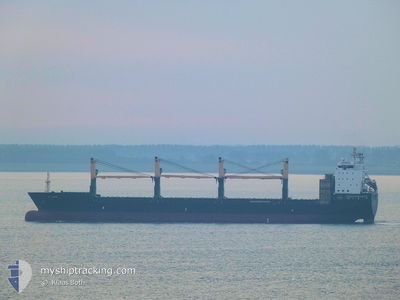
CS FAITH
General Cargo
Current Trip
PENANG
| Time Travelled | 2 h, 46 mins |
|---|---|
| Remaining Time | --- |
| Distance Travelled | 31.31 nm |
| Remaining Distance | --- |
| AVG Speed | 12.6 Knopen |
| MAX Speed | 13.5 Knopen |
| AVG Wind | 3.5 knots |
| MAX Wind | 4 knots |
| MIN Temp | 28.7°C / 83.66°F |
| MAX Temp | 29.5°C / 85.1°F |
| Diepgang | 7 M |
| Positie ontvangen | 4 d geleden |
Current Position
| Lengtegraad | 103.59116° |
|---|---|
| Breedtegraat | 1.19549° |
| Status | Under way using engine |
| Snelheid | 14.6 Knopen |
| Koers | 279.3° |
| Gebied | Singapore Strait |
| Station | T-AIS |
| Positie ontvangen | 4 d geleden |
Info
Information
The current position of CS FAITH is in Singapore Strait with coordinates 1.19549° / 103.59116° as reported on 2024-05-29 17:08 by AIS to our vessel tracker app. The vessel's current speed is 14.6 Knopen
The vessel CS FAITH (IMO: 9509700, MMSI: 352526000) is a General Cargo that was built in 2011 ( 13 Jaar oud ). It's sailing under the flag of [PA] Panama.
In this page you can find informations about the vessels current position, last detected port calls, and current voyage information. If the vessels is not in coverage by AIS you will find the latest position.
The current position of CS FAITH is detected by our AIS receivers and we are not responsible for the reliability of the data. The last position was recorded while the vessel was in Coverage by the Ais receivers of our vessel tracking app.
The current draught of CS FAITH as reported by AIS is 7 meters
Weather
| Temperature | 29.5°C / 85.1°F |
|---|---|
| Wind Speed | 3 knots |
| Direction | 270° W |
| Pressure | 1008.8 hPa |
| Humidity | 68.9 % |
| Cloud Coverage | 84 % |
Featured Company
Most Visited Ports (Last year)
| Port | Arrivals | |
|---|---|---|
| 2 | ||
| 2 | ||
| 2 | ||
| 2 | ||
| 2 | ||
| 2 |
Last Trips
| Origin | Departure | Destination | Arrival | Distance | |
|---|---|---|---|---|---|
| 2024-04-27 18:27 | 2024-05-31 06:50 | 3884.76 nm | |||
| 2024-03-26 13:21 | 2024-04-16 10:07 | 4741.27 nm |
Events
| Tijd | Evenement | Details | Positie / Bestemming | Info |
|---|---|---|---|---|
| 2024-06-03 09:18 | Vertrekhaven |
|
5.45277 / 100.34473
PENANG
|
Snelheid: 11.2 kn Koers: 356° |
| 2024-06-03 08:58 | Start beweging |
5.39208 / 100.36264
[MY] PENANG
|
Snelheid: 4.1 kn Koers: 322° |
|
| 2024-05-30 23:55 | Stop beweging |
5.38999 / 100.36443
[MY] PENANG
|
Snelheid: Koers: 346° |
|
| 2024-05-30 22:50 | Aankomsthaven |
|
5.43368 / 100.35050
[MY] PENANG
|
Snelheid: 12.9 kn Koers: 163° |
| 2024-05-29 17:14 | Status Changed | Default Under way using engine |
1.19948 / 103.56817
PENANG
|
Snelheid: 14.6 kn Koers: 279.3° |
| 2024-05-29 17:08 | Buitenbereik |
1.19549 / 103.59116
Singapore Strait
PENANG
|
Snelheid: 14.6 kn Koers: 279.3° |
|
| 2024-05-29 16:31 | Wijzig zee gebeid | Indonesian part of the Singapore Strait Singaporean part of the Singapore Strait |
1.14252 / 103.71960
Singapore Strait
PENANG
|
Snelheid: 12.7 kn Koers: 285.1° |
| 2024-05-29 15:08 | Start beweging | 2 nm, East of SINGAPORE |
1.25375 / 103.88761
PENANG
|
Snelheid: 3.8 kn Koers: 87° |
| 2024-05-29 15:06 | Status Changed | Under way using engine At anchor |
1.25330 / 103.88644
PENANG
|
Snelheid: 1.4 kn Koers: 63° |
| 2024-05-29 15:02 | Draught Changed | 7 6.8 |
1.25282 / 103.88611
PENANG
|
Snelheid: 0.4 kn Koers: 77° |