
CRINIS
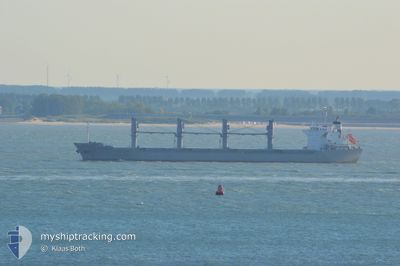
Bulk Carrier
Current Trip
| Time Travelled | 3 days |
|---|---|
| Remaining Time | --- |
| Distance Travelled | 323.53 nm |
| Remaining Distance | --- |
| AVG Speed | 8.4 Knopen |
| MAX Speed | 12.7 Knopen |
| AVG Wind | 8.1 knots |
| MAX Wind | 20.8 knots |
| MIN Temp | 15.2°C / 59.36°F |
| MAX Temp | 23.8°C / 74.84°F |
| Diepgang | 5.4 M |
| Positie ontvangen | 16 h, 6 m geleden |
Current Position
| Lengtegraad | 7.88611° |
|---|---|
| Breedtegraat | 38.06223° |
| Status | Under way using engine |
| Snelheid | 1 Knopen |
| Koers | 217° |
| Gebied | Mediterranean Sea - Western Basin |
| Station | T-AIS |
| Positie ontvangen | 16 h, 6 m geleden |
Info
Information
The current position of CRINIS is in Mediterranean Sea - Western Basin with coordinates 38.06223° / 7.88611° as reported on 2024-05-09 19:53 by AIS to our vessel tracker app. The vessel's current speed is 1 Knopen and is heading at the port of TERNEUZEN. The estimated time of arrival as calculated by MyShipTracking vessel tracking app is 2024-05-07 12:00 LT
The vessel CRINIS (IMO: 9598165, MMSI: 636015289) is a Bulk Carrier that was built in 2011 ( 13 Jaar oud ). It's sailing under the flag of [LR] Liberia.
In this page you can find informations about the vessels current position, last detected port calls, and current voyage information. If the vessels is not in coverage by AIS you will find the latest position.
The current position of CRINIS is detected by our AIS receivers and we are not responsible for the reliability of the data. The last position was recorded while the vessel was in Coverage by the Ais receivers of our vessel tracking app.
The current draught of CRINIS as reported by AIS is 5.4 meters
Weather
| Temperature | 17.5°C / 63.5°F |
|---|---|
| Wind Speed | 12 knots |
| Direction | 276° W |
| Pressure | 1018.7 hPa |
| Humidity | 85.4 % |
| Cloud Coverage | 100 % |
Featured Company
Most Visited Ports (Last year)
| Port | Arrivals | |
|---|---|---|
| 2 | ||
| 2 | ||
| 1 | ||
| 1 | ||
| 1 | ||
| 1 |
Events
| Tijd | Evenement | Details | Positie / Bestemming | Info |
|---|---|---|---|---|
| 2024-05-09 20:03 | Status Changed | Default Under way using engine |
38.05887 / 7.88669
FOR ORDER
|
Snelheid: 1 kn Koers: 217° |
| 2024-05-09 19:53 | Wijzig zee gebeid | Italian part of the Mediterranean Sea - Western Basin Tunisian part of the Mediterranean Sea - Western Basin |
38.06223 / 7.88611
Mediterranean Sea - Western Basin
|
Snelheid: 1 kn Koers: 175° |
| 2024-05-09 19:53 | Status Changed | Under way using engine Default |
38.06223 / 7.88611
FOR ORDER
|
Snelheid: 1.1 kn Koers: 217° |
| 2024-05-09 19:53 | Binnenbereik |
38.06223 / 7.88611
Mediterranean Sea - Western Basin
|
Snelheid: 1 kn Koers: 175° |
|
| 2024-05-09 19:53 | Buitenbereik |
38.06223 / 7.88611
Mediterranean Sea - Western Basin
|
Snelheid: 1 kn Koers: 175° |
|
| 2024-05-08 00:10 | Status Changed | Default Under way using engine |
38.01003 / 10.43054
FOR ORDER
|
Snelheid: 1.8 kn Koers: 35° |
| 2024-05-08 00:06 | Buitenbereik |
38.00989 / 10.42808
Mediterranean Sea - Western Basin
|
Snelheid: 1.8 kn Koers: 87.1° |
|
| 2024-05-07 23:21 | Status Changed | Under way using engine Not under command |
38.00761 / 10.40043
FOR ORDER
|
Snelheid: 1.8 kn Koers: 37° |
| 2024-05-07 23:06 | Status Changed | Not under command Default |
38.00657 / 10.39089
FOR ORDER
|
Snelheid: 1.7 kn Koers: 24° |
| 2024-05-07 22:38 | Status Changed | Default Not under command |
38.00284 / 10.37469
FOR ORDER
|
Snelheid: 1.6 kn Koers: 11° |