
CRINIS
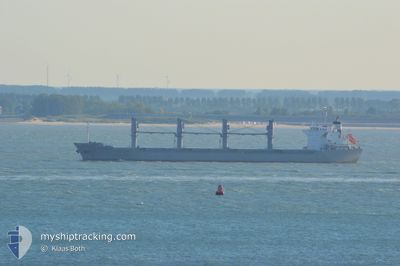
Bulk Carrier
Current Trip
| Time Travelled | 8 days |
|---|---|
| Remaining Time | --- |
| Distance Travelled | 1466.09 nm |
| Remaining Distance | --- |
| AVG Speed | 10.9 Knots |
| MAX Speed | 13.5 Knots |
| AVG Wind | 9 knots |
| MAX Wind | 20.8 knots |
| MIN Temp | 15.2°C / 59.36°F |
| MAX Temp | 23.8°C / 74.84°F |
| Dybgang | 5.5 m |
| Position Modtaget | 10 h, 28 m siden |
Current Position
| Longitude | 20.31559° |
|---|---|
| Latitude | 34.07599° |
| Status | Under way using engine |
| Fart | 11.9 Knots |
| Kurs | 108.5° |
| Område | Mediterranean Sea - Eastern Basin |
| Station | T-AIS |
| Position Modtaget | 10 h, 28 m siden |
Info
Information
The current position of CRINIS is in Mediterranean Sea - Eastern Basin with coordinates 34.07599° / 20.31559° as reported on 2024-05-15 18:18 by AIS to our vessel tracker app. The vessel's current speed is 11.9 Knots and is heading at the port of ABU QIR. The estimated time of arrival as calculated by MyShipTracking vessel tracking app is 2024-05-17 15:00 LT
The vessel CRINIS (IMO: 9598165, MMSI: 636015289) is a Bulk Carrier that was built in 2011 ( 13 år gamle ). It's sailing under the flag of [LR] Liberia.
In this page you can find informations about the vessels current position, last detected port calls, and current voyage information. If the vessels is not in coverage by AIS you will find the latest position.
The current position of CRINIS is detected by our AIS receivers and we are not responsible for the reliability of the data. The last position was recorded while the vessel was in Coverage by the Ais receivers of our vessel tracking app.
The current draught of CRINIS as reported by AIS is 5.5 meters
Weather
| Temperature | 19.8°C / 67.64°F |
|---|---|
| Wind Speed | 10 knots |
| Direction | 79° E |
| Pressure | 1013.1 hPa |
| Humidity | 86.6 % |
| Cloud Coverage | 4 % |
Featured Company
Events
| Tid | Hændelsen | Detaljer | Position / Dest | Info |
|---|---|---|---|---|
| 2024-05-15 18:27 | Status er ændret | Default Under way using engine |
34.06777 / 20.34727
ABU QIR
|
Fart: 11.9 kn Kurs: 108.5° |
| 2024-05-15 18:18 | Udenfor Dækning |
34.07599 / 20.31559
Mediterranean Sea - Eastern Basin
ABU QIR
|
Fart: 11.9 kn Kurs: 108.5° |
|
| 2024-05-15 18:09 | Status er ændret | Under way using engine Default |
34.08659 / 20.27885
ABU QIR
|
Fart: 12.2 kn Kurs: 108° |
| 2024-05-15 17:35 | Status er ændret | Default Under way using engine |
34.12346 / 20.14857
ABU QIR
|
Fart: 12.2 kn Kurs: 109° |
| 2024-05-15 17:06 | Status er ændret | Under way using engine Default |
34.15338 / 20.03579
ABU QIR
|
Fart: 12.4 kn Kurs: 107° |
| 2024-05-15 17:06 | Indenfor Dækning |
34.15338 / 20.03579
Mediterranean Sea - Eastern Basin
ABU QIR
|
Fart: 12.4 kn Kurs: 105.3° |
|
| 2024-05-15 15:31 | Status er ændret | Default Under way using engine |
34.25684 / 19.65082
ABU QIR
|
Fart: 12.9 kn Kurs: 107.4° |
| 2024-05-15 15:29 | Status er ændret | Under way using engine Default |
34.25929 / 19.64185
ABU QIR
|
Fart: 13 kn Kurs: 110° |
| 2024-05-15 15:29 | Udenfor Dækning |
34.25929 / 19.64185
Mediterranean Sea - Eastern Basin
ABU QIR
|
Fart: 12.9 kn Kurs: 107.4° |
|
| 2024-05-15 15:13 | Status er ændret | Default Under way using engine |
34.27697 / 19.57899
ABU QIR
|
Fart: 12.9 kn Kurs: 107.9° |