
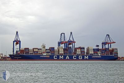
CMA CGM INTEGRITY
Cargo
Current Trip
| Time Travelled | 9 days |
|---|---|
| Remaining Time | 3 days |
| Distance Travelled | 4448.50 nm |
| Remaining Distance | 1638.11 nm |
| AVG Speed | 19 Knopen |
| MAX Speed | 20.4 Knopen |
| AVG Wind | 12.1 knots |
| MAX Wind | 19.7 knots |
| MIN Temp | 7.2°C / 44.96°F |
| MAX Temp | 23.8°C / 74.84°F |
| Diepgang | 14.3 M |
| Positie ontvangen | 6 d geleden |
Current Position
| Lengtegraad | -129.06611° |
|---|---|
| Breedtegraat | 33.96862° |
| Status | Under way using engine |
| Snelheid | 18.8 Knopen |
| Koers | 299.6° |
| Gebied | North Pacific Ocean |
| Station | T-AIS |
| Positie ontvangen | 6 d geleden |
Info
Information
The current position of CMA CGM INTEGRITY is in North Pacific Ocean with coordinates 33.96862° / -129.06611° as reported on 2024-04-22 18:33 by AIS to our vessel tracker app. The vessel's current speed is 18.8 Knopen and is heading at the port of YOKOHAMA. The estimated time of arrival as calculated by MyShipTracking vessel tracking app is 2024-05-02 12:57 LT
The vessel CMA CGM INTEGRITY (IMO: 9897781, MMSI: 229464000) is a Cargo It's sailing under the flag of [MT] Malta.
In this page you can find informations about the vessels current position, last detected port calls, and current voyage information. If the vessels is not in coverage by AIS you will find the latest position.
The current position of CMA CGM INTEGRITY is detected by our AIS receivers and we are not responsible for the reliability of the data. The last position was recorded while the vessel was in Coverage by the Ais receivers of our vessel tracking app.
The current draught of CMA CGM INTEGRITY as reported by AIS is 14.3 meters
Weather
| Temperature | 14.9°C / 58.82°F |
|---|---|
| Wind Speed | 18 knots |
| Direction | 184° S |
| Pressure | 1017 hPa |
| Humidity | 81.8 % |
| Cloud Coverage | 100 % |
Featured Company
Last Port Calls
| Port | Arrival | Departure | Time In Port |
|---|---|---|---|
| 2024-04-16 16:19 | 2024-04-19 05:28 | 2 d | |
| 2024-04-13 10:16 | 2024-04-14 22:40 | 1 d | |
| 2024-04-06 05:39 | 2024-04-07 21:59 | 1 d | |
| 2024-04-01 01:21 | 2024-04-02 11:42 | 1 d | |
| 2024-03-27 13:38 | 2024-03-27 13:41 | 2 m | |
| 2024-03-21 13:57 | 2024-03-22 13:55 | 23 h | |
| 2024-03-19 03:46 | 2024-03-21 02:42 | 1 d | |
| 2024-02-28 02:49 | 2024-03-01 09:43 | 2 d | |
| 2024-02-22 04:14 | |||
| 2024-02-16 00:02 | 2024-02-17 18:20 | 1 d |
Most Visited Ports (Last year)
| Port | Arrivals | |
|---|---|---|
| 8 | ||
| 8 | ||
| 7 | ||
| 4 | ||
| 4 | ||
| 4 |
Last Trips
| Origin | Departure | Destination | Arrival | Distance | |
|---|---|---|---|---|---|
| 2024-04-14 17:40 | 2024-04-16 11:19 | 184.99 nm | |||
| 2024-04-07 16:59 | 2024-04-13 05:16 | 1827.99 nm | |||
| 2024-04-02 06:42 | 2024-04-06 00:39 | 894.84 nm | |||
| 2024-03-27 08:41 | 2024-03-31 20:21 | 1166.52 nm | |||
| 2024-03-22 07:55 | 2024-03-27 08:38 | 1735.57 nm | |||
| 2024-03-20 20:42 | 2024-03-21 07:57 | 166.75 nm | |||
| 2024-03-01 18:43 | 2024-03-18 21:46 | 6641.60 nm | |||
| 2024-02-22 12:14 | 2024-02-28 11:49 | 812.29 nm | |||
| 2024-02-08 00:26 | 2024-02-16 09:02 | 1165.48 nm | |||
| 2024-01-22 11:59 | 2024-02-07 07:33 | 6521.30 nm |
Events
| Tijd | Evenement | Details | Positie / Bestemming | Info |
|---|---|---|---|---|
| 2024-04-22 18:38 | Status Changed | Default Under way using engine |
33.98036 / -129.09050
MXZLO-JPYOK
|
Snelheid: 18.8 kn Koers: 299.6° |
| 2024-04-22 18:33 | Status Changed | Under way using engine Default |
33.96862 / -129.06611
MXZLO-JPYOK
|
Snelheid: 18.8 kn Koers: 300° |
| 2024-04-22 18:33 | Buitenbereik |
33.96862 / -129.06611
North Pacific Ocean
MXZLO-JPYOK
|
Snelheid: 18.8 kn Koers: 299.6° |
|
| 2024-04-22 18:23 | Status Changed | Default Under way using engine |
33.94167 / -129.01056
MXZLO-JPYOK
|
Snelheid: 19.1 kn Koers: 301.6° |
| 2024-04-22 18:21 | Status Changed | Under way using engine Default |
33.93502 / -128.99753
MXZLO-JPYOK
|
Snelheid: 19.1 kn Koers: 301° |
| 2024-04-22 17:34 | Status Changed | Default Under way using engine |
33.80645 / -128.74654
MXZLO-JPYOK
|
Snelheid: 18.8 kn Koers: 301.3° |
| 2024-04-22 17:05 | Status Changed | Under way using engine Default |
33.72916 / -128.59299
MXZLO-JPYOK
|
Snelheid: 18.6 kn Koers: 303° |
| 2024-04-22 16:53 | Status Changed | Default Under way using engine |
33.69540 / -128.53032
MXZLO-JPYOK
|
Snelheid: 18.5 kn Koers: 303.4° |
| 2024-04-22 16:46 | Status Changed | Under way using engine Default |
33.67576 / -128.49394
MXZLO-JPYOK
|
Snelheid: 18.5 kn Koers: 303° |
| 2024-04-22 16:37 | Binnenbereik |
33.67576 / -128.49394
North Pacific Ocean
MXZLO-JPYOK
|
Snelheid: 18.5 kn Koers: 303.4° |