
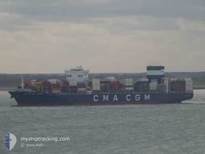
CMA CGM CARL ANTOINE
Cargo A
Current Trip
| Time Travelled | 1 day |
|---|---|
| Remaining Time | --- |
| Distance Travelled | 866.83 nm |
| Remaining Distance | --- |
| AVG Speed | 18.8 Knopen |
| MAX Speed | 21 Knopen |
| AVG Wind | 7 knots |
| MAX Wind | 14 knots |
| MIN Temp | 22.5°C / 72.5°F |
| MAX Temp | 28.7°C / 83.66°F |
| Diepgang | 14 M |
| Positie ontvangen | 18 h, 20 m geleden |
Current Position
| Lengtegraad | -63.04554° |
|---|---|
| Breedtegraat | 23.45997° |
| Status | Under way using engine |
| Snelheid | 19 Knopen |
| Koers | 47.9° |
| Gebied | North Atlantic Ocean |
| Station | T-AIS |
| Positie ontvangen | 18 h, 20 m geleden |
Info
Information
The current position of CMA CGM CARL ANTOINE is in North Atlantic Ocean with coordinates 23.45997° / -63.04554° as reported on 2024-05-13 13:52 by AIS to our vessel tracker app. The vessel's current speed is 19 Knopen and is heading at the port of ROTTERDAM. The estimated time of arrival as calculated by MyShipTracking vessel tracking app is 2024-05-21 14:00 LT
The vessel CMA CGM CARL ANTOINE (IMO: 9729087, MMSI: 248030000) is a Cargo A It's sailing under the flag of [MT] Malta.
In this page you can find informations about the vessels current position, last detected port calls, and current voyage information. If the vessels is not in coverage by AIS you will find the latest position.
The current position of CMA CGM CARL ANTOINE is detected by our AIS receivers and we are not responsible for the reliability of the data. The last position was recorded while the vessel was in Coverage by the Ais receivers of our vessel tracking app.
The current draught of CMA CGM CARL ANTOINE as reported by AIS is 14 meters
Weather
| Temperature | 22.5°C / 72.5°F |
|---|---|
| Wind Speed | 12 knots |
| Direction | 335° NNW |
| Pressure | 1016.1 hPa |
| Humidity | 65.9 % |
| Cloud Coverage | 64 % |
Featured Company
Last Port Calls
| Port | Arrival | Departure | Time In Port |
|---|---|---|---|
| 2024-05-11 01:38 | 2024-05-12 09:46 | 1 d | |
| 2024-05-08 15:47 | 2024-05-09 15:03 | 23 h | |
| 2024-05-06 21:54 | 2024-05-07 14:32 | 16 h | |
| 2024-05-03 00:25 | 2024-05-04 04:22 | 1 d | |
| 2024-04-30 11:09 | 2024-05-01 10:33 | 23 h | |
| 2024-04-24 01:16 | 2024-04-26 10:16 | 2 d | |
| 2024-04-19 19:17 | 2024-04-20 16:13 | 20 h | |
| 2024-04-12 22:50 | 2024-04-13 11:59 | 13 h | |
| 2024-04-09 07:22 | 2024-04-10 08:22 | 1 d | |
| 2024-04-07 03:30 | 2024-04-07 13:52 | 10 h |
Last Trips
| Origin | Departure | Destination | Arrival | Distance | |
|---|---|---|---|---|---|
| 2024-05-09 10:03 | 2024-05-10 21:38 | 627.83 nm | |||
| 2024-05-07 09:32 | 2024-05-08 10:47 | 300.18 nm | |||
| 2024-05-03 23:22 | 2024-05-06 16:54 | 828.03 nm | |||
| 2024-05-01 05:33 | 2024-05-02 19:25 | 689.97 nm | |||
| 2024-04-26 06:16 | 2024-04-30 06:09 | 1345.20 nm | |||
| 2024-04-20 11:13 | 2024-04-23 21:16 | 1340.36 nm | |||
| 2024-04-13 06:59 | 2024-04-19 14:17 | 1362.89 nm | |||
| 2024-04-10 03:22 | 2024-04-12 17:50 | 714.70 nm | |||
| 2024-04-07 09:52 | 2024-04-09 02:22 | 657.76 nm | |||
| 2024-03-24 06:49 | 2024-04-06 23:30 | 5339.24 nm |
Events
| Tijd | Evenement | Details | Positie / Bestemming | Info |
|---|---|---|---|---|
| 2024-05-13 14:01 | Status Changed | Default Under way using engine |
23.49167 / -63.00834
NLRTM
|
Snelheid: 19 kn Koers: 47.9° |
| 2024-05-13 13:52 | Buitenbereik |
23.45997 / -63.04554
North Atlantic Ocean
NLRTM
|
Snelheid: 19 kn Koers: 47.9° |
|
| 2024-05-13 09:40 | Wijzig zee gebeid | High seas of the North Atlantic Ocean Domican Republic part of the Caribbean Sea |
22.52518 / -64.09266
North Atlantic Ocean
NLRTM
|
Snelheid: 19.4 kn Koers: 46.5° |
| 2024-05-13 09:40 | Status Changed | Under way using engine Default |
22.52518 / -64.09266
NLRTM
|
Snelheid: 19.4 kn Koers: 47° |
| 2024-05-13 09:22 | Binnenbereik |
22.52518 / -64.09266
North Atlantic Ocean
NLRTM
|
Snelheid: 19.4 kn Koers: 46.5° |
|
| 2024-05-12 10:25 | Status Changed | Default Under way using engine |
18.30966 / -69.51466
NLRTM
|
Snelheid: 17 kn Koers: 144.6° |
| 2024-05-12 10:19 | Buitenbereik |
18.33039 / -69.53009
Caribbean Sea
NLRTM
|
Snelheid: 17 kn Koers: 144.6° |
|
| 2024-05-12 09:46 | Vertrekhaven |
|
18.42930 / -69.61546
NLRTM
|
Snelheid: 8.2 kn Koers: 117° |
| 2024-05-12 09:39 | Start beweging |
18.42991 / -69.62880
[DO] BOCA CHIKA
|
Snelheid: 3.2 kn Koers: 56° |
|
| 2024-05-12 09:31 | Status Changed | Under way using engine Moored |
18.42900 / -69.63100
[DO] BOCA CHIKA
|
Snelheid: Koers: 349° |