
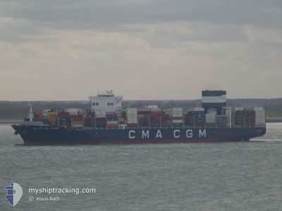
CMA CGM CARL ANTOINE
Cargo A
Current Trip
| Time Travelled | 9 days |
|---|---|
| Remaining Time | 10 h, 17 mins |
| Distance Travelled | 3918.57 nm |
| Remaining Distance | 129.24 nm |
| AVG Speed | 18.2 Noeuds |
| MAX Speed | 21 Noeuds |
| AVG Wind | 9 knots |
| MAX Wind | 20.1 knots |
| MIN Temp | 11.9°C / 53.42°F |
| MAX Temp | 28.7°C / 83.66°F |
| Tirant d eau | 14 m |
| Position reçue | 1 m depuis |
Current Position
| Longitude | 1.44541° |
|---|---|
| Latitude | 50.88780° |
| Etat | Under way using engine |
| Vitesse | 13.3 Noeuds |
| Parcours | 13.1° |
| Zone | English Channel |
| Station | T-AIS |
| Position reçue | 1 m depuis |
Info
Information
The current position of CMA CGM CARL ANTOINE is in English Channel with coordinates 50.88780° / 1.44541° as reported on 2024-05-21 11:12 by AIS to our vessel tracker app. The vessel's current speed is 13.3 Noeuds and is heading at the port of ROTTERDAM. The estimated time of arrival as calculated by MyShipTracking vessel tracking app is 2024-05-21 23:31 LT
The vessel CMA CGM CARL ANTOINE (IMO: 9729087, MMSI: 248030000) is a Cargo A It's sailing under the flag of [MT] Malta.
In this page you can find informations about the vessels current position, last detected port calls, and current voyage information. If the vessels is not in coverage by AIS you will find the latest position.
The current position of CMA CGM CARL ANTOINE is detected by our AIS receivers and we are not responsible for the reliability of the data. The last position was recorded while the vessel was in Coverage by the Ais receivers of our vessel tracking app.
The current draught of CMA CGM CARL ANTOINE as reported by AIS is 14 meters
Weather
| Temperature | 13.2°C / 55.76°F |
|---|---|
| Wind Speed | 5 knots |
| Direction | 40° NE |
| Pressure | 1008.8 hPa |
| Humidity | 90.8 % |
| Cloud Coverage | 100 % |
Featured Company
Last Port Calls
| Port | Arrival | Departure | Time In Port |
|---|---|---|---|
| 2024-05-10 21:38 | 2024-05-12 05:46 | 1 d | |
| 2024-05-08 10:47 | 2024-05-09 10:03 | 23 h | |
| 2024-05-06 16:54 | 2024-05-07 09:32 | 16 h | |
| 2024-05-02 19:25 | 2024-05-03 23:22 | 1 d | |
| 2024-04-30 06:09 | 2024-05-01 05:33 | 23 h | |
| 2024-04-23 21:16 | 2024-04-26 06:16 | 2 d | |
| 2024-04-19 14:17 | 2024-04-20 11:13 | 20 h | |
| 2024-04-12 17:50 | 2024-04-13 06:59 | 13 h | |
| 2024-04-09 02:22 | 2024-04-10 03:22 | 1 d | |
| 2024-04-06 23:30 | 2024-04-07 09:52 | 10 h |
Last Trips
| Origin | Departure | Destination | Arrival | Distance | |
|---|---|---|---|---|---|
| 2024-05-09 10:03 | 2024-05-10 21:38 | 627.83 nm | |||
| 2024-05-07 09:32 | 2024-05-08 10:47 | 300.18 nm | |||
| 2024-05-03 23:22 | 2024-05-06 16:54 | 828.03 nm | |||
| 2024-05-01 05:33 | 2024-05-02 19:25 | 689.97 nm | |||
| 2024-04-26 06:16 | 2024-04-30 06:09 | 1345.20 nm | |||
| 2024-04-20 11:13 | 2024-04-23 21:16 | 1340.36 nm | |||
| 2024-04-13 06:59 | 2024-04-19 14:17 | 1362.89 nm | |||
| 2024-04-10 03:22 | 2024-04-12 17:50 | 714.70 nm | |||
| 2024-04-07 09:52 | 2024-04-09 02:22 | 657.76 nm | |||
| 2024-03-24 06:49 | 2024-04-06 23:30 | 5339.24 nm |
Events
| Heure | Evenement | Détails | Position/ Destination | Info |
|---|---|---|---|---|
| 2024-05-21 08:53 | Etat Changé | Under way using engine Default |
50.52146 / 1.04345
NLRTM
|
Vitesse: 11.3 kn Parcours: 53° |
| 2024-05-21 08:45 | Etat Changé | Default Under way using engine |
50.50693 / 1.00622
NLRTM
|
Vitesse: 11.5 kn Parcours: 67.7° |
| 2024-05-21 08:40 | Changement de zone | French part of the English Channel United Kingdom part of the English Channel |
50.50076 / .98303
English Channel
NLRTM
|
Vitesse: 11.5 kn Parcours: 67.7° |
| 2024-05-21 08:40 | Etat Changé | Under way using engine Default |
50.50076 / .98303
NLRTM
|
Vitesse: 11.6 kn Parcours: 73° |
| 2024-05-21 08:13 | Etat Changé | Default Under way using engine |
50.47447 / .85290
NLRTM
|
Vitesse: 11.7 kn Parcours: 70.5° |
| 2024-05-21 01:13 | Detecté en mer | United Kingdom part of the English Channel |
50.13792 / -1.01577
English Channel
NLRTM
|
Vitesse: 8.3 kn Parcours: 75.3° |
| 2024-05-21 01:07 | Etat Changé | Under way using engine Default |
50.13461 / -1.03529
NLRTM
|
Vitesse: 8.3 kn Parcours: 75° |
| 2024-05-21 00:50 | Etat Changé | Default Under way using engine |
50.12484 / -1.09318
NLRTM
|
Vitesse: 8 kn Parcours: 75.4° |
| 2024-05-21 00:31 | Etat Changé | Under way using engine Default |
50.11377 / -1.15922
NLRTM
|
Vitesse: 8.1 kn Parcours: 76° |
| 2024-05-21 00:19 | Etat Changé | Default Under way using engine |
50.10683 / -1.19991
NLRTM
|
Vitesse: 8 kn Parcours: 75° |