
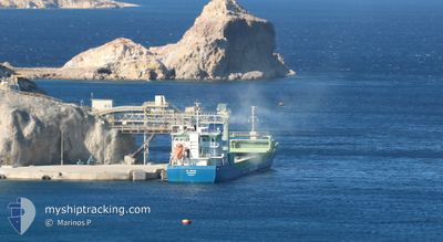
CL ATLAS
General Cargo
Current Trip
| Trip Time | 3 days |
|---|---|
| Trip Distance | 656.10 nm |
| AVG Speed | 7.3 Knopen |
| MAX Speed | 10.8 Knopen |
| Diepgang | 4.8 M |
| AVG Wind | 18.3 knots |
| MAX Wind | 32 knots |
| MIN Temp | 9.6°C / 49.28°F |
| MAX Temp | 18°C / 64.4°F |
| Positie ontvangen | 1 m geleden |
Current Position
| Lengtegraad | --- |
|---|---|
| Breedtegraat | --- |
| Status | Under way using engine |
| Snelheid | |
| Koers | 264° |
| Gebied | North Atlantic Ocean |
| Station | T-AIS |
| Positie ontvangen | 1 m geleden |
Info
Information
The current position of CL ATLAS is in North Atlantic Ocean with coordinates 40.65380° / -8.71831° as reported on 2025-03-15 19:15 by AIS to our vessel tracker app. The vessel's current speed is 0 Knopen and is currently inside the port of AVEIRO.
The vessel CL ATLAS (IMO: 9357511, MMSI: 205023000) is a General Cargo that was built in 2008 ( 17 Jaar oud ). It's sailing under the flag of [BE] Belgium.
In this page you can find informations about the vessels current position, last detected port calls, and current voyage information. If the vessels is not in coverage by AIS you will find the latest position.
The current position of CL ATLAS is detected by our AIS receivers and we are not responsible for the reliability of the data. The last position was recorded while the vessel was in Coverage by the Ais receivers of our vessel tracking app.
The current draught of CL ATLAS as reported by AIS is 4.8 meters
Weather
| Temperature | 9.8°C / 49.64°F |
|---|---|
| Wind Speed | 12 knots |
| Direction | 172° S |
| Pressure | 1014.6 hPa |
| Humidity | 86.4 % |
| Cloud Coverage | 100 % |
Featured Company
Last Port Calls
| Port | Arrival | Departure | Time In Port |
|---|---|---|---|
| 2025-03-15 10:24 | |||
| 2025-03-10 15:43 | 2025-03-11 17:54 | 1 d | |
| 2025-03-05 16:10 | 2025-03-09 00:32 | 3 d | |
| 2025-02-28 06:48 | 2025-03-01 23:34 | 1 d | |
| 2025-02-23 15:31 | 2025-02-26 21:50 | 3 d | |
| 2025-02-12 18:09 | 2025-02-18 20:26 | 6 d | |
| 2025-02-06 03:40 | 2025-02-07 12:45 | 1 d | |
| 2025-02-02 00:58 | 2025-02-04 01:51 | 2 d | |
| 2025-02-01 14:53 | 2025-02-01 22:54 | 8 h | |
| 2025-01-29 01:00 | 2025-01-30 01:01 | 1 d |
Last Trips
| Origin | Departure | Destination | Arrival | Distance | |
|---|---|---|---|---|---|
| 2025-03-11 17:54 | 2025-03-15 10:24 | 656.10 nm | |||
| 2025-03-09 00:32 | 2025-03-10 15:43 | 417.24 nm | |||
| 2025-03-01 23:34 | 2025-03-05 16:10 | 342.75 nm | |||
| 2025-02-26 21:50 | 2025-02-28 06:48 | 304.59 nm | |||
| 2025-02-18 20:26 | 2025-02-23 15:31 | 654.62 nm | |||
| 2025-02-07 12:45 | 2025-02-12 18:09 | 484.28 nm | |||
| 2025-02-04 01:51 | 2025-02-06 03:40 | 444.92 nm | |||
| 2025-01-30 01:01 | 2025-02-02 00:58 | 617.69 nm | |||
| 2025-01-30 01:01 | 2025-02-01 14:53 | 596.23 nm | |||
| 2025-01-27 22:24 | 2025-01-29 01:00 | 154.83 nm |
Events
| Tijd | Evenement | Details | Positie / Bestemming | Info |
|---|---|---|---|---|
| 2025-03-15 10:51 | Stop beweging |
40.65376 / -8.71819
[PT] AVEIRO
|
Snelheid: 0.1 kn Koers: 258° |
|
| 2025-03-15 10:24 | Aankomsthaven |
|
40.64376 / -8.75755
[PT] AVEIRO
|
Snelheid: 7.9 kn Koers: 60.9° |
| 2025-03-14 22:57 | ETA Changed | 2025/03/15 09:00 2025/03/15 04:00 |
39.64688 / -9.57804
PTAVE
|
Snelheid: 7.2 kn Koers: 33.1° |
| 2025-03-14 09:34 | ETA Changed | 2025/03/15 04:00 2025/03/14 22:00 |
38.07121 / -9.65545
PTAVE
|
Snelheid: 7.5 kn Koers: 348° |
| 2025-03-14 05:26 | ETA Changed | 2025/03/14 22:00 2025/03/14 16:00 |
37.54167 / -9.49489
PTAVE
|
Snelheid: 8.3 kn Koers: 345.2° |
| 2025-03-14 05:21 | Gevonden in zee | Portuguese part of the North Atlantic Ocean |
37.53200 / -9.49176
North Atlantic Ocean
PTAVE
|
Snelheid: 8.2 kn Koers: 346.7° |
| 2025-03-14 05:21 | Status Changed | Under way using engine Default |
37.53200 / -9.49176
PTAVE
|
Snelheid: 8.2 kn Koers: 344° |
| 2025-03-14 05:08 | Binnenbereik |
37.53200 / -9.49176
North Atlantic Ocean
PTAVE
|
Snelheid: 8.2 kn Koers: 346.7° |
|
| 2025-03-12 23:10 | Status Changed | Default Under way using engine |
36.01906 / -5.99053
PTAVE
|
Snelheid: 9.1 kn Koers: 281.6° |
| 2025-03-12 23:06 | Buitenbereik |
36.01711 / -5.97752
Strait of Gibraltar
PTAVE
|
Snelheid: 9.1 kn Koers: 281.6° |