
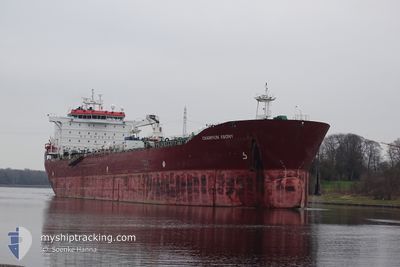
CHAMPION EBONY
Oil/Chemical Tanker
Current Trip
| Time Travelled | 13 days |
|---|---|
| Remaining Time | --- |
| Distance Travelled | 2302.11 nm |
| Remaining Distance | 3511.81 nm |
| AVG Speed | 10.3 Knopen |
| MAX Speed | 14.9 Knopen |
| AVG Wind | 10.5 knots |
| MAX Wind | 30.9 knots |
| MIN Temp | 24°C / 75.2°F |
| MAX Temp | 33.4°C / 92.12°F |
| Diepgang | 11.4 M |
| Positie ontvangen | 6 d geleden |
Current Position
| Lengtegraad | 103.45092° |
|---|---|
| Breedtegraat | 1.22929° |
| Status | Under way using engine |
| Snelheid | 11.8 Knopen |
| Koers | 284.3° |
| Gebied | Malacca Strait |
| Station | T-AIS |
| Positie ontvangen | 6 d geleden |
Info
Information
The current position of CHAMPION EBONY is in Malacca Strait with coordinates 1.22929° / 103.45092° as reported on 2024-05-22 05:15 by AIS to our vessel tracker app. The vessel's current speed is 11.8 Knopen and is heading at the port of SUEZ CANAL. The estimated time of arrival as calculated by MyShipTracking vessel tracking app is 2024-06-08 19:00 LT
The vessel CHAMPION EBONY (IMO: 9290608, MMSI: 258028000) is a Oil/Chemical Tanker that was built in 2004 ( 20 Jaar oud ). It's sailing under the flag of [NO] Norway.
In this page you can find informations about the vessels current position, last detected port calls, and current voyage information. If the vessels is not in coverage by AIS you will find the latest position.
The current position of CHAMPION EBONY is detected by our AIS receivers and we are not responsible for the reliability of the data. The last position was recorded while the vessel was in Coverage by the Ais receivers of our vessel tracking app.
The current draught of CHAMPION EBONY as reported by AIS is 11.4 meters
Weather
| Temperature | 28.4°C / 83.12°F |
|---|---|
| Wind Speed | 27 knots |
| Direction | 280° W |
| Pressure | 1007.4 hPa |
| Humidity | 84.3 % |
| Cloud Coverage | 100 % |
Featured Company
Last Port Calls
| Port | Arrival | Departure | Time In Port |
|---|---|---|---|
| 2024-05-12 09:48 | 2024-05-14 20:52 | 2 d | |
| 2024-03-23 14:44 | 2024-03-24 13:45 | 23 h |
Most Visited Ports (Last year)
| Port | Arrivals | |
|---|---|---|
| 6 | ||
| 3 | ||
| 3 | ||
| 1 | ||
| 1 | ||
| 1 |
Last Trips
| Origin | Departure | Destination | Arrival | Distance | |
|---|---|---|---|---|---|
| 2024-03-24 19:15 | 2024-05-12 16:48 | 6110.17 nm | |||
| 2024-02-03 02:58 | 2024-03-23 20:14 | 12214.08 nm |
Events
| Tijd | Evenement | Details | Positie / Bestemming | Info |
|---|---|---|---|---|
| 2024-05-22 05:20 | Status Changed | Default Under way using engine |
1.23314 / 103.43510
SUEZ EGYPT
|
Snelheid: 11.8 kn Koers: 284.3° |
| 2024-05-22 05:15 | Wijzig zee gebeid | Malaysian part of the Malacca Strait Malaysian part of the Singapore Strait |
1.22929 / 103.45092
Malacca Strait
SUEZ EGYPT
|
Snelheid: 11.8 kn Koers: 284.3° |
| 2024-05-22 05:15 | Status Changed | Under way using engine Default |
1.22929 / 103.45092
SUEZ EGYPT
|
Snelheid: 11.7 kn Koers: 284° |
| 2024-05-22 05:15 | Buitenbereik |
1.22929 / 103.45092
Malacca Strait
SUEZ EGYPT
|
Snelheid: 11.8 kn Koers: 284.3° |
|
| 2024-05-22 05:12 | Status Changed | Default Under way using engine |
1.22703 / 103.46053
SUEZ EGYPT
|
Snelheid: 11.7 kn Koers: 284.9° |
| 2024-05-22 04:32 | Wijzig zee gebeid | Malaysian part of the Singapore Strait Indonesian part of the Singapore Strait |
1.20098 / 103.58756
Singapore Strait
SUEZ EGYPT
|
Snelheid: 11.4 kn Koers: 282.2° |
| 2024-05-22 03:41 | Wijzig zee gebeid | Indonesian part of the Singapore Strait Singaporean part of the Singapore Strait |
1.13929 / 103.72702
Singapore Strait
SUEZ EGYPT
|
Snelheid: 9.9 kn Koers: 271.1° |
| 2024-05-22 01:48 | Start beweging | 4.56 nm, East of SINGAPORE |
1.27740 / 103.92794
SUEZ EGYPT
|
Snelheid: 3.1 kn Koers: 105° |
| 2024-05-22 01:44 | Status Changed | Under way using engine At anchor |
1.27839 / 103.92618
SUEZ EGYPT
|
Snelheid: 0.2 kn Koers: 101° |
| 2024-05-21 19:59 | Draught Changed | 11.4 10.9 |
1.27903 / 103.92821
SUEZ EGYPT
|
Snelheid: Koers: 229° |