
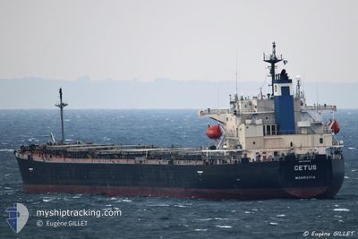
CETUS
Bulk Carrier
Current Trip
| Trip Time | 68 days |
|---|---|
| Trip Distance | 8220.31 nm |
| AVG Speed | 10.1 Knopen |
| MAX Speed | 10.1 Knopen |
| Diepgang | 11.8 M |
| AVG Wind | 11.9 knots |
| MAX Wind | 28.8 knots |
| MIN Temp | 10.4°C / 50.72°F |
| MAX Temp | 27.7°C / 81.86°F |
| Positie ontvangen | 12 d geleden |
Current Position
| Lengtegraad | --- |
|---|---|
| Breedtegraat | --- |
| Status | Under way using engine |
| Snelheid | 10.4 Knopen |
| Koers | 86° |
| Gebied | Gulf of Suez |
| Station | T-AIS |
| Positie ontvangen | 12 d geleden |
Info
Information
The current position of CETUS is in Gulf of Suez with coordinates 27.49850° / 34.07202° as reported on 2024-11-13 05:16 by AIS to our vessel tracker app. The vessel's current speed is 10.4 Knopen and is currently inside the port of YANBU.
The vessel CETUS (IMO: 9276482, MMSI: 636016823) is a Bulk Carrier that was built in 2003 ( 21 Jaar oud ). It's sailing under the flag of [LR] Liberia.
In this page you can find informations about the vessels current position, last detected port calls, and current voyage information. If the vessels is not in coverage by AIS you will find the latest position.
The current position of CETUS is detected by our AIS receivers and we are not responsible for the reliability of the data. The last position was recorded while the vessel was in Coverage by the Ais receivers of our vessel tracking app.
The current draught of CETUS as reported by AIS is 11.8 meters
Weather
| Temperature | 23.4°C / 74.12°F |
|---|---|
| Wind Speed | 17 knots |
| Direction | 308° NW |
| Pressure | 1012.3 hPa |
| Humidity | 67.1 % |
| Cloud Coverage | --- |
Featured Company
Last Port Calls
| Port | Arrival | Departure | Time In Port |
|---|---|---|---|
| 2024-11-21 15:14 | |||
| 2024-11-12 05:16 | 2024-11-12 14:25 | 9 h | |
| 2024-09-11 21:43 | 2024-09-14 03:53 | 2 d |
Most Visited Ports (Last year)
| Port | Arrivals | |
|---|---|---|
| 6 | ||
| 3 | ||
| 2 | ||
| 1 | ||
| 1 | ||
| 1 |
Last Trips
| Origin | Departure | Destination | Arrival | Distance | |
|---|---|---|---|---|---|
| 2024-09-14 00:53 | 2024-11-21 18:14 | 8220.31 nm | |||
| 2024-09-14 00:53 | 2024-11-12 07:16 | 6987.93 nm | |||
| 2024-08-06 09:00 | 2024-09-11 18:43 | 9373.18 nm |
Events
| Tijd | Evenement | Details | Positie / Bestemming | Info |
|---|---|---|---|---|
| 2024-11-21 15:51 | Stop beweging |
24.08132 / 38.07085
[SA] YANBU
|
Snelheid: 0.3 kn Koers: 207° |
|
| 2024-11-21 15:14 | Aankomsthaven |
|
24.06792 / 38.05118
[SA] YANBU
|
Snelheid: 6.1 kn Koers: 41° |
| 2024-11-20 05:12 | Start beweging | 6.41 nm, South West of AQABA INDUSTRIAL |
29.30249 / 34.87112
AQABA,JORDAN
|
Snelheid: 12.9 kn Koers: 199° |
| 2024-11-20 03:56 | Stop beweging | 1.1 nm, South East of AQABA INDUSTRIAL |
29.36115 / 34.96993
AQABA,JORDAN
|
Snelheid: Koers: 280° |
| 2024-11-20 03:44 | Start beweging | 1.09 nm, South East of AQABA INDUSTRIAL |
29.36228 / 34.97155
AQABA,JORDAN
|
Snelheid: 10.6 kn Koers: 212° |
| 2024-11-19 18:09 | Stop beweging |
31.71857 / 35.99927
AQABA,JORDAN
|
Snelheid: 0.1 kn Koers: 280° |
|
| 2024-11-19 04:12 | Start beweging |
31.70300 / 36.03737
AQABA,JORDAN
|
Snelheid: 18.9 kn Koers: 293° |
|
| 2024-11-18 20:30 | Start beweging |
31.76517 / 36.03183
AQABA,JORDAN
|
Snelheid: 51.8 kn Koers: 23° |
|
| 2024-11-18 19:39 | Stop beweging |
31.71488 / 36.00203
AQABA,JORDAN
|
Snelheid: 0.1 kn Koers: 280° |
|
| 2024-11-18 19:09 | Start beweging |
31.72265 / 35.97740
AQABA,JORDAN
|
Snelheid: 13.6 kn Koers: 292° |