

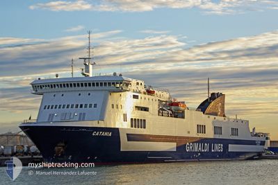
CATANIA
Ro-Ro/Passenger Ship

Current Trip
ITSAL>TNLGN
| Time Travelled | 15 h, 17 mins |
|---|---|
| Remaining Time | --- |
| Distance Travelled | 188.32 nm |
| Remaining Distance | --- |
| AVG Speed | 18 Knopen |
| MAX Speed | 18.7 Knopen |
| AVG Wind | 14.4 knots |
| MAX Wind | 17.3 knots |
| MIN Temp | 13.7°C / 56.66°F |
| MAX Temp | 16.4°C / 61.52°F |
| Diepgang | 6.7 M |
| Positie ontvangen | 14 h, 43 m geleden |
Current Position
| Lengtegraad | --- |
|---|---|
| Breedtegraat | --- |
| Status | Under way using engine |
| Snelheid | 18.5 Knopen |
| Koers | 19° |
| Gebied | Mediterranean Sea - Western Basin |
| Station | T-AIS |
| Positie ontvangen | 14 h, 43 m geleden |
Information
The current position of CATANIA is in Mediterranean Sea - Western Basin with coordinates 36.87800° / 10.41833° as reported on 2025-03-25 16:59 by AIS to our vessel tracker app. The vessel's current speed is 18.5 Knopen
The vessel CATANIA (IMO: 9261554, MMSI: 247098200) is a Ro-Ro/Passenger Ship that was built in 2003 ( 22 Jaar oud ). It's sailing under the flag of [IT] Italy.
In this page you can find informations about the vessels current position, last detected port calls, and current voyage information. If the vessels is not in coverage by AIS you will find the latest position.
The current position of CATANIA is detected by our AIS receivers and we are not responsible for the reliability of the data. The last position was recorded while the vessel was in Coverage by the Ais receivers of our vessel tracking app.
The current draught of CATANIA as reported by AIS is 6.7 meters
Weather
| Temperature | 14°C / 57.2°F |
|---|---|
| Wind Speed | 9 knots |
| Direction | 26° NNE |
| Pressure | 1013.6 hPa |
| Humidity | 76.5 % |
| Cloud Coverage | 18 % |


Featured Company
Last Port Calls
| Port | Arrival | Departure | Time In Port |
|---|---|---|---|
| 2025-03-25 08:04 | 2025-03-25 17:25 | 9 h | |
| 2025-03-24 08:42 | 2025-03-24 14:42 | 5 h | |
| 2025-03-23 19:27 | 2025-03-23 23:43 | 4 h | |
| 2025-03-22 23:46 | 2025-03-23 09:35 | 9 h | |
| 2025-03-22 09:05 | 2025-03-22 13:06 | 4 h | |
| 2025-03-21 19:25 | 2025-03-22 00:29 | 5 h | |
| 2025-03-21 06:20 | 2025-03-21 10:41 | 4 h | |
| 2025-03-20 11:47 | 2025-03-20 18:11 | 6 h | |
| 2025-03-18 09:34 | 2025-03-18 17:19 | 7 h | |
| 2025-03-17 08:40 | 2025-03-17 17:05 | 8 h |
Most Visited Ports (Last year)
| Port | Arrivals | |
|---|---|---|
| 173 | ||
| 136 | ||
| 96 | ||
| 39 |
Last Trips
| Origin | Departure | Destination | Arrival | Distance | |
|---|---|---|---|---|---|
| 2025-03-24 14:42 | 2025-03-25 08:04 | 312.68 nm | |||
| 2025-03-23 23:43 | 2025-03-24 08:42 | 165.82 nm | |||
| 2025-03-23 09:35 | 2025-03-23 19:27 | 186.85 nm | |||
| 2025-03-22 13:06 | 2025-03-22 23:46 | 190.56 nm | |||
| 2025-03-22 00:29 | 2025-03-22 09:05 | 164.58 nm | |||
| 2025-03-21 10:41 | 2025-03-21 19:25 | 165.84 nm | |||
| 2025-03-20 18:11 | 2025-03-21 06:20 | 187.09 nm | |||
| 2025-03-18 17:19 | 2025-03-20 11:47 | 613.41 nm | |||
| 2025-03-17 17:05 | 2025-03-18 09:34 | 312.68 nm | |||
| 2025-03-16 23:36 | 2025-03-17 08:40 | 166.18 nm |
Events
| Tijd | Evenement | Details | Positie / Bestemming | Info |
|---|---|---|---|---|
| 2025-03-25 17:08 | Status Changed | Default Under way using engine |
36.92150 / 10.43717
ITSAL>TNLGN
|
Snelheid: 18.5 kn Koers: 19° |
| 2025-03-25 16:59 | Status Changed | Under way using engine Default |
36.87800 / 10.41833
ITSAL>TNLGN
|
Snelheid: 17.9 kn Koers: 24° |
| 2025-03-25 16:59 | Buitenbereik |
36.87800 / 10.41833
Mediterranean Sea - Western Basin
|
Snelheid: 18.5 kn Koers: 19° |
|
| 2025-03-25 16:53 | Status Changed | Default Under way using engine |
36.84900 / 10.40517
ITSAL>TNLGN
|
Snelheid: 17 kn Koers: 35° |
| 2025-03-25 16:39 | Status Changed | Under way using engine Default |
36.79583 / 10.36217
ITSAL>TNLGN
|
Snelheid: 6.3 kn Koers: 125° |
| 2025-03-25 16:25 | Vertrekhaven |
|
36.79583 / 10.36217
ITSAL>TNLGN
|
Snelheid: 6.3 kn Koers: 125° |
| 2025-03-25 16:23 | Start beweging |
36.80833 / 10.30150
[TN] RADES
|
Snelheid: 6.3 kn Koers: 125° |
|
| 2025-03-25 16:23 | Binnenbereik |
36.79617 / 10.36250
Mediterranean Sea - Western Basin
|
Snelheid: 13 kn Koers: 53° |
|
| 2025-03-25 07:35 | Stop beweging |
36.81217 / 10.29700
[TN] RADES
|
Snelheid: Koers: 128° |
|
| 2025-03-25 06:40 | Buitenbereik |
36.79283 / 10.36300
Mediterranean Sea - Western Basin
[TN] RADES
|
Snelheid: 12 kn Koers: 255° |