

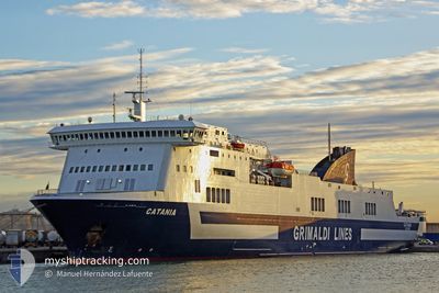
CATANIA
Ro-Ro/Passenger Ship

Current Trip
| Time Travelled | 10 h, 46 mins |
|---|---|
| Remaining Time | --- |
| Distance Travelled | 141.58 nm |
| Remaining Distance | --- |
| AVG Speed | 19.7 Knots |
| MAX Speed | 21 Knots |
| AVG Wind | 8.5 knots |
| MAX Wind | 11 knots |
| MIN Temp | 10°C / 50°F |
| MAX Temp | 14.1°C / 57.38°F |
| Dybgang | 6.5 m |
| Position Modtaget | 3 h, 12 m siden |
Current Position
| Longitude | --- |
|---|---|
| Latitude | --- |
| Status | Under way using engine |
| Fart | 19.2 Knots |
| Kurs | 41° |
| Område | Tyrrhenian Sea |
| Station | T-AIS |
| Position Modtaget | 3 h, 12 m siden |
Information
The current position of CATANIA is in Tyrrhenian Sea with coordinates 38.58966° / 12.32550° as reported on 2025-02-28 10:14 by AIS to our vessel tracker app. The vessel's current speed is 19.2 Knots and is heading at the port of SALERNO. The estimated time of arrival as calculated by MyShipTracking vessel tracking app is 2025-02-28 20:00 LT
The vessel CATANIA (IMO: 9261554, MMSI: 247098200) is a Ro-Ro/Passenger Ship that was built in 2003 ( 22 år gamle ). It's sailing under the flag of [IT] Italy.
In this page you can find informations about the vessels current position, last detected port calls, and current voyage information. If the vessels is not in coverage by AIS you will find the latest position.
The current position of CATANIA is detected by our AIS receivers and we are not responsible for the reliability of the data. The last position was recorded while the vessel was in Coverage by the Ais receivers of our vessel tracking app.
The current draught of CATANIA as reported by AIS is 6.5 meters
Weather
| Temperature | 14.1°C / 57.38°F |
|---|---|
| Wind Speed | 11 knots |
| Direction | 195° SSW |
| Pressure | 1020.9 hPa |
| Humidity | 72.6 % |
| Cloud Coverage | 14 % |


Featured Company
Last Port Calls
| Port | Arrival | Departure | Time In Port |
|---|---|---|---|
| 2025-02-27 18:44 | 2025-02-28 03:40 | 8 h | |
| 2025-02-26 17:40 | 2025-02-27 01:25 | 7 h | |
| 2025-02-25 14:13 | 2025-02-26 00:20 | 10 h | |
| 2025-02-24 23:07 | 2025-02-25 03:46 | 4 h | |
| 2025-02-24 07:58 | 2025-02-24 13:47 | 5 h | |
| 2025-02-23 18:51 | 2025-02-23 22:49 | 3 h | |
| 2025-02-23 08:44 | |||
| 2025-02-22 06:53 | 2025-02-22 12:37 | 5 h | |
| 2025-02-21 15:33 | 2025-02-21 20:43 | 5 h | |
| 2025-02-20 14:07 | 2025-02-20 22:13 | 8 h |
Most Visited Ports (Last year)
| Port | Arrivals | |
|---|---|---|
| 172 | ||
| 127 | ||
| 93 | ||
| 38 |
Last Trips
| Origin | Departure | Destination | Arrival | Distance | |
|---|---|---|---|---|---|
| 2025-02-27 01:25 | 2025-02-27 18:44 | 332.92 nm | |||
| 2025-02-26 00:20 | 2025-02-26 17:40 | 327.74 nm | |||
| 2025-02-25 03:46 | 2025-02-25 14:13 | 191.00 nm | |||
| 2025-02-24 13:47 | 2025-02-24 23:07 | 165.46 nm | |||
| 2025-02-23 22:49 | 2025-02-24 07:58 | 166.41 nm | |||
| 2025-02-23 08:44 | 2025-02-23 18:51 | 187.05 nm | |||
| 2025-02-21 20:43 | 2025-02-22 06:53 | 165.61 nm | |||
| 2025-02-20 22:13 | 2025-02-21 15:33 | 311.72 nm | |||
| 2025-02-18 20:54 | 2025-02-20 14:07 | 308.97 nm | |||
| 2025-02-18 02:26 | 2025-02-18 13:57 | 191.52 nm |
Events
| Tid | Hændelsen | Detaljer | Position / Dest | Info |
|---|---|---|---|---|
| 2025-02-28 10:14 | Udenfor Dækning |
38.58966 / 12.32550
Tyrrhenian Sea
TNLGN>ITSAL
|
Fart: 19.2 kn Kurs: 41° |
|
| 2025-02-28 10:11 | Status er ændret | Under way using engine Default |
38.57967 / 12.31450
TNLGN>ITSAL
|
Fart: 19.1 kn Kurs: 40° |
| 2025-02-28 09:53 | Status er ændret | Default Under way using engine |
38.50583 / 12.23350
TNLGN>ITSAL
|
Fart: 19 kn Kurs: 41° |
| 2025-02-28 08:08 | Destination er ændret | TNLGN>ITSAL ITPMO>TNLGN |
38.08417 / 11.74783
TNLGN>ITSAL
|
Fart: 19.7 kn Kurs: 41° |
| 2025-02-28 08:08 | ETA er ændret | 2025/02/28 19:00 2025/02/24 08:00 |
38.08417 / 11.74783
TNLGN>ITSAL
|
Fart: 19.7 kn Kurs: 41° |
| 2025-02-28 07:56 | Ændre havområde | Italian part of the Tyrrhenian Sea Italian part of the Mediterranean Sea - Western Basin |
38.03733 / 11.68917
Tyrrhenian Sea
|
Fart: 19.4 kn Kurs: 44° |
| 2025-02-28 07:25 | Status er ændret | Under way using engine Default |
37.91683 / 11.54333
ITPMO>TNLGN
|
Fart: 19.4 kn Kurs: 41° |
| 2025-02-28 07:25 | Indenfor Dækning |
37.91683 / 11.54333
Mediterranean Sea - Western Basin
|
Fart: 19.7 kn Kurs: 43° |
|
| 2025-02-28 02:40 | Afsejlet fra sidste havn |
|
36.81250 / 10.37450
ITPMO>TNLGN
|
Fart: 6.2 kn Kurs: 122° |
| 2025-02-27 17:44 | Skibe i havn |
|
36.81100 / 10.29850
[TN] RADES
|
Fart: 17.8 kn Kurs: 181° |