
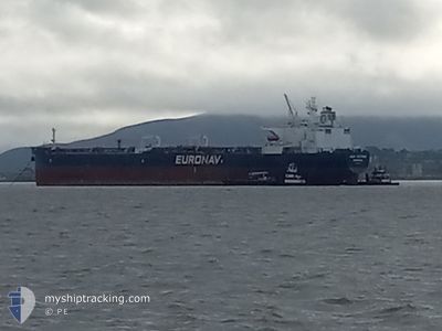
CAP VICTOR
Crude Oil Tanker
Current Trip
| Time Travelled | 16 days |
|---|---|
| Remaining Time | --- |
| Distance Travelled | 2848.86 nm |
| Remaining Distance | --- |
| AVG Speed | 8.2 Knopen |
| MAX Speed | 15.8 Knopen |
| AVG Wind | 9.4 knots |
| MAX Wind | 21 knots |
| MIN Temp | 11.3°C / 52.34°F |
| MAX Temp | 30°C / 86°F |
| Diepgang | 8.6 M |
| Positie ontvangen | 3 d geleden |
Current Position
| Lengtegraad | -100.33925° |
|---|---|
| Breedtegraat | 15.62386° |
| Status | Under way using engine |
| Snelheid | 7.5 Knopen |
| Koers | 115.5° |
| Gebied | North Pacific Ocean |
| Station | T-AIS |
| Positie ontvangen | 3 d geleden |
Info
Information
The current position of CAP VICTOR is in North Pacific Ocean with coordinates 15.62386° / -100.33925° as reported on 2024-05-03 18:58 by AIS to our vessel tracker app. The vessel's current speed is 7.5 Knopen and is heading at the port of ESMERALDAS. The estimated time of arrival as calculated by MyShipTracking vessel tracking app is 2024-05-12 04:00 LT
The vessel CAP VICTOR (IMO: 9321720, MMSI: 636020915) is a Crude Oil Tanker that was built in 2007 ( 17 Jaar oud ). It's sailing under the flag of [LR] Liberia.
In this page you can find informations about the vessels current position, last detected port calls, and current voyage information. If the vessels is not in coverage by AIS you will find the latest position.
The current position of CAP VICTOR is detected by our AIS receivers and we are not responsible for the reliability of the data. The last position was recorded while the vessel was in Coverage by the Ais receivers of our vessel tracking app.
The current draught of CAP VICTOR as reported by AIS is 8.6 meters
Weather
| Temperature | 28.8°C / 83.84°F |
|---|---|
| Wind Speed | 6 knots |
| Direction | 346° NNW |
| Pressure | 1008.5 hPa |
| Humidity | 71.8 % |
| Cloud Coverage | 100 % |
Featured Company
Most Visited Ports (Last year)
| Port | Arrivals | |
|---|---|---|
| 1 | ||
| 1 | ||
| 1 | ||
| 1 | ||
| 1 | ||
| 1 |
Last Trips
| Origin | Departure | Destination | Arrival | Distance | |
|---|---|---|---|---|---|
| 2024-01-26 23:31 | 2024-04-17 20:11 | 4809.81 nm |
Events
| Tijd | Evenement | Details | Positie / Bestemming | Info |
|---|---|---|---|---|
| 2024-05-03 19:05 | Status Changed | Default Under way using engine |
15.61744 / -100.32564
ECESM
|
Snelheid: 7.5 kn Koers: 115.5° |
| 2024-05-03 18:58 | Status Changed | Under way using engine Default |
15.62386 / -100.33925
ECESM
|
Snelheid: 7.5 kn Koers: 115° |
| 2024-05-03 18:58 | Buitenbereik |
15.62386 / -100.33925
North Pacific Ocean
ECESM
|
Snelheid: 7.5 kn Koers: 115.5° |
|
| 2024-05-03 18:41 | Status Changed | Default Under way using engine |
15.64038 / -100.37420
ECESM
|
Snelheid: 7.5 kn Koers: 116.5° |
| 2024-05-03 18:37 | Status Changed | Under way using engine Default |
15.64419 / -100.38192
ECESM
|
Snelheid: 7.5 kn Koers: 116° |
| 2024-05-03 18:26 | Binnenbereik |
15.64419 / -100.38192
North Pacific Ocean
ECESM
|
Snelheid: 7.5 kn Koers: 116.5° |
|
| 2024-05-02 10:27 | Status Changed | Default Under way using engine |
18.18507 / -104.05475
ECESM
|
Snelheid: 7.3 kn Koers: 123.5° |
| 2024-05-02 10:21 | Buitenbereik |
18.19179 / -104.06536
North Pacific Ocean
ECESM
|
Snelheid: 7.3 kn Koers: 123.5° |
|
| 2024-05-02 10:16 | Status Changed | Under way using engine Default |
18.19659 / -104.07257
ECESM
|
Snelheid: 7.3 kn Koers: 123° |
| 2024-05-02 10:14 | Status Changed | Default Under way using engine |
18.19923 / -104.07658
ECESM
|
Snelheid: 7.4 kn Koers: 123.2° |