
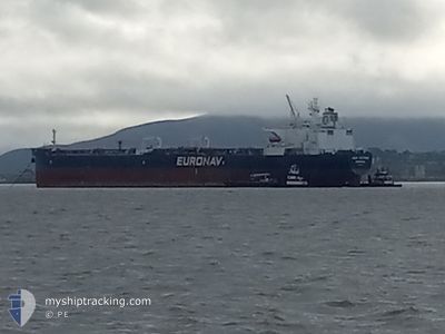
CAP VICTOR
Crude Oil Tanker
Current Trip
| Time Travelled | 5 days |
|---|---|
| Remaining Time | --- |
| Distance Travelled | 840.10 nm |
| Remaining Distance | --- |
| AVG Speed | 8.5 Knots |
| MAX Speed | 15.8 Knots |
| AVG Wind | 8.2 knots |
| MAX Wind | 19 knots |
| MIN Temp | 11.3°C / 52.34°F |
| MAX Temp | 21.2°C / 70.16°F |
| Dybgang | 8.6 m |
| Position Modtaget | 3 d siden |
Current Position
| Longitude | -124.18704° |
|---|---|
| Latitude | 36.61015° |
| Status | Under way using engine |
| Fart | 6.6 Knots |
| Kurs | 226.7° |
| Område | North Pacific Ocean |
| Station | T-AIS |
| Position Modtaget | 3 d siden |
Info
Information
The current position of CAP VICTOR is in North Pacific Ocean with coordinates 36.61015° / -124.18704° as reported on 2024-04-23 00:08 by AIS to our vessel tracker app. The vessel's current speed is 6.6 Knots and is heading at the port of ESMERALDAS. The estimated time of arrival as calculated by MyShipTracking vessel tracking app is 2024-05-12 04:00 LT
The vessel CAP VICTOR (IMO: 9321720, MMSI: 636020915) is a Crude Oil Tanker that was built in 2007 ( 17 år gamle ). It's sailing under the flag of [LR] Liberia.
In this page you can find informations about the vessels current position, last detected port calls, and current voyage information. If the vessels is not in coverage by AIS you will find the latest position.
The current position of CAP VICTOR is detected by our AIS receivers and we are not responsible for the reliability of the data. The last position was recorded while the vessel was in Coverage by the Ais receivers of our vessel tracking app.
The current draught of CAP VICTOR as reported by AIS is 8.6 meters
Weather
| Temperature | 16.3°C / 61.34°F |
|---|---|
| Wind Speed | 17 knots |
| Direction | 325° NW |
| Pressure | 1020 hPa |
| Humidity | 76.7 % |
| Cloud Coverage | 100 % |
Featured Company
Most Visited Ports (Last year)
| Port | Arrivals | |
|---|---|---|
| 1 | ||
| 1 | ||
| 1 | ||
| 1 | ||
| 1 | ||
| 1 |
Last Trips
| Origin | Departure | Destination | Arrival | Distance | |
|---|---|---|---|---|---|
| 2024-01-26 23:31 | 2024-04-17 20:11 | 4809.81 nm |
Events
| Tid | Hændelsen | Detaljer | Position / Dest | Info |
|---|---|---|---|---|
| 2024-04-23 00:13 | Status er ændret | Default Under way using engine |
36.60255 / -124.19624
ECESM
|
Fart: 6.6 kn Kurs: 226.7° |
| 2024-04-23 00:08 | Status er ændret | Under way using engine Default |
36.61015 / -124.18704
ECESM
|
Fart: 6.6 kn Kurs: 225° |
| 2024-04-23 00:08 | Udenfor Dækning |
36.61015 / -124.18704
North Pacific Ocean
ECESM
|
Fart: 6.6 kn Kurs: 226.7° |
|
| 2024-04-22 23:37 | Status er ændret | Default Under way using engine |
36.65085 / -124.13724
ECESM
|
Fart: 6.9 kn Kurs: 227.8° |
| 2024-04-22 23:28 | Status er ændret | Under way using engine Default |
36.66286 / -124.12260
ECESM
|
Fart: 6.9 kn Kurs: 224° |
| 2024-04-22 22:55 | Status er ændret | Default Under way using engine |
36.70890 / -124.06715
ECESM
|
Fart: 7 kn Kurs: 221.1° |
| 2024-04-22 22:39 | Status er ændret | Under way using engine Default |
36.73170 / -124.04126
ECESM
|
Fart: 7 kn Kurs: 221° |
| 2024-04-22 22:29 | Status er ændret | Default Under way using engine |
36.74715 / -124.02419
ECESM
|
Fart: 7 kn Kurs: 217.3° |
| 2024-04-22 20:51 | Status er ændret | Under way using engine Default |
36.89434 / -123.89272
ECESM
|
Fart: 6.4 kn Kurs: 215° |
| 2024-04-22 20:44 | Status er ændret | Default Under way using engine |
36.90596 / -123.88250
ECESM
|
Fart: 6.3 kn Kurs: 217.5° |