
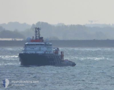
BYLGIA
Anchor Handling Vessel
Current Trip
| Time Travelled | 1 day |
|---|---|
| Remaining Time | 1 day |
| Distance Travelled | 271.21 nm |
| Remaining Distance | 189.48 nm |
| AVG Speed | 6.3 Knopen |
| MAX Speed | 7.8 Knopen |
| AVG Wind | 11.6 knots |
| MAX Wind | 32.8 knots |
| MIN Temp | 5.8°C / 42.44°F |
| MAX Temp | 10.1°C / 50.18°F |
| Diepgang | 8 M |
| Positie ontvangen | 17 h, 57 m geleden |
Current Position
| Lengtegraad | 5.32962° |
|---|---|
| Breedtegraat | 56.20474° |
| Status | Restricted manoeuverability |
| Snelheid | 6.4 Knopen |
| Koers | 169.2° |
| Gebied | North Sea |
| Station | T-AIS |
| Positie ontvangen | 17 h, 57 m geleden |
Info
Information
The current position of BYLGIA is in North Sea with coordinates 56.20474° / 5.32962° as reported on 2024-04-28 10:51 by AIS to our vessel tracker app. The vessel's current speed is 6.4 Knopen and is heading at the port of ROTTERDAM. The estimated time of arrival as calculated by MyShipTracking vessel tracking app is 2024-04-30 16:50 LT
The vessel BYLGIA (IMO: 9646314, MMSI: 244740210) is a Anchor Handling Vessel that was built in 2013 ( 11 Jaar oud ). It's sailing under the flag of [NL] Netherlands.
In this page you can find informations about the vessels current position, last detected port calls, and current voyage information. If the vessels is not in coverage by AIS you will find the latest position.
The current position of BYLGIA is detected by our AIS receivers and we are not responsible for the reliability of the data. The last position was recorded while the vessel was in Coverage by the Ais receivers of our vessel tracking app.
The current draught of BYLGIA as reported by AIS is 8 meters
Weather
| Temperature | 8.9°C / 48.02°F |
|---|---|
| Wind Speed | 16 knots |
| Direction | 202° SSW |
| Pressure | 1014.4 hPa |
| Humidity | 85.2 % |
| Cloud Coverage | 8 % |
Featured Company
Last Port Calls
| Port | Arrival | Departure | Time In Port |
|---|---|---|---|
| 2024-04-25 14:49 | 2024-04-27 06:31 | 1 d | |
| 2024-04-22 16:09 | 2024-04-25 14:16 | 2 d | |
| 2024-04-19 16:22 | 2024-04-22 05:05 | 2 d | |
| 2024-04-13 07:06 | 2024-04-14 19:14 | 1 d | |
| 2024-04-05 20:15 | 2024-04-13 04:10 | 7 d | |
| 2024-04-04 12:38 | 2024-04-05 18:27 | 1 d | |
| 2024-04-03 19:11 | 2024-04-04 05:24 | 10 h | |
| 2024-03-23 12:20 | 2024-04-03 17:30 | 11 d | |
| 2024-03-22 14:00 | 2024-03-23 09:39 | 19 h | |
| 2024-03-21 09:54 | 2024-03-22 11:52 | 1 d |
Most Visited Ports (Last year)
| Port | Arrivals | |
|---|---|---|
| 11 | ||
| 9 | ||
| 4 | ||
| 4 | ||
| 4 | ||
| 4 |
Last Trips
| Origin | Departure | Destination | Arrival | Distance | |
|---|---|---|---|---|---|
| 2024-04-25 16:16 | 2024-04-25 16:49 | 3.23 nm | |||
| 2024-04-22 07:05 | 2024-04-22 18:09 | 4.37 nm | |||
| 2024-04-14 21:14 | 2024-04-19 18:22 | 541.48 nm | |||
| 2024-04-13 06:10 | 2024-04-13 09:06 | 21.95 nm | |||
| 2024-04-05 20:27 | 2024-04-05 22:15 | 16.78 nm | |||
| 2024-04-04 07:24 | 2024-04-04 14:38 | 38.96 nm | |||
| 2024-04-03 19:30 | 2024-04-03 21:11 | 16.69 nm | |||
| 2024-03-23 10:39 | 2024-03-23 13:20 | 17.93 nm | |||
| 2024-03-22 12:52 | 2024-03-22 15:00 | 17.32 nm | |||
| 2024-02-26 10:44 | 2024-03-21 10:54 | 6276.76 nm |
Events
| Tijd | Evenement | Details | Positie / Bestemming | Info |
|---|---|---|---|---|
| 2024-04-28 11:02 | Status Changed | Default Restricted manoeuverability |
56.18655 / 5.33604
ROTTERDAM
|
Snelheid: 6.4 kn Koers: 169.2° |
| 2024-04-28 10:51 | Buitenbereik |
56.20474 / 5.32962
North Sea
ROTTERDAM
|
Snelheid: 6.4 kn Koers: 169.2° |
|
| 2024-04-28 10:37 | Status Changed | Restricted manoeuverability Default |
56.23024 / 5.32046
ROTTERDAM
|
Snelheid: 6.4 kn Koers: 170° |
| 2024-04-28 10:17 | Status Changed | Default Restricted manoeuverability |
56.26434 / 5.30795
ROTTERDAM
|
Snelheid: 6.5 kn Koers: 168.2° |
| 2024-04-28 09:19 | Status Changed | Restricted manoeuverability Default |
56.36741 / 5.26981
ROTTERDAM
|
Snelheid: 6.5 kn Koers: 169° |
| 2024-04-28 09:12 | Status Changed | Default Restricted manoeuverability |
56.37924 / 5.26534
ROTTERDAM
|
Snelheid: 6.4 kn Koers: 167.1° |
| 2024-04-28 08:55 | Gevonden in zee | Danish part of the North Sea |
56.40983 / 5.25353
North Sea
ROTTERDAM
|
Snelheid: 6.5 kn Koers: 168.5° |
| 2024-04-28 08:54 | Status Changed | Restricted manoeuverability Default |
56.41186 / 5.25276
ROTTERDAM
|
Snelheid: 6.4 kn Koers: 169° |
| 2024-04-28 08:35 | Binnenbereik |
56.40983 / 5.25353
North Sea
ROTTERDAM
|
Snelheid: 6.5 kn Koers: 168.5° |
|
| 2024-04-28 05:54 | Buitenbereik |
56.73235 / 5.17087
North Sea
ROTTERDAM
|
Snelheid: 6.6 kn Koers: 177.9° |