
BUZLUDJA
Cargo
Current Trip
| Time Travelled | 15 days |
|---|---|
| Remaining Time | --- |
| Distance Travelled | 4174.61 nm |
| Remaining Distance | --- |
| AVG Speed | 10.6 Knopen |
| MAX Speed | 12.7 Knopen |
| AVG Wind | 14.6 knots |
| MAX Wind | 25 knots |
| MIN Temp | -0.8°C / 30.56°F |
| MAX Temp | 22.3°C / 72.14°F |
| Diepgang | 10 M |
| Positie ontvangen | 3 d geleden |
Current Position
| Lengtegraad | -15.37405° |
|---|---|
| Breedtegraat | 27.50324° |
| Status | Under way using engine |
| Snelheid | 11.4 Knopen |
| Koers | 205.7° |
| Gebied | North Atlantic Ocean |
| Station | T-AIS |
| Positie ontvangen | 3 d geleden |
Info
Information
The current position of BUZLUDJA is in North Atlantic Ocean with coordinates 27.50324° / -15.37405° as reported on 2024-05-15 03:58 by AIS to our vessel tracker app. The vessel's current speed is 11.4 Knopen and is heading at the port of BUENOS AIRES. The estimated time of arrival as calculated by MyShipTracking vessel tracking app is 2024-06-01 09:00 LT
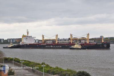
The vessel BUZLUDJA (IMO: 9835783, MMSI: 215475000) is a Cargo It's sailing under the flag of [MT] Malta.
In this page you can find informations about the vessels current position, last detected port calls, and current voyage information. If the vessels is not in coverage by AIS you will find the latest position.
The current position of BUZLUDJA is detected by our AIS receivers and we are not responsible for the reliability of the data. The last position was recorded while the vessel was in Coverage by the Ais receivers of our vessel tracking app.
The current draught of BUZLUDJA as reported by AIS is 10 meters
Weather
| Temperature | 22.3°C / 72.14°F |
|---|---|
| Wind Speed | 16 knots |
| Direction | 11° N |
| Pressure | 1014.8 hPa |
| Humidity | 80.2 % |
| Cloud Coverage | 26 % |
Featured Company
Most Visited Ports (Last year)
| Port | Arrivals | |
|---|---|---|
| 2 | ||
| 2 | ||
| 2 | ||
| 2 | ||
| 1 | ||
| 1 |
Last Trips
| Origin | Departure | Destination | Arrival | Distance | |
|---|---|---|---|---|---|
| 2024-04-09 04:44 | 2024-04-24 04:10 | 3602.88 nm | |||
| 2024-02-25 23:39 | 2024-03-28 08:16 | 1409.94 nm |
Events
| Tijd | Evenement | Details | Positie / Bestemming | Info |
|---|---|---|---|---|
| 2024-05-15 04:00 | Status Changed | Default Under way using engine |
27.49667 / -15.37667
RECALADA
|
Snelheid: 11.4 kn Koers: 205.7° |
| 2024-05-15 03:58 | Status Changed | Under way using engine Default |
27.50324 / -15.37405
RECALADA
|
Snelheid: 11 kn Koers: 205° |
| 2024-05-15 03:58 | Buitenbereik |
27.50324 / -15.37405
North Atlantic Ocean
RECALADA
|
Snelheid: 11.4 kn Koers: 205.7° |
|
| 2024-05-15 03:23 | Status Changed | Default Under way using engine |
27.60396 / -15.32073
RECALADA
|
Snelheid: 11.4 kn Koers: 201.7° |
| 2024-05-15 00:28 | ETA Changed | 2024/06/01 12:00 2024/06/01 17:00 |
28.07994 / -15.33722
RECALADA
|
Snelheid: 9.9 kn Koers: 138.6° |
| 2024-05-15 00:02 | Start beweging | 1.41 nm, South East of LAS PALMAS |
28.10958 / -15.39765
RECALADA
|
Snelheid: 3.4 kn Koers: 108° |
| 2024-05-14 23:54 | Status Changed | Under way using engine At anchor |
28.10711 / -15.39757
RECALADA
|
Snelheid: 1.1 kn Koers: 346° |
| 2024-05-14 23:43 | Status Changed | At anchor Default |
28.10728 / -15.39652
RECALADA
|
Snelheid: 0.9 kn Koers: 29° |
| 2024-05-14 23:37 | Status Changed | Default At anchor |
28.10714 / -15.39804
RECALADA
|
Snelheid: 0.3 kn Koers: 43° |
| 2024-05-14 23:31 | Status Changed | At anchor Default |
28.10699 / -15.39926
RECALADA
|
Snelheid: Koers: -1° |