

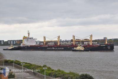
BUZLUDJA
Cargo

Current Trip
| Time Travelled | 11 days |
|---|---|
| Remaining Time | --- |
| Distance Travelled | 2930.40 nm |
| Remaining Distance | 983.70 nm |
| AVG Speed | 10.8 Knots |
| MAX Speed | 12.7 Knots |
| AVG Wind | 9.5 knots |
| MAX Wind | 22 knots |
| MIN Temp | 14.2°C / 57.56°F |
| MAX Temp | 29.1°C / 84.38°F |
| Dybgang | 6.5 m |
| Position Modtaget | 1 d siden |
Current Position
| Longitude | --- |
|---|---|
| Latitude | --- |
| Status | Under way using engine |
| Fart | 10.5 Knots |
| Kurs | 324.3° |
| Område | North Pacific Ocean |
| Station | T-AIS |
| Position Modtaget | 1 d siden |
Information
The current position of BUZLUDJA is in North Pacific Ocean with coordinates 29.68482° / -121.81100° as reported on 2025-03-26 01:44 by AIS to our vessel tracker app. The vessel's current speed is 10.5 Knots and is heading at the port of VANCOUVER. The estimated time of arrival as calculated by MyShipTracking vessel tracking app is 2025-03-30 12:00 LT
The vessel BUZLUDJA (IMO: 9835783, MMSI: 215475000) is a Cargo It's sailing under the flag of [MT] Malta.
In this page you can find informations about the vessels current position, last detected port calls, and current voyage information. If the vessels is not in coverage by AIS you will find the latest position.
The current position of BUZLUDJA is detected by our AIS receivers and we are not responsible for the reliability of the data. The last position was recorded while the vessel was in Coverage by the Ais receivers of our vessel tracking app.
The current draught of BUZLUDJA as reported by AIS is 6.5 meters
Weather
| Temperature | 14.3°C / 57.74°F |
|---|---|
| Wind Speed | 21 knots |
| Direction | 256° WSW |
| Pressure | 1017.6 hPa |
| Humidity | 74.5 % |
| Cloud Coverage | 66 % |


Featured Company
Last Port Calls
| Port | Arrival | Departure | Time In Port |
|---|---|---|---|
| 2025-03-12 23:10 | 2025-03-16 08:04 | 3 d | |
| 2025-02-21 12:06 | 2025-02-27 05:22 | 5 d | |
| 2025-02-12 16:50 | 2025-02-18 14:56 | 5 d |
Most Visited Ports (Last year)
| Port | Arrivals | |
|---|---|---|
| 3 | ||
| 1 | ||
| 1 | ||
| 1 | ||
| 1 | ||
| 1 |
Last Trips
| Origin | Departure | Destination | Arrival | Distance | |
|---|---|---|---|---|---|
| 2025-02-27 05:22 | 2025-03-12 23:10 | 891.22 nm | |||
| 2025-02-18 14:56 | 2025-02-21 12:06 | 584.34 nm | |||
| 2024-12-08 21:44 | 2025-02-12 16:50 | 6895.08 nm |
Events
| Tid | Hændelsen | Detaljer | Position / Dest | Info |
|---|---|---|---|---|
| 2025-03-26 01:55 | Status er ændret | Default Under way using engine |
29.71113 / -121.83312
CAVAN
|
Fart: 10.5 kn Kurs: 324.3° |
| 2025-03-26 01:44 | Status er ændret | Under way using engine Default |
29.68482 / -121.81100
CAVAN
|
Fart: 10.3 kn Kurs: 323° |
| 2025-03-26 01:44 | Udenfor Dækning |
29.68482 / -121.81100
North Pacific Ocean
CAVAN
|
Fart: 10.5 kn Kurs: 324.3° |
|
| 2025-03-26 01:05 | Status er ændret | Default Under way using engine |
29.59258 / -121.73440
CAVAN
|
Fart: 10.7 kn Kurs: 324.1° |
| 2025-03-26 01:00 | Status er ændret | Under way using engine Default |
29.57974 / -121.72402
CAVAN
|
Fart: 10.5 kn Kurs: 325° |
| 2025-03-26 00:34 | Status er ændret | Default Under way using engine |
29.51826 / -121.67428
CAVAN
|
Fart: 10.3 kn Kurs: 324.9° |
| 2025-03-26 00:23 | Status er ændret | Under way using engine Default |
29.49142 / -121.65322
CAVAN
|
Fart: 10.8 kn Kurs: 325° |
| 2025-03-26 00:23 | Indenfor Dækning |
29.49142 / -121.65322
North Pacific Ocean
CAVAN
|
Fart: 10.7 kn Kurs: 325.4° |
|
| 2025-03-25 21:10 | Status er ændret | Default Under way using engine |
29.08665 / -121.20425
CAVAN
|
Fart: 10.3 kn Kurs: 305.7° |
| 2025-03-25 21:05 | Udenfor Dækning |
29.07865 / -121.19187
North Pacific Ocean
CAVAN
|
Fart: 10.3 kn Kurs: 305.7° |