
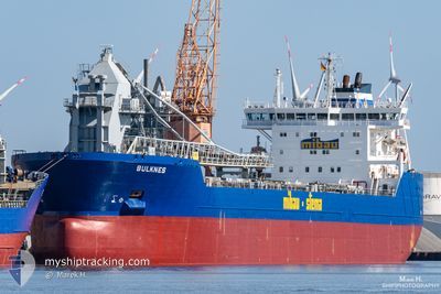
BULKNES
Self Discharging Bulk Carrier
Current Trip
| Time Travelled | 2 days |
|---|---|
| Remaining Time | 1 day |
| Distance Travelled | 322.44 nm |
| Remaining Distance | 146.07 nm |
| AVG Speed | 6.5 Knopen |
| MAX Speed | 14.8 Knopen |
| AVG Wind | 7.6 knots |
| MAX Wind | 20 knots |
| MIN Temp | -3.5°C / 25.7°F |
| MAX Temp | 2.8°C / 37.04°F |
| Diepgang | 9.2 M |
| Positie ontvangen | 5 h, 4 m geleden |
Current Position
| Lengtegraad | --- |
|---|---|
| Breedtegraat | --- |
| Status | Under way using engine |
| Snelheid | 5.5 Knopen |
| Koers | 227° |
| Gebied | North Sea |
| Station | T-AIS |
| Positie ontvangen | 5 h, 4 m geleden |
Info
Information
The current position of BULKNES is in North Sea with coordinates 53.03133° / 4.13167° as reported on 2025-02-17 13:16 by AIS to our vessel tracker app. The vessel's current speed is 5.5 Knopen and is heading at the port of SHEERNESS. The estimated time of arrival as calculated by MyShipTracking vessel tracking app is 2025-02-18 23:57 LT
The vessel BULKNES (IMO: 9384370, MMSI: 305425000) is a Self Discharging Bulk Carrier that was built in 2009 ( 16 Jaar oud ). It's sailing under the flag of [AG] Antigua Barbuda.
In this page you can find informations about the vessels current position, last detected port calls, and current voyage information. If the vessels is not in coverage by AIS you will find the latest position.
The current position of BULKNES is detected by our AIS receivers and we are not responsible for the reliability of the data. The last position was recorded while the vessel was in Coverage by the Ais receivers of our vessel tracking app.
The current draught of BULKNES as reported by AIS is 9.2 meters
Weather
| Temperature | 2.3°C / 36.14°F |
|---|---|
| Wind Speed | 15 knots |
| Direction | 95° E |
| Pressure | 1024.5 hPa |
| Humidity | 59.3 % |
| Cloud Coverage | 33 % |
Featured Company
Last Port Calls
| Port | Arrival | Departure | Time In Port |
|---|---|---|---|
| 2025-02-14 08:04 | 2025-02-14 21:07 | 13 h | |
| 2025-02-13 20:58 | 2025-02-14 07:40 | 10 h | |
| 2025-02-03 05:07 | 2025-02-03 16:36 | 11 h | |
| 2025-01-29 02:24 | 2025-01-29 12:15 | 9 h | |
| 2025-01-23 20:42 | 2025-01-24 06:06 | 9 h | |
| 2024-12-30 13:51 | 2025-01-01 15:09 | 2 d | |
| 2024-12-21 11:19 | 2024-12-21 23:14 | 11 h | |
| 2024-12-18 05:08 | 2024-12-18 06:15 | 1 h | |
| 2024-12-17 07:26 | 2024-12-18 04:32 | 21 h | |
| 2024-12-17 05:15 | 2024-12-17 06:56 | 1 h |
Last Trips
| Origin | Departure | Destination | Arrival | Distance | |
|---|---|---|---|---|---|
| 2025-02-14 07:40 | 2025-02-14 08:04 | 0.54 nm | |||
| 2025-02-03 16:36 | 2025-02-13 20:58 | 1736.56 nm | |||
| 2025-01-29 12:15 | 2025-02-03 05:07 | 774.17 nm | |||
| 2025-01-24 06:06 | 2025-01-29 02:24 | 793.31 nm | |||
| 2025-01-01 15:09 | 2025-01-23 20:42 | 3919.71 nm | |||
| 2024-12-21 23:14 | 2024-12-30 13:51 | 1303.90 nm | |||
| 2024-12-18 06:15 | 2024-12-21 11:19 | 699.25 nm | |||
| 2024-12-18 04:32 | 2024-12-18 05:08 | 2.27 nm | |||
| 2024-12-17 06:56 | 2024-12-17 07:26 | 0.99 nm | |||
| 2024-12-06 22:26 | 2024-12-17 05:15 | 2088.91 nm |
Events
| Tijd | Evenement | Details | Positie / Bestemming | Info |
|---|---|---|---|---|
| 2025-02-17 13:18 | Status Changed | Default Under way using engine |
53.02850 / 4.12650
GBSHS
|
Snelheid: 5.5 kn Koers: 227° |
| 2025-02-17 13:16 | Buitenbereik |
53.03133 / 4.13167
North Sea
GBSHS
|
Snelheid: 5.5 kn Koers: 227° |
|
| 2025-02-17 12:48 | Status Changed | Under way using engine Default |
53.05950 / 4.18400
GBSHS
|
Snelheid: 5.5 kn Koers: 233° |
| 2025-02-17 12:48 | Binnenbereik |
53.05833 / 4.18167
North Sea
GBSHS
|
Snelheid: 5.4 kn Koers: 228° |
|
| 2025-02-17 11:39 | Status Changed | Default Under way using engine |
53.12783 / 4.32033
GBSHS
|
Snelheid: 5.5 kn Koers: 226° |
| 2025-02-17 11:33 | Buitenbereik |
53.13367 / 4.33100
North Sea
GBSHS
|
Snelheid: 5.5 kn Koers: 226° |
|
| 2025-02-17 11:07 | Status Changed | Under way using engine Default |
53.16100 / 4.37983
GBSHS
|
Snelheid: 5.7 kn Koers: 209° |
| 2025-02-17 10:59 | Status Changed | Default Under way using engine |
53.16900 / 4.39300
GBSHS
|
Snelheid: 5.4 kn Koers: 207° |
| 2025-02-17 10:50 | Status Changed | Under way using engine Default |
53.18217 / 4.40383
GBSHS
|
Snelheid: 4.8 kn Koers: 207° |
| 2025-02-17 10:36 | Binnenbereik |
53.17783 / 4.40017
North Sea
GBSHS
|
Snelheid: 5.5 kn Koers: 205° |