
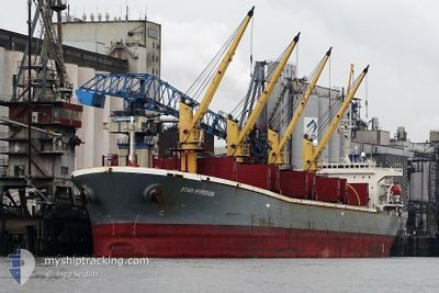
BR VICTORY
Bulk Carrier
Current Trip
| Time Travelled | 11 days |
|---|---|
| Remaining Time | --- |
| Distance Travelled | 1295.20 nm |
| Remaining Distance | --- |
| AVG Speed | 8.9 Knopen |
| MAX Speed | 12.3 Knopen |
| AVG Wind | 13.8 knots |
| MAX Wind | 29.8 knots |
| MIN Temp | 0.3°C / 32.54°F |
| MAX Temp | 15.7°C / 60.26°F |
| Diepgang | 6 M |
| Positie ontvangen | 1 d geleden |
Current Position
| Lengtegraad | --- |
|---|---|
| Breedtegraat | --- |
| Status | Under way using engine |
| Snelheid | 10 Knopen |
| Koers | 38.1° |
| Gebied | Black Sea |
| Station | T-AIS |
| Positie ontvangen | 1 d geleden |
Information
The current position of BR VICTORY is in Black Sea with coordinates 41.26195° / 29.17153° as reported on 2025-02-20 20:53 by AIS to our vessel tracker app. The vessel's current speed is 10 Knopen
The vessel BR VICTORY (IMO: 9145956, MMSI: 356370000) is a Bulk Carrier that was built in 1996 ( 29 Jaar oud ). It's sailing under the flag of [PA] Panama.
In this page you can find informations about the vessels current position, last detected port calls, and current voyage information. If the vessels is not in coverage by AIS you will find the latest position.
The current position of BR VICTORY is detected by our AIS receivers and we are not responsible for the reliability of the data. The last position was recorded while the vessel was in Coverage by the Ais receivers of our vessel tracking app.
The current draught of BR VICTORY as reported by AIS is 6 meters
Weather
| Temperature | -0.3°C / 31.46°F |
|---|---|
| Wind Speed | 18 knots |
| Direction | 42° NE |
| Pressure | 1037.5 hPa |
| Humidity | 52.4 % |
| Cloud Coverage | 100 % |
Featured Company
Last Port Calls
| Port | Arrival | Departure | Time In Port |
|---|---|---|---|
| 2025-02-04 22:35 | 2025-02-10 16:45 | 5 d | |
| 2025-01-28 09:04 | 2025-02-04 19:08 | 7 d | |
| 2025-01-21 22:37 | 2025-01-22 16:55 | 18 h | |
| 2025-01-17 08:15 | 2025-01-17 08:43 | 27 m | |
| 2025-01-10 11:53 | 2025-01-12 09:05 | 1 d | |
| 2024-12-31 06:19 | 2025-01-09 05:03 | 8 d | |
| 2024-12-29 10:24 | 2024-12-30 13:37 | 1 d |
Most Visited Ports (Last year)
| Port | Arrivals | |
|---|---|---|
| 4 | ||
| 3 | ||
| 2 | ||
| 2 | ||
| 1 | ||
| 1 |
Last Trips
| Origin | Departure | Destination | Arrival | Distance | |
|---|---|---|---|---|---|
| 2025-02-04 21:08 | 2025-02-05 00:35 | 8.81 nm | |||
| 2025-01-22 18:55 | 2025-01-28 11:04 | 15.04 nm | |||
| 2025-01-17 11:43 | 2025-01-22 00:37 | 761.30 nm | |||
| 2025-01-12 12:05 | 2025-01-17 11:15 | 461.95 nm | |||
| 2025-01-09 08:03 | 2025-01-10 14:53 | 232.90 nm | |||
| 2024-12-30 16:37 | 2024-12-31 09:19 | 72.21 nm | |||
| 2024-11-22 15:11 | 2024-12-29 13:24 | 1746.37 nm |
Events
| Tijd | Evenement | Details | Positie / Bestemming | Info |
|---|---|---|---|---|
| 2025-02-20 21:23 | Status Changed | Default Under way using engine |
41.32901 / 29.23653
RO SUL
|
Snelheid: 10 kn Koers: 38.1° |
| 2025-02-20 20:53 | Buitenbereik |
41.26195 / 29.17153
Black Sea
RO SUL
|
Snelheid: 10 kn Koers: 38.1° |
|
| 2025-02-20 20:40 | Wijzig zee gebeid | Turkish part of the Black Sea Turkish part of the Sea of Marmara |
41.23361 / 29.14226
Black Sea
RO SUL
|
Snelheid: 10.2 kn Koers: 36.8° |
| 2025-02-20 20:39 | Destination Changed | RO SUL UAODS |
41.23065 / 29.13926
RO SUL
|
Snelheid: 10.1 kn Koers: 37.6° |
| 2025-02-20 20:34 | Status Changed | Under way using engine Default |
41.21905 / 29.12957
UAODS
|
Snelheid: 7.9 kn Koers: 43° |
| 2025-02-20 20:03 | Status Changed | Default Under way using engine |
41.17172 / 29.07707
UAODS
|
Snelheid: 6.9 kn Koers: 42.3° |
| 2025-02-20 16:11 | Status Changed | Under way using engine Default |
40.69809 / 28.79662
UAODS
|
Snelheid: 8.3 kn Koers: 20° |
| 2025-02-20 16:11 | Binnenbereik |
40.70147 / 28.79843
Sea of Marmara
UAODS
|
Snelheid: 8.7 kn Koers: 22.4° |
|
| 2025-02-20 14:48 | Start beweging | 13.96 nm, North West of MUDANYA |
40.52192 / 28.71019
UAODS
|
Snelheid: 4.1 kn Koers: 23° |
| 2025-02-19 20:37 | Stop beweging | 14.13 nm, North West of MUDANYA |
40.52215 / 28.70524
UAODS
|
Snelheid: 0.1 kn Koers: 41° |