
BOKA GLACIER
Tug
Current Trip
| Time Travelled | --- |
|---|---|
| Remaining Time | --- |
| Distance Travelled | 829.96 nm |
| Remaining Distance | --- |
| AVG Speed | 4.3 Knopen |
| MAX Speed | 11.2 Knopen |
| AVG Wind | 17.5 knots |
| MAX Wind | 32 knots |
| MIN Temp | 0.9°C / 33.62°F |
| MAX Temp | 18.7°C / 65.66°F |
| Diepgang | 5.8 M |
| Positie ontvangen | 24 m geleden |
Current Position
| Lengtegraad | --- |
|---|---|
| Breedtegraat | --- |
| Status | At anchor |
| Snelheid | 0.4 Knopen |
| Koers | 270° |
| Gebied | Aegean Sea |
| Station | T-AIS |
| Positie ontvangen | 24 m geleden |
Info
Information
The current position of BOKA GLACIER is in Aegean Sea with coordinates 38.88365° / 26.98121° as reported on 2026-01-08 14:43 by AIS to our vessel tracker app. The vessel's current speed is 0.4 Knopen
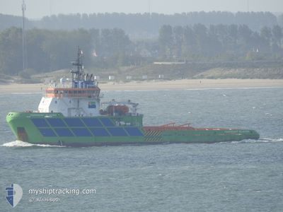
The vessel BOKA GLACIER (IMO: 9344796, MMSI: 248568000) is a Tug that was built in 2006 ( 20 Jaar oud ). It's sailing under the flag of [MT] Malta.
In this page you can find informations about the vessels current position, last detected port calls, and current voyage information. If the vessels is not in coverage by AIS you will find the latest position.
The current position of BOKA GLACIER is detected by our AIS receivers and we are not responsible for the reliability of the data. The last position was recorded while the vessel was in Coverage by the Ais receivers of our vessel tracking app.
The current draught of BOKA GLACIER as reported by AIS is 5.8 meters
Weather
| Temperature | 12.2°C / 53.96°F |
|---|---|
| Wind Speed | 29 knots |
| Direction | 254° WSW |
| Pressure | 1005.9 hPa |
| Humidity | 55.6 % |
| Cloud Coverage | 3 % |
Featured Company
Last Port Calls
Most Visited Ports (Last year)
| Port | Arrivals | |
|---|---|---|
| 2 | ||
| 2 | ||
| 1 | ||
| 1 | ||
| 1 | ||
| 1 |
Last Trips
| Origin | Departure | Destination | Arrival | Distance |
|---|
Events
| Tijd | Evenement | Details | Positie / Bestemming | Info |
|---|---|---|---|---|
| 2026-01-08 12:12 | Binnenbereik |
38.88483 / 26.97674
Aegean Sea
|
Snelheid: 0.5 kn Koers: 128.3° |
|
| 2026-01-08 09:36 | Buitenbereik |
38.88430 / 26.97350
Aegean Sea
|
Snelheid: 1.4 kn Koers: 341.2° |
|
| 2026-01-08 09:36 | Binnenbereik |
38.88430 / 26.97350
Aegean Sea
|
Snelheid: 1.4 kn Koers: 341.2° |
|
| 2026-01-08 06:48 | Buitenbereik |
38.88332 / 26.97169
Aegean Sea
|
Snelheid: 0.4 kn Koers: 143.9° |
|
| 2026-01-08 06:48 | Binnenbereik |
38.88332 / 26.97169
Aegean Sea
|
Snelheid: 0.4 kn Koers: 143.9° |
|
| 2026-01-08 05:33 | Buitenbereik |
38.88342 / 26.97093
Aegean Sea
|
Snelheid: 1 kn Koers: 89° |
|
| 2026-01-08 05:18 | Binnenbereik |
38.88333 / 26.97040
Aegean Sea
|
Snelheid: 0.1 kn Koers: 48.3° |
|
| 2026-01-07 23:30 | Buitenbereik |
38.88283 / 26.96997
Aegean Sea
|
Snelheid: 0.1 kn Koers: 171.7° |
|
| 2026-01-07 23:30 | Stop beweging | 3.54 nm, North of ALIAGA |
38.88283 / 26.96997
TR ALI
|
Snelheid: 0.1 kn Koers: 172° |
| 2026-01-07 23:18 | Binnenbereik |
38.88287 / 26.97141
Aegean Sea
|
Snelheid: 0.6 kn Koers: 111.6° |