
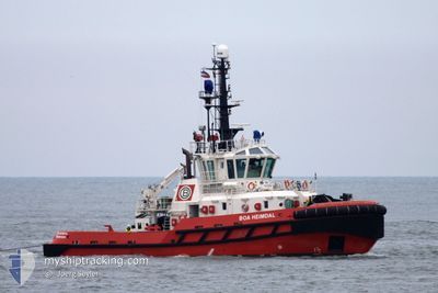
BOA HEIMDAL
Tug
Current Trip
SN DKR
| Time Travelled | 8 days |
|---|---|
| Remaining Time | --- |
| Distance Travelled | 324.44 nm |
| Remaining Distance | --- |
| AVG Speed | 5.5 Knopen |
| MAX Speed | 11.4 Knopen |
| AVG Wind | 13.4 knots |
| MAX Wind | 20.9 knots |
| MIN Temp | 20.4°C / 68.72°F |
| MAX Temp | 24.7°C / 76.46°F |
| Diepgang | 5.8 M |
| Positie ontvangen | 6 d geleden |
Current Position
| Lengtegraad | -17.59798° |
|---|---|
| Breedtegraat | 16.04730° |
| Status | Under way using engine |
| Snelheid | 1.1 Knopen |
| Koers | 338° |
| Gebied | North Atlantic Ocean |
| Station | T-AIS |
| Positie ontvangen | 6 d geleden |
Info
Information
The current position of BOA HEIMDAL is in North Atlantic Ocean with coordinates 16.04730° / -17.59798° as reported on 2024-04-20 21:25 by AIS to our vessel tracker app. The vessel's current speed is 1.1 Knopen
The vessel BOA HEIMDAL (IMO: 9551909, MMSI: 259088000) is a Tug that was built in 2010 ( 14 Jaar oud ). It's sailing under the flag of [NO] Norway.
In this page you can find informations about the vessels current position, last detected port calls, and current voyage information. If the vessels is not in coverage by AIS you will find the latest position.
The current position of BOA HEIMDAL is detected by our AIS receivers and we are not responsible for the reliability of the data. The last position was recorded while the vessel was in Coverage by the Ais receivers of our vessel tracking app.
The current draught of BOA HEIMDAL as reported by AIS is 5.8 meters
Weather
| Temperature | 22.6°C / 72.68°F |
|---|---|
| Wind Speed | 20 knots |
| Direction | 351° N |
| Pressure | 1007.1 hPa |
| Humidity | 77.3 % |
| Cloud Coverage | 3 % |
Featured Company
Last Trips
| Origin | Departure | Destination | Arrival | Distance | |
|---|---|---|---|---|---|
| 2024-03-19 10:50 | 2024-04-18 14:52 | 647.07 nm | |||
| 2024-02-10 17:32 | 2024-03-18 23:41 | 81.72 nm | |||
| 2024-02-10 14:00 | 2024-02-10 14:36 | 2.89 nm | |||
| 2024-02-09 22:44 | 2024-02-09 23:28 | 2.43 nm | |||
| 2023-12-23 11:39 | 2024-02-09 16:24 | 1420.46 nm |
Events
| Tijd | Evenement | Details | Positie / Bestemming | Info |
|---|---|---|---|---|
| 2024-04-26 15:10 | Stop beweging | 1.46 nm, North East of DAKAR |
14.69501 / -17.40702
SN DKR
|
Snelheid: 0.2 kn Koers: 348° |
| 2024-04-26 14:58 | Start beweging | 0.75 nm, North East of DAKAR |
14.68923 / -17.41770
SN DKR
|
Snelheid: 7.8 kn Koers: 136° |
| 2024-04-26 14:42 | Stop beweging | 0.74 nm, North East of DAKAR |
14.69140 / -17.42054
SN DKR
|
Snelheid: 0.2 kn Koers: 309° |
| 2024-04-26 13:06 | Start beweging | 1.86 nm, South East of GOREE |
14.64804 / -17.37512
SN DKR
|
Snelheid: 3.8 kn Koers: 6° |
| 2024-04-26 11:46 | Stop beweging | 1.55 nm, South East of GOREE |
14.65092 / -17.37963
SN DKR
|
Snelheid: 0.3 kn Koers: 16° |
| 2024-04-26 10:18 | Start beweging | 0.78 nm, North East of DAKAR |
14.68723 / -17.41568
SN DKR
|
Snelheid: 9.4 kn Koers: 125° |
| 2024-04-26 09:54 | Stop beweging | 0.81 nm, North East of DAKAR |
14.69327 / -17.42168
SN DKR
|
Snelheid: 0.2 kn Koers: 37° |
| 2024-04-26 09:42 | Start beweging | 1.22 nm, East of DAKAR |
14.68841 / -17.40793
SN DKR
|
Snelheid: 7.4 kn Koers: 195° |
| 2024-04-25 15:48 | Stop beweging | 1.44 nm, North East of DAKAR |
14.69510 / -17.40733
SN DKR
|
Snelheid: 0.1 kn Koers: 10° |
| 2024-04-25 15:38 | Start beweging | 0.81 nm, East of DAKAR |
14.68555 / -17.41429
SN DKR
|
Snelheid: 8.4 kn Koers: 118° |