
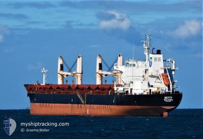
BETTY
Bulk Carrier
Current Trip
| Time Travelled | 22 days |
|---|---|
| Remaining Time | 1 h, 18 mins |
| Distance Travelled | 6018.08 nm |
| Remaining Distance | 28.22 nm |
| AVG Speed | 11.8 Knopen |
| MAX Speed | 14.7 Knopen |
| AVG Wind | 12.6 knots |
| MAX Wind | 33.8 knots |
| MIN Temp | 11°C / 51.8°F |
| MAX Temp | 25.9°C / 78.62°F |
| Diepgang | 9.2 M |
| Positie ontvangen | 2 d geleden |
Current Position
| Lengtegraad | -79.52969° |
|---|---|
| Breedtegraat | 25.53445° |
| Status | Under way using engine |
| Snelheid | 10.4 Knopen |
| Koers | 190.1° |
| Gebied | North Atlantic Ocean |
| Station | T-AIS |
| Positie ontvangen | 2 d geleden |
Info
Information
The current position of BETTY is in North Atlantic Ocean with coordinates 25.53445° / -79.52969° as reported on 2024-04-25 05:58 by AIS to our vessel tracker app. The vessel's current speed is 10.4 Knopen and is heading at the port of HAVANA. The estimated time of arrival as calculated by MyShipTracking vessel tracking app is 2024-04-27 16:44 LT
The vessel BETTY (IMO: 9522881, MMSI: 538009422) is a Bulk Carrier that was built in 2011 ( 13 Jaar oud ). It's sailing under the flag of [MH] Marshall Is.
In this page you can find informations about the vessels current position, last detected port calls, and current voyage information. If the vessels is not in coverage by AIS you will find the latest position.
The current position of BETTY is detected by our AIS receivers and we are not responsible for the reliability of the data. The last position was recorded while the vessel was in Coverage by the Ais receivers of our vessel tracking app.
The current draught of BETTY as reported by AIS is 9.2 meters
Weather
| Temperature | 25.8°C / 78.44°F |
|---|---|
| Wind Speed | 19 knots |
| Direction | 98° E |
| Pressure | 1018.5 hPa |
| Humidity | 68 % |
| Cloud Coverage | 100 % |
Featured Company
Last Port Calls
| Port | Arrival | Departure | Time In Port |
|---|---|---|---|
| 2024-04-05 12:07 | 2024-04-05 13:20 | 1 h | |
| 2024-03-31 22:13 | |||
| 2024-03-04 16:24 | 2024-03-08 20:13 | 4 d | |
| 2024-02-28 09:06 | 2024-02-28 18:30 | 9 h |
Most Visited Ports (Last year)
| Port | Arrivals | |
|---|---|---|
| 5 | ||
| 2 | ||
| 1 | ||
| 1 | ||
| 1 | ||
| 1 |
Last Trips
| Origin | Departure | Destination | Arrival | Distance | |
|---|---|---|---|---|---|
| 2024-04-01 01:13 | 2024-04-05 15:07 | 614.64 nm | |||
| 2024-01-08 14:18 | 2024-03-04 17:24 | 7757.28 nm | |||
| 2024-01-08 14:18 | 2024-02-28 11:06 | 7656.62 nm |
Events
| Tijd | Evenement | Details | Positie / Bestemming | Info |
|---|---|---|---|---|
| 2024-04-27 14:52 | Stop beweging | 21.18 nm, North of HAVANA |
23.47833 / -82.42333
CUHAV
|
Snelheid: Koers: -1° |
| 2024-04-27 12:25 | Start beweging |
23.81167 / -82.35333
CUHAV
|
Snelheid: 5 kn Koers: 71° |
|
| 2024-04-26 21:31 | Stop beweging | 17.91 nm, North of HAVANA |
23.42667 / -82.40166
CUHAV
|
Snelheid: Koers: -1° |
| 2024-04-26 19:52 | Start beweging | 5.2 nm, North of HAVANA |
23.21833 / -82.32667
CUHAV
|
Snelheid: 4 kn Koers: -1° |
| 2024-04-26 01:43 | Stop beweging | 12.29 nm, North East of HAVANA |
23.31833 / -82.24667
CUHAV
|
Snelheid: Koers: -1° |
| 2024-04-25 06:01 | Status Changed | Default Under way using engine |
25.52333 / -79.53167
CUHAV
|
Snelheid: 10.4 kn Koers: 190.1° |
| 2024-04-25 05:58 | Status Changed | Under way using engine Default |
25.53445 / -79.52969
CUHAV
|
Snelheid: 10 kn Koers: 187° |
| 2024-04-25 05:58 | Buitenbereik |
25.53445 / -79.52969
North Atlantic Ocean
|
Snelheid: 10.4 kn Koers: 190.1° |
|
| 2024-04-25 05:49 | Status Changed | Default Under way using engine |
25.55833 / -79.52500
CUHAV
|
Snelheid: 10.3 kn Koers: 187.4° |
| 2024-04-25 04:43 | Status Changed | Under way using engine Default |
25.74720 / -79.49447
CUHAV
|
Snelheid: 10 kn Koers: 193° |