
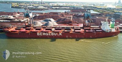
BERGE TRIGLAV
Bulk Carrier
Current Trip
| Time Travelled | 8 days |
|---|---|
| Remaining Time | --- |
| Distance Travelled | 655.20 nm |
| Remaining Distance | 386.40 nm |
| AVG Speed | 8.7 Knopen |
| MAX Speed | 13.2 Knopen |
| AVG Wind | 10.5 knots |
| MAX Wind | 22.2 knots |
| MIN Temp | 5.8°C / 42.44°F |
| MAX Temp | 12°C / 53.6°F |
| Diepgang | 18.3 M |
| Positie ontvangen | 23 d geleden |
Current Position
| Lengtegraad | --- |
|---|---|
| Breedtegraat | --- |
| Status | Under way using engine |
| Snelheid | 8.8 Knopen |
| Koers | 348° |
| Gebied | Indian Ocean |
| Station | T-AIS |
| Positie ontvangen | 23 d geleden |
Info
Information
The current position of BERGE TRIGLAV is in Indian Ocean with coordinates -17.16886° / 116.93951° as reported on 2025-02-20 20:47 by AIS to our vessel tracker app. The vessel's current speed is 8.8 Knopen and is heading at the port of QINGDAO. The estimated time of arrival as calculated by MyShipTracking vessel tracking app is 2025-03-06 08:00 LT
The vessel BERGE TRIGLAV (IMO: 9572666, MMSI: 636019093) is a Bulk Carrier that was built in 2010 ( 15 Jaar oud ). It's sailing under the flag of [LR] Liberia.
In this page you can find informations about the vessels current position, last detected port calls, and current voyage information. If the vessels is not in coverage by AIS you will find the latest position.
The current position of BERGE TRIGLAV is detected by our AIS receivers and we are not responsible for the reliability of the data. The last position was recorded while the vessel was in Coverage by the Ais receivers of our vessel tracking app.
The current draught of BERGE TRIGLAV as reported by AIS is 18.3 meters
Weather
| Temperature | 6.4°C / 43.52°F |
|---|---|
| Wind Speed | 14 knots |
| Direction | 325° NW |
| Pressure | 1025.3 hPa |
| Humidity | 52 % |
| Cloud Coverage | 55 % |
Featured Company
Last Port Calls
| Port | Arrival | Departure | Time In Port |
|---|---|---|---|
| 2025-03-07 09:21 | 2025-03-09 02:57 | 1 d | |
| 2025-02-18 03:39 | 2025-02-20 00:48 | 1 d | |
| 2025-01-26 17:13 | 2025-01-28 01:09 | 1 d | |
| 2025-01-17 20:12 | 2025-01-19 14:25 | 1 d | |
| 2025-01-01 21:56 |
Most Visited Ports (Last year)
| Port | Arrivals | |
|---|---|---|
| 3 | ||
| 2 | ||
| 2 | ||
| 1 | ||
| 1 | ||
| 1 |
Last Trips
| Origin | Departure | Destination | Arrival | Distance | |
|---|---|---|---|---|---|
| 2025-02-20 00:48 | 2025-03-07 09:21 | 3694.42 nm | |||
| 2025-01-28 01:09 | 2025-02-18 03:39 | 4322.02 nm | |||
| 2025-01-19 14:25 | 2025-01-26 17:13 | 533.16 nm | |||
| 2025-01-01 21:56 | 2025-01-17 20:12 | 3704.16 nm |
Events
| Tijd | Evenement | Details | Positie / Bestemming | Info |
|---|---|---|---|---|
| 2025-03-14 10:06 | Stop beweging | 10.71 nm, South East of YANGSHAN |
30.47783 / 122.27729
QINGDAO
|
Snelheid: 0.1 kn Koers: 246° |
| 2025-03-14 07:06 | Start beweging | 17.06 nm, South of SHENGSI |
30.45976 / 122.48049
QINGDAO
|
Snelheid: 3.3 kn Koers: 292° |
| 2025-03-13 23:16 | Stop beweging | 17.17 nm, South of SHENGSI |
30.45903 / 122.48756
QINGDAO
|
Snelheid: 0.2 kn Koers: 63° |
| 2025-03-12 12:42 | Start beweging |
34.18257 / 124.02831
QINGDAO
|
Snelheid: 5.6 kn Koers: 212° |
|
| 2025-03-12 11:56 | Stop beweging |
34.19935 / 124.03499
QINGDAO
|
Snelheid: 0.2 kn Koers: 27° |
|
| 2025-03-12 06:05 | Start beweging |
34.39496 / 123.92313
QINGDAO
|
Snelheid: 5.2 kn Koers: 181° |
|
| 2025-03-11 11:05 | Stop beweging |
34.15120 / 123.94445
QINGDAO
|
Snelheid: 0.2 kn Koers: 101° |
|
| 2025-03-11 00:58 | Start beweging |
34.39331 / 123.90402
QINGDAO
|
Snelheid: 3.5 kn Koers: 165° |
|
| 2025-03-10 04:53 | Stop beweging |
34.17429 / 123.94692
QINGDAO
|
Snelheid: 0.3 kn Koers: 112° |
|
| 2025-03-08 18:57 | Vertrekhaven |
|
34.75016 / 119.54054
QINGDAO
|
Snelheid: 11.9 kn Koers: 64° |