
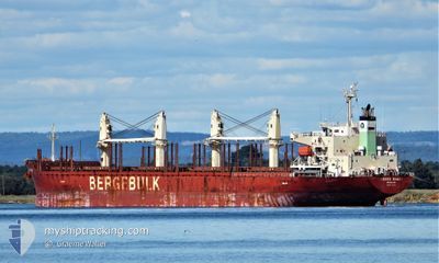
BERGE SHARI
Cargo
Current Trip
| Time Travelled | 1 day |
|---|---|
| Remaining Time | --- |
| Distance Travelled | 288.66 nm |
| Remaining Distance | --- |
| AVG Speed | 7.6 Knopen |
| MAX Speed | 11.7 Knopen |
| AVG Wind | 10.8 knots |
| MAX Wind | 13 knots |
| MIN Temp | 24.4°C / 75.92°F |
| MAX Temp | 27.7°C / 81.86°F |
| Diepgang | 7 M |
| Positie ontvangen | 20 d geleden |
Current Position
| Lengtegraad | -16.38370° |
|---|---|
| Breedtegraat | 27.03110° |
| Status | Under way using engine |
| Snelheid | 12.7 Knopen |
| Koers | 243.5° |
| Gebied | North Atlantic Ocean |
| Station | T-AIS |
| Positie ontvangen | 20 d geleden |
Info
Information
The current position of BERGE SHARI is in North Atlantic Ocean with coordinates 27.03110° / -16.38370° as reported on 2024-04-08 09:56 by AIS to our vessel tracker app. The vessel's current speed is 12.7 Knopen and is heading at the port of PARAMARIBO.
The vessel BERGE SHARI (IMO: 9713208, MMSI: 235115731) is a Cargo It's sailing under the flag of [GB] United Kingdom.
In this page you can find informations about the vessels current position, last detected port calls, and current voyage information. If the vessels is not in coverage by AIS you will find the latest position.
The current position of BERGE SHARI is detected by our AIS receivers and we are not responsible for the reliability of the data. The last position was recorded while the vessel was in Coverage by the Ais receivers of our vessel tracking app.
The current draught of BERGE SHARI as reported by AIS is 7 meters
Weather
| Temperature | 27.2°C / 80.96°F |
|---|---|
| Wind Speed | 11 knots |
| Direction | 69° ENE |
| Pressure | 1009.7 hPa |
| Humidity | 81.3 % |
| Cloud Coverage | 83 % |
Featured Company
Last Port Calls
| Port | Arrival | Departure | Time In Port |
|---|---|---|---|
| 2024-04-26 00:29 | 2024-04-27 00:58 | 1 d | |
| 2024-04-18 07:15 | 2024-04-24 11:14 | 6 d | |
| 2024-03-27 14:28 | 2024-03-29 17:04 | 2 d | |
| 2024-03-19 20:05 | 2024-03-25 07:53 | 5 d | |
| 2024-03-18 08:30 | |||
| 2024-03-14 13:12 |
Most Visited Ports (Last year)
| Port | Arrivals | |
|---|---|---|
| 2 | ||
| 1 | ||
| 1 | ||
| 1 | ||
| 1 | ||
| 1 |
Last Trips
| Origin | Departure | Destination | Arrival | Distance | |
|---|---|---|---|---|---|
| 2024-04-24 08:14 | 2024-04-25 20:29 | 250.42 nm | |||
| 2024-03-29 20:04 | 2024-04-18 04:15 | 5451.81 nm | |||
| 2024-03-25 10:53 | 2024-03-27 17:28 | 6.13 nm | |||
| 2024-03-18 11:30 | 2024-03-19 23:05 | 300.66 nm |
Events
| Tijd | Evenement | Details | Positie / Bestemming | Info |
|---|---|---|---|---|
| 2024-04-27 14:08 | Start beweging |
7.22785 / -57.56434
PARAMARIBO
|
Snelheid: 3.5 kn Koers: 96° |
|
| 2024-04-27 11:08 | Stop beweging |
7.25324 / -57.56329
PARAMARIBO
|
Snelheid: 0.1 kn Koers: 129° |
|
| 2024-04-27 00:58 | Start beweging | 1.47 nm, North of GEORGETOWN |
6.81373 / -58.17177
PARAMARIBO
|
Snelheid: 4.3 kn Koers: 5° |
| 2024-04-27 00:58 | Vertrekhaven |
|
6.81373 / -58.17177
PARAMARIBO
|
Snelheid: 1.6 kn Koers: 233° |
| 2024-04-26 00:35 | Stop beweging |
6.81236 / -58.16869
[GY] GEORGETOWN
|
Snelheid: 0.3 kn Koers: 184° |
|
| 2024-04-26 00:29 | Aankomsthaven |
|
6.81257 / -58.16915
[GY] GEORGETOWN
|
Snelheid: 0.8 kn Koers: 170° |
| 2024-04-25 06:34 | Start beweging | 5.03 nm, North East of PARAMARIBO |
5.86992 / -55.09346
PARAMARIBO
|
Snelheid: 3.3 kn Koers: 349° |
| 2024-04-24 22:13 | Stop beweging | 4.92 nm, North East of PARAMARIBO |
5.86649 / -55.09302
PARAMARIBO
|
Snelheid: 0.3 kn Koers: 33° |
| 2024-04-24 18:50 | Start beweging | 2.92 nm, North East of PARANAM |
5.65526 / -55.06400
PARAMARIBO
|
Snelheid: 4.4 kn Koers: 45° |
| 2024-04-24 13:01 | Stop beweging | 2.75 nm, North East of PARANAM |
5.65256 / -55.06508
PARAMARIBO
|
Snelheid: 0.3 kn Koers: 186° |