
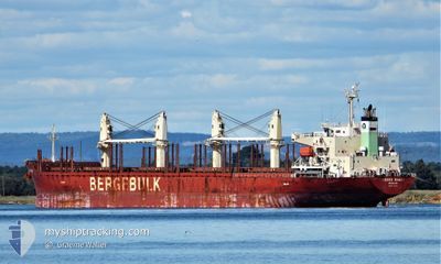
BERGE SHARI
Cargo
Current Trip
PARAMARIBO
| Time Travelled | 9 days |
|---|---|
| Remaining Time | --- |
| Distance Travelled | 1843.41 nm |
| Remaining Distance | --- |
| AVG Speed | 8.7 Noeuds |
| MAX Speed | 13 Noeuds |
| AVG Wind | 13.7 knots |
| MAX Wind | 23 knots |
| MIN Temp | 24.4°C / 75.92°F |
| MAX Temp | 29°C / 84.2°F |
| Tirant d eau | 7 m |
| Position reçue | 1 d depuis |
Current Position
| Longitude | -38.27681° |
|---|---|
| Latitude | -3.55215° |
| Etat | Under way using engine |
| Vitesse | 12 Noeuds |
| Parcours | 75.4° |
| Zone | South Atlantic Ocean |
| Station | T-AIS |
| Position reçue | 1 d depuis |
Info
Information
The current position of BERGE SHARI is in South Atlantic Ocean with coordinates -3.55215° / -38.27681° as reported on 2024-05-04 17:41 by AIS to our vessel tracker app. The vessel's current speed is 12 Noeuds
The vessel BERGE SHARI (IMO: 9713208, MMSI: 235115731) is a Cargo It's sailing under the flag of [GB] United Kingdom.
In this page you can find informations about the vessels current position, last detected port calls, and current voyage information. If the vessels is not in coverage by AIS you will find the latest position.
The current position of BERGE SHARI is detected by our AIS receivers and we are not responsible for the reliability of the data. The last position was recorded while the vessel was in Coverage by the Ais receivers of our vessel tracking app.
The current draught of BERGE SHARI as reported by AIS is 7 meters
Weather
| Temperature | 28.3°C / 82.94°F |
|---|---|
| Wind Speed | 14 knots |
| Direction | 139° SE |
| Pressure | 1011.4 hPa |
| Humidity | 76.2 % |
| Cloud Coverage | 15 % |
Featured Company
Last Port Calls
| Port | Arrival | Departure | Time In Port |
|---|---|---|---|
| 2024-04-26 00:29 | 2024-04-27 00:58 | 1 d | |
| 2024-04-18 07:15 | 2024-04-24 11:14 | 6 d | |
| 2024-03-27 14:28 | 2024-03-29 17:04 | 2 d | |
| 2024-03-19 20:05 | 2024-03-25 07:53 | 5 d | |
| 2024-03-18 08:30 | |||
| 2024-03-14 13:12 |
Most Visited Ports (Last year)
| Port | Arrivals | |
|---|---|---|
| 2 | ||
| 1 | ||
| 1 | ||
| 1 | ||
| 1 | ||
| 1 |
Last Trips
| Origin | Departure | Destination | Arrival | Distance | |
|---|---|---|---|---|---|
| 2024-04-24 08:14 | 2024-04-25 20:29 | 250.42 nm | |||
| 2024-03-29 20:04 | 2024-04-18 04:15 | 5451.81 nm | |||
| 2024-03-25 10:53 | 2024-03-27 17:28 | 6.13 nm | |||
| 2024-03-18 11:30 | 2024-03-19 23:05 | 300.66 nm |
Events
| Heure | Evenement | Détails | Position/ Destination | Info |
|---|---|---|---|---|
| 2024-05-04 17:49 | Etat Changé | Default Under way using engine |
-3.54594 / -38.25193
PARAMARIBO
|
Vitesse: 12 kn Parcours: 75.4° |
| 2024-05-04 17:41 | Hors de la zone couverte |
-3.55215 / -38.27681
South Atlantic Ocean
|
Vitesse: 12 kn Parcours: 75.4° |
|
| 2024-05-04 17:37 | Etat Changé | Under way using engine Default |
-3.55569 / -38.29081
PARAMARIBO
|
Vitesse: 12.3 kn Parcours: 66° |
| 2024-05-04 17:32 | Etat Changé | Default Under way using engine |
-3.56061 / -38.30512
PARAMARIBO
|
Vitesse: 12.3 kn Parcours: 64.9° |
| 2024-05-04 16:40 | Démarrage | 6.41 nm, North East of FORTALEZA |
-3.62554 / -38.44223
PARAMARIBO
|
Vitesse: 4.2 kn Parcours: 66° |
| 2024-05-04 16:37 | Etat Changé | Under way using engine Default |
-3.62766 / -38.44439
PARAMARIBO
|
Vitesse: 0.3 kn Parcours: 86° |
| 2024-05-04 16:32 | Etat Changé | Default At anchor |
-3.62951 / -38.44558
PARAMARIBO
|
Vitesse: 0.4 kn Parcours: 121° |
| 2024-05-04 15:50 | Etat Changé | At anchor Default |
-3.62895 / -38.44673
PARAMARIBO
|
Vitesse: 0.3 kn Parcours: 94° |
| 2024-05-04 15:23 | Etat Changé | Default At anchor |
-3.62852 / -38.44667
PARAMARIBO
|
Vitesse: 0.5 kn Parcours: 92° |
| 2024-05-04 15:20 | Etat Changé | At anchor Default |
-3.62895 / -38.44677
PARAMARIBO
|
Vitesse: 0.5 kn Parcours: 119° |