
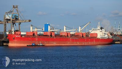
BBG NOVA
Cargo
Current Trip
| Time Travelled | 50 days |
|---|---|
| Remaining Time | --- |
| Distance Travelled | 12959.97 nm |
| Remaining Distance | --- |
| AVG Speed | 12.3 Knopen |
| MAX Speed | 16.3 Knopen |
| AVG Wind | 12.8 knots |
| MAX Wind | 31 knots |
| MIN Temp | 7.8°C / 46.04°F |
| MAX Temp | 29.8°C / 85.64°F |
| Diepgang | 10.3 M |
| Positie ontvangen | 1 d geleden |
Current Position
| Lengtegraad | --- |
|---|---|
| Breedtegraat | --- |
| Status | Under way using engine |
| Snelheid | 6.8 Knopen |
| Koers | 64.2° |
| Gebied | Tyrrhenian Sea |
| Station | T-AIS |
| Positie ontvangen | 1 d geleden |
Info
Information
The current position of BBG NOVA is in Tyrrhenian Sea with coordinates 40.61135° / 14.76751° as reported on 2025-01-14 04:36 by AIS to our vessel tracker app. The vessel's current speed is 6.8 Knopen
The vessel BBG NOVA (IMO: 9705342, MMSI: 636017382) is a Cargo It's sailing under the flag of [LR] Liberia.
In this page you can find informations about the vessels current position, last detected port calls, and current voyage information. If the vessels is not in coverage by AIS you will find the latest position.
The current position of BBG NOVA is detected by our AIS receivers and we are not responsible for the reliability of the data. The last position was recorded while the vessel was in Coverage by the Ais receivers of our vessel tracking app.
The current draught of BBG NOVA as reported by AIS is 10.3 meters
Weather
| Temperature | 10°C / 50°F |
|---|---|
| Wind Speed | 8 knots |
| Direction | 36° NE |
| Pressure | 1020.7 hPa |
| Humidity | 51.9 % |
| Cloud Coverage | 65 % |
Featured Company
Last Port Calls
| Port | Arrival | Departure | Time In Port |
|---|---|---|---|
| 2024-11-24 02:58 | 2024-11-26 05:40 | 2 d | |
| 2024-11-14 21:32 | 2024-11-22 21:32 | 8 d | |
| 2024-11-08 19:44 | 2024-11-14 10:14 | 5 d | |
| 2024-11-04 14:07 | 2024-11-06 18:56 | 2 d |
Last Trips
| Origin | Departure | Destination | Arrival | Distance | |
|---|---|---|---|---|---|
| 2024-11-23 06:32 | 2024-11-24 11:58 | 365.28 nm | |||
| 2024-11-14 19:14 | 2024-11-15 06:32 | 67.97 nm | |||
| 2024-11-07 03:56 | 2024-11-09 04:44 | 366.48 nm | |||
| 2024-09-16 13:05 | 2024-11-04 23:07 | 5133.14 nm |
Events
| Tijd | Evenement | Details | Positie / Bestemming | Info |
|---|---|---|---|---|
| 2025-01-14 05:27 | Stop beweging | 1.97 nm, South West of ARECHI |
40.61762 / 14.78766
IT SAL
|
Snelheid: 0.1 kn Koers: 15° |
| 2025-01-14 04:43 | Status Changed | Default Under way using engine |
40.61602 / 14.77938
IT SAL
|
Snelheid: 6.8 kn Koers: 64.2° |
| 2025-01-14 04:36 | Status Changed | Under way using engine Default |
40.61135 / 14.76751
IT SAL
|
Snelheid: 8.8 kn Koers: 62° |
| 2025-01-14 04:36 | Buitenbereik |
40.61135 / 14.76751
Tyrrhenian Sea
|
Snelheid: 6.8 kn Koers: 64.2° |
|
| 2025-01-14 04:30 | Status Changed | Default Under way using engine |
40.60571 / 14.75294
IT SAL
|
Snelheid: 10.3 kn Koers: 76.7° |
| 2025-01-14 02:42 | ETA Changed | 2025/01/14 00:30 2025/01/13 17:00 |
40.50344 / 14.34710
IT SAL
|
Snelheid: 11.6 kn Koers: 62.1° |
| 2025-01-14 01:56 | Status Changed | Under way using engine Default |
40.43184 / 14.18086
IT SAL
|
Snelheid: 11.3 kn Koers: 63° |
| 2025-01-14 01:53 | Status Changed | Default Under way using engine |
40.42697 / 14.16856
IT SAL
|
Snelheid: 11.2 kn Koers: 72° |
| 2025-01-14 01:28 | Status Changed | Under way using engine Default |
40.40483 / 14.06957
IT SAL
|
Snelheid: 11.1 kn Koers: 79° |
| 2025-01-14 01:25 | Status Changed | Default Under way using engine |
40.40302 / 14.05745
IT SAL
|
Snelheid: 11.1 kn Koers: 78.5° |