
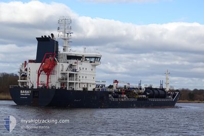
BASAT
Oil/Chemical Tanker
Current Trip
| Time Travelled | 13 days |
|---|---|
| Remaining Time | 3 days |
| Distance Travelled | 4048.44 nm |
| Remaining Distance | 1086.60 nm |
| AVG Speed | 11.5 Knopen |
| MAX Speed | 15.3 Knopen |
| AVG Wind | 10.1 knots |
| MAX Wind | 28 knots |
| MIN Temp | 16°C / 60.8°F |
| MAX Temp | 28.6°C / 83.48°F |
| Diepgang | 8.9 M |
| Positie ontvangen | 1 d geleden |
Current Position
| Lengtegraad | --- |
|---|---|
| Breedtegraat | --- |
| Status | Under way using engine |
| Snelheid | 12.5 Knopen |
| Koers | 134.1° |
| Gebied | North Atlantic Ocean |
| Station | T-AIS |
| Positie ontvangen | 1 d geleden |
Info
Information
The current position of BASAT is in North Atlantic Ocean with coordinates 11.05334° / -17.90619° as reported on 2024-11-23 06:34 by AIS to our vessel tracker app. The vessel's current speed is 12.5 Knopen and is heading at the port of LAGOS. The estimated time of arrival as calculated by MyShipTracking vessel tracking app is 2024-11-28 10:54 LT
The vessel BASAT (IMO: 9447029, MMSI: 249255000) is a Oil/Chemical Tanker that was built in 2008 ( 16 Jaar oud ). It's sailing under the flag of [MT] Malta.
In this page you can find informations about the vessels current position, last detected port calls, and current voyage information. If the vessels is not in coverage by AIS you will find the latest position.
The current position of BASAT is detected by our AIS receivers and we are not responsible for the reliability of the data. The last position was recorded while the vessel was in Coverage by the Ais receivers of our vessel tracking app.
The current draught of BASAT as reported by AIS is 8.9 meters
Weather
| Temperature | 28.6°C / 83.48°F |
|---|---|
| Wind Speed | 7 knots |
| Direction | 221° SW |
| Pressure | 1011.1 hPa |
| Humidity | 70.9 % |
| Cloud Coverage | 6 % |
Featured Company
Last Port Calls
| Port | Arrival | Departure | Time In Port |
|---|---|---|---|
| 2024-11-08 08:52 | 2024-11-10 21:27 | 2 d | |
| 2024-11-02 02:38 | 2024-11-06 06:34 | 4 d | |
| 2024-10-24 04:14 | 2024-10-25 00:55 | 20 h | |
| 2024-10-21 02:19 | 2024-10-22 14:56 | 1 d | |
| 2024-10-19 14:11 | 2024-10-20 05:37 | 15 h | |
| 2024-10-08 00:38 | 2024-10-09 14:46 | 1 d | |
| 2024-10-05 23:05 | 2024-10-07 15:47 | 1 d | |
| 2024-10-01 16:49 | 2024-10-03 05:46 | 1 d | |
| 2024-09-23 08:38 | 2024-09-24 06:26 | 21 h | |
| 2024-09-12 05:37 | 2024-09-17 15:32 | 5 d |
Last Trips
| Origin | Departure | Destination | Arrival | Distance | |
|---|---|---|---|---|---|
| 2024-11-06 09:34 | 2024-11-08 10:52 | 589.04 nm | |||
| 2024-10-25 03:55 | 2024-11-02 05:38 | 354.22 nm | |||
| 2024-10-22 17:56 | 2024-10-24 07:14 | 321.90 nm | |||
| 2024-10-20 08:37 | 2024-10-21 05:19 | 205.98 nm | |||
| 2024-10-09 16:46 | 2024-10-19 17:11 | 2969.43 nm | |||
| 2024-10-07 17:47 | 2024-10-08 02:38 | 106.17 nm | |||
| 2024-10-03 07:46 | 2024-10-06 01:05 | 719.19 nm | |||
| 2024-09-24 09:26 | 2024-10-01 18:49 | 1728.04 nm | |||
| 2024-09-17 17:32 | 2024-09-23 11:38 | 779.75 nm | |||
| 2024-09-04 02:26 | 2024-09-12 07:37 | 2616.24 nm |
Events
| Tijd | Evenement | Details | Positie / Bestemming | Info |
|---|---|---|---|---|
| 2024-11-23 06:38 | Status Changed | Default Under way using engine |
11.04417 / -17.89668
NGLOS
|
Snelheid: 12.5 kn Koers: 134.1° |
| 2024-11-23 06:34 | Buitenbereik |
11.05334 / -17.90619
North Atlantic Ocean
NGLOS
|
Snelheid: 12.5 kn Koers: 134.1° |
|
| 2024-11-23 06:25 | Status Changed | Under way using engine Default |
11.07362 / -17.92698
NGLOS
|
Snelheid: 12.3 kn Koers: 135° |
| 2024-11-23 06:23 | Status Changed | Default Under way using engine |
11.08053 / -17.93408
NGLOS
|
Snelheid: 12.4 kn Koers: 132.8° |
| 2024-11-23 06:21 | Status Changed | Under way using engine Default |
11.08383 / -17.93750
NGLOS
|
Snelheid: 12.6 kn Koers: 136° |
| 2024-11-23 05:50 | Status Changed | Default Under way using engine |
11.15867 / -18.01467
NGLOS
|
Snelheid: 12.2 kn Koers: 134.8° |
| 2024-11-23 05:17 | Wijzig zee gebeid | Guinea Bissau part of the North Atlantic Ocean Senegalese part of the North Atlantic Ocean |
11.24100 / -18.10017
North Atlantic Ocean
NGLOS
|
Snelheid: 12.5 kn Koers: 134.8° |
| 2024-11-23 05:17 | Status Changed | Under way using engine Default |
11.24100 / -18.10017
NGLOS
|
Snelheid: 12.4 kn Koers: 135° |
| 2024-11-23 05:02 | Binnenbereik |
11.24100 / -18.10017
North Atlantic Ocean
NGLOS
|
Snelheid: 12.5 kn Koers: 134.8° |
|
| 2024-11-23 01:41 | Buitenbereik |
11.81703 / -18.55204
North Atlantic Ocean
NGLOS
|
Snelheid: 12.6 kn Koers: 179.3° |