
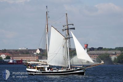
BANJAARD
Sailing Vessel
Current Trip
SAILING
| Time Travelled | 2 days |
|---|---|
| Remaining Time | --- |
| Distance Travelled | 46.95 nm |
| Remaining Distance | --- |
| AVG Speed | 5.6 Knopen |
| MAX Speed | 7.3 Knopen |
| AVG Wind | 17.4 knots |
| MAX Wind | 20.6 knots |
| MIN Temp | 11.1°C / 51.98°F |
| MAX Temp | 18°C / 64.4°F |
| Diepgang | 2 M |
| Positie ontvangen | 1 m geleden |
Current Position
| Lengtegraad | 10.31559° |
|---|---|
| Breedtegraat | 55.01301° |
| Status | Under way sailing |
| Snelheid | 0.1 Knopen |
| Koers | 91° |
| Gebied | Kattegat |
| Station | T-AIS |
| Positie ontvangen | 1 m geleden |
Info
Information
The current position of BANJAARD is in Kattegat with coordinates 55.01301° / 10.31559° as reported on 2024-05-02 02:05 by AIS to our vessel tracker app. The vessel's current speed is 0.1 Knopen
The vessel BANJAARD (IMO: 9096959, MMSI: 245898000) is a Sailing Vessel that was built in 1913 ( 111 Jaar oud ). It's sailing under the flag of [NL] Netherlands.
In this page you can find informations about the vessels current position, last detected port calls, and current voyage information. If the vessels is not in coverage by AIS you will find the latest position.
The current position of BANJAARD is detected by our AIS receivers and we are not responsible for the reliability of the data. The last position was recorded while the vessel was in Coverage by the Ais receivers of our vessel tracking app.
The current draught of BANJAARD as reported by AIS is 2 meters
Weather
| Temperature | 10.5°C / 50.9°F |
|---|---|
| Wind Speed | 21 knots |
| Direction | 78° ENE |
| Pressure | 1009.6 hPa |
| Humidity | 80.7 % |
| Cloud Coverage | 91 % |
Featured Company
Last Port Calls
| Port | Arrival | Departure | Time In Port |
|---|---|---|---|
| 2024-04-29 09:54 | 2024-04-29 10:16 | 21 m | |
| 2024-04-29 08:53 | 2024-04-29 09:48 | 55 m | |
| 2024-04-27 13:57 | 2024-04-28 08:04 | 18 h | |
| 2024-04-26 07:57 | 2024-04-26 08:43 | 45 m | |
| 2024-04-02 08:58 | 2024-04-03 06:31 | 21 h | |
| 2024-03-28 13:42 | 2024-04-02 06:41 | 4 d | |
| 2024-03-28 07:45 |
Most Visited Ports (Last year)
| Port | Arrivals | |
|---|---|---|
| 15 | ||
| 15 | ||
| 9 | ||
| 6 | ||
| 5 | ||
| 2 |
Last Trips
| Origin | Departure | Destination | Arrival | Distance | |
|---|---|---|---|---|---|
| 2024-04-29 11:48 | 2024-04-29 11:54 | 0.43 nm | |||
| 2024-04-28 10:04 | 2024-04-29 10:53 | 22.18 nm | |||
| 2024-04-26 10:43 | 2024-04-27 15:57 | 28.98 nm | |||
| 2024-04-03 08:31 | 2024-04-26 09:57 | 432.45 nm | |||
| 2024-04-02 08:41 | 2024-04-02 10:58 | 12.49 nm | |||
| 2024-03-28 08:45 | 2024-03-28 14:42 | 27.36 nm |
Events
| Tijd | Evenement | Details | Positie / Bestemming | Info |
|---|---|---|---|---|
| 2024-05-01 16:38 | Stop beweging | 4.66 nm, North East of SOEBY |
55.01314 / 10.31564
SAILING
|
Snelheid: 0.3 kn Koers: 117° |
| 2024-05-01 13:14 | Wijzig zee gebeid | Danish part of the Kattegat Danish part of the Baltic Sea |
54.80686 / 10.19307
Kattegat
SAILING
|
Snelheid: 5.4 kn Koers: 354.5° |
| 2024-05-01 12:44 | Wijzig zee gebeid | Danish part of the Baltic Sea German part of the Baltic Sea |
54.76301 / 10.20103
Baltic Sea
SAILING
|
Snelheid: 5.4 kn Koers: 355.9° |
| 2024-05-01 08:21 | Start beweging | 0.93 nm, South West of STICKENHΟRN SPORT |
54.36913 / 10.15571
SAILING
|
Snelheid: 3.3 kn Koers: 51° |
| 2024-05-01 06:24 | ETA Changed | 2024/05/05 15:00 2025/04/29 11:00 |
54.36892 / 10.15106
SAILING
|
Snelheid: Koers: 89° |
| 2024-05-01 06:24 | Status Changed | Under way sailing At anchor |
54.36892 / 10.15106
SAILING
|
Snelheid: Koers: 89° |
| 2024-05-01 00:04 | ETA Changed | 2025/04/29 11:00 2024/04/29 11:00 |
54.36893 / 10.15107
SAILING
|
Snelheid: Koers: 89° |
| 2024-04-29 12:29 | Status Changed | At anchor Under way using engine |
54.36893 / 10.15108
SAILING
|
Snelheid: Koers: 90° |
| 2024-04-29 10:26 | Stop beweging | 1.03 nm, South West of STICKENHΟRN SPORT |
54.36891 / 10.15105
SAILING
|
Snelheid: 0.1 kn Koers: 88° |
| 2024-04-29 10:16 | Vertrekhaven |
|
54.36467 / 10.16401
SAILING
|
Snelheid: 7.5 kn Koers: 305° |