
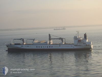
ATLANTIC REEFER
Reefer
Current Trip
| Time Travelled | 6 days |
|---|---|
| Remaining Time | --- |
| Distance Travelled | 1566.78 nm |
| Remaining Distance | --- |
| AVG Speed | 15.4 Knopen |
| MAX Speed | 18.9 Knopen |
| AVG Wind | 22 knots |
| MAX Wind | 37 knots |
| MIN Temp | 1.1°C / 33.98°F |
| MAX Temp | 20.2°C / 68.36°F |
| Diepgang | 7.8 M |
| Positie ontvangen | 1 h, 32 m geleden |
Current Position
| Lengtegraad | --- |
|---|---|
| Breedtegraat | --- |
| Status | Under way using engine |
| Snelheid | 15.7 Knopen |
| Koers | 237.8° |
| Gebied | North Atlantic Ocean |
| Station | T-AIS |
| Positie ontvangen | 1 h, 32 m geleden |
Info
Information
The current position of ATLANTIC REEFER is in North Atlantic Ocean with coordinates 35.18028° / -25.59011° as reported on 2024-11-28 23:43 by AIS to our vessel tracker app. The vessel's current speed is 15.7 Knopen and is heading at the port of POINTE A PITRE. The estimated time of arrival as calculated by MyShipTracking vessel tracking app is 2024-12-04 12:00 LT
The vessel ATLANTIC REEFER (IMO: 9179256, MMSI: 636016238) is a Reefer that was built in 1998 ( 26 Jaar oud ). It's sailing under the flag of [LR] Liberia.
In this page you can find informations about the vessels current position, last detected port calls, and current voyage information. If the vessels is not in coverage by AIS you will find the latest position.
The current position of ATLANTIC REEFER is detected by our AIS receivers and we are not responsible for the reliability of the data. The last position was recorded while the vessel was in Coverage by the Ais receivers of our vessel tracking app.
The current draught of ATLANTIC REEFER as reported by AIS is 7.8 meters
Weather
| Temperature | 20.3°C / 68.54°F |
|---|---|
| Wind Speed | 14 knots |
| Direction | 265° W |
| Pressure | 1016.9 hPa |
| Humidity | 71.9 % |
| Cloud Coverage | 100 % |
Featured Company
Last Port Calls
| Port | Arrival | Departure | Time In Port |
|---|---|---|---|
| 2024-11-22 12:57 | 2024-11-23 01:28 | 12 h | |
| 2024-11-19 08:09 | 2024-11-21 20:25 | 2 d | |
| 2024-11-18 08:49 | 2024-11-18 22:18 | 13 h | |
| 2024-11-02 23:07 | 2024-11-03 06:12 | 7 h | |
| 2024-10-29 08:02 | 2024-11-01 01:56 | 2 d | |
| 2024-10-23 13:03 | 2024-10-23 16:46 | 3 h | |
| 2024-10-19 19:41 | 2024-10-20 06:47 | 11 h | |
| 2024-10-17 15:35 | 2024-10-19 05:07 | 1 d | |
| 2024-10-15 13:00 | 2024-10-15 20:00 | 6 h | |
| 2024-10-14 20:59 | 2024-10-15 04:34 | 7 h |
Most Visited Ports (Last year)
| Port | Arrivals | |
|---|---|---|
| 9 | ||
| 8 | ||
| 8 | ||
| 8 | ||
| 8 | ||
| 7 |
Last Trips
| Origin | Departure | Destination | Arrival | Distance | |
|---|---|---|---|---|---|
| 2024-11-21 20:25 | 2024-11-22 12:57 | 250.56 nm | |||
| 2024-11-18 22:18 | 2024-11-19 08:09 | 97.20 nm | |||
| 2024-11-03 06:12 | 2024-11-18 08:49 | 5624.19 nm | |||
| 2024-11-01 01:56 | 2024-11-02 23:07 | 346.97 nm | |||
| 2024-10-23 16:46 | 2024-10-29 08:02 | 1213.60 nm | |||
| 2024-10-20 06:47 | 2024-10-23 13:03 | 1184.22 nm | |||
| 2024-10-19 05:07 | 2024-10-19 19:41 | 222.09 nm | |||
| 2024-10-15 20:00 | 2024-10-17 15:35 | 659.01 nm | |||
| 2024-10-15 04:34 | 2024-10-15 13:00 | 114.02 nm | |||
| 2024-10-15 04:34 | 2024-10-14 20:59 | 114.02 nm |
Events
| Tijd | Evenement | Details | Positie / Bestemming | Info |
|---|---|---|---|---|
| 2024-11-28 23:47 | Status Changed | Default Under way using engine |
35.16970 / -25.61116
GP PTP
|
Snelheid: 15.7 kn Koers: 237.8° |
| 2024-11-28 23:43 | Buitenbereik |
35.18028 / -25.59011
North Atlantic Ocean
GP PTP
|
Snelheid: 15.7 kn Koers: 237.8° |
|
| 2024-11-28 23:36 | Status Changed | Under way using engine Default |
35.19542 / -25.56022
GP PTP
|
Snelheid: 16 kn Koers: 239° |
| 2024-11-28 23:25 | Binnenbereik |
35.19542 / -25.56022
North Atlantic Ocean
GP PTP
|
Snelheid: 16.1 kn Koers: 238° |
|
| 2024-11-28 21:34 | Status Changed | Default Under way using engine |
35.47773 / -24.98973
GP PTP
|
Snelheid: 15.9 kn Koers: 239.5° |
| 2024-11-28 21:24 | Buitenbereik |
35.50003 / -24.94407
North Atlantic Ocean
GP PTP
|
Snelheid: 15.9 kn Koers: 239.5° |
|
| 2024-11-28 21:15 | Status Changed | Under way using engine Default |
35.51848 / -24.90499
GP PTP
|
Snelheid: 15.8 kn Koers: 240° |
| 2024-11-28 21:13 | Status Changed | Default Under way using engine |
35.52442 / -24.89240
GP PTP
|
Snelheid: 15.9 kn Koers: 239.1° |
| 2024-11-28 20:50 | Status Changed | Under way using engine Default |
35.57506 / -24.78730
GP PTP
|
Snelheid: 15.6 kn Koers: 239° |
| 2024-11-28 20:45 | Status Changed | Default Under way using engine |
35.58721 / -24.76152
GP PTP
|
Snelheid: 15.9 kn Koers: 238.7° |