
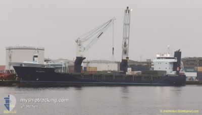
ATLANTIC
General Cargo
Current Trip
| Time Travelled | 3 days |
|---|---|
| Remaining Time | 17 mins |
| Distance Travelled | 1320.41 nm |
| Remaining Distance | 8.82 nm |
| AVG Speed | 15.1 Knopen |
| MAX Speed | 16.6 Knopen |
| AVG Wind | 12.8 knots |
| MAX Wind | 18 knots |
| MIN Temp | 21.9°C / 71.42°F |
| MAX Temp | 27°C / 80.6°F |
| Diepgang | 5.1 M |
| Positie ontvangen | 1 m geleden |
Current Position
| Lengtegraad | -15.35345° |
|---|---|
| Breedtegraat | 28.05507° |
| Status | Under way using engine |
| Snelheid | 14.3 Knopen |
| Koers | 341.5° |
| Gebied | North Atlantic Ocean |
| Station | T-AIS |
| Positie ontvangen | 1 m geleden |
Info
Information
The current position of ATLANTIC is in North Atlantic Ocean with coordinates 28.05507° / -15.35345° as reported on 2024-09-08 00:56 by AIS to our vessel tracker app. The vessel's current speed is 14.3 Knopen and is heading at the port of LAS PALMAS. The estimated time of arrival as calculated by MyShipTracking vessel tracking app is 2024-09-08 01:15 LT
The vessel ATLANTIC (IMO: 9573634, MMSI: 246757000) is a General Cargo that was built in 2011 ( 13 Jaar oud ). It's sailing under the flag of [NL] Netherlands.
In this page you can find informations about the vessels current position, last detected port calls, and current voyage information. If the vessels is not in coverage by AIS you will find the latest position.
The current position of ATLANTIC is detected by our AIS receivers and we are not responsible for the reliability of the data. The last position was recorded while the vessel was in Coverage by the Ais receivers of our vessel tracking app.
The current draught of ATLANTIC as reported by AIS is 5.1 meters
Weather
| Temperature | 22.6°C / 72.68°F |
|---|---|
| Wind Speed | 14 knots |
| Direction | 9° N |
| Pressure | 1015.3 hPa |
| Humidity | 72 % |
| Cloud Coverage | --- |
Featured Company
Last Port Calls
| Port | Arrival | Departure | Time In Port |
|---|---|---|---|
| 2024-09-03 09:02 | 2024-09-04 09:41 | 1 d | |
| 2024-08-17 01:19 | 2024-08-17 17:11 | 15 h | |
| 2024-08-10 12:13 | 2024-08-10 17:46 | 5 h | |
| 2024-07-31 11:32 | 2024-08-02 14:05 | 2 d | |
| 2024-07-27 10:55 | 2024-07-28 01:30 | 14 h | |
| 2024-07-24 04:56 | 2024-07-24 16:41 | 11 h | |
| 2024-07-22 04:18 | 2024-07-23 16:20 | 1 d |
Last Trips
| Origin | Departure | Destination | Arrival | Distance | |
|---|---|---|---|---|---|
| 2024-08-17 12:11 | 2024-09-03 09:02 | 5307.34 nm | |||
| 2024-08-10 14:46 | 2024-08-16 20:19 | 2240.00 nm | |||
| 2024-08-02 15:05 | 2024-08-10 09:13 | 2603.17 nm | |||
| 2024-07-28 02:30 | 2024-07-31 12:32 | 1316.22 nm | |||
| 2024-07-24 18:41 | 2024-07-27 11:55 | 1034.50 nm | |||
| 2024-07-23 18:20 | 2024-07-24 06:56 | 100.43 nm | |||
| 2024-06-30 20:40 | 2024-07-22 06:18 | 6895.10 nm |
Events
| Tijd | Evenement | Details | Positie / Bestemming | Info |
|---|---|---|---|---|
| 2024-09-07 23:50 | Draught Changed | 5.1 5.4 |
27.80020 / -15.36308
LAS PALMAS
|
Snelheid: 14.2 kn Koers: 20° |
| 2024-09-07 23:50 | Destination Changed | LAS PALMAS KAMSAR |
27.80020 / -15.36308
LAS PALMAS
|
Snelheid: 14.2 kn Koers: 20° |
| 2024-09-07 23:50 | ETA Changed | 2024/09/08 01:00 2024/09/01 09:00 |
27.80020 / -15.36308
LAS PALMAS
|
Snelheid: 14.2 kn Koers: 20° |
| 2024-09-07 23:40 | Status Changed | Under way using engine Default |
27.76483 / -15.37753
KAMSAR
|
Snelheid: 14.2 kn Koers: 19° |
| 2024-09-07 23:27 | Status Changed | Default Under way using engine |
27.71622 / -15.39662
KAMSAR
|
Snelheid: 14 kn Koers: 19.1° |
| 2024-09-07 23:19 | Wijzig zee gebeid | Spanish (Canary Islands) part of the North Atlantic Ocean United States part of the North Atlantic Ocean |
27.68677 / -15.40788
North Atlantic Ocean
|
Snelheid: 14 kn Koers: 19.1° |
| 2024-09-07 23:19 | Status Changed | Under way using engine Default |
27.68677 / -15.40788
KAMSAR
|
Snelheid: 14 kn Koers: 20° |
| 2024-09-07 23:11 | Binnenbereik |
27.68677 / -15.40788
North Atlantic Ocean
|
Snelheid: 14 kn Koers: 19.1° |
|
| 2024-09-04 09:41 | Vertrekhaven |
|
10.64812 / -14.62942
KAMSAR
|
Snelheid: 5.1 kn Koers: 253° |
| 2024-09-04 09:30 | Start beweging |
10.65013 / -14.61948
[GN] KAMSAR
|
Snelheid: 3.1 kn Koers: 107° |