
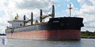
ATHENA
Bulk Carrier
Current Trip
C0STANTA
| Time Travelled | 2 days |
|---|---|
| Remaining Time | --- |
| Distance Travelled | 230.08 nm |
| Remaining Distance | --- |
| AVG Speed | 6.5 Knopen |
| MAX Speed | 12.8 Knopen |
| AVG Wind | 17.6 knots |
| MAX Wind | 24.9 knots |
| MIN Temp | 21.1°C / 69.98°F |
| MAX Temp | 26.2°C / 79.16°F |
| Diepgang | 7.4 M |
| Positie ontvangen | 1 m geleden |
Current Position
| Lengtegraad | 25.57706° |
|---|---|
| Breedtegraat | 39.04039° |
| Status | Under way using engine |
| Snelheid | 1.9 Knopen |
| Koers | 124° |
| Gebied | Aegean Sea |
| Station | T-AIS |
| Positie ontvangen | 1 m geleden |
Info
Information
The current position of ATHENA is in Aegean Sea with coordinates 39.04039° / 25.57706° as reported on 2024-06-26 18:15 by AIS to our vessel tracker app. The vessel's current speed is 1.9 Knopen
The vessel ATHENA (IMO: 9497880, MMSI: 636021147) is a Bulk Carrier that was built in 2012 ( 12 Jaar oud ). It's sailing under the flag of [LR] Liberia.
In this page you can find informations about the vessels current position, last detected port calls, and current voyage information. If the vessels is not in coverage by AIS you will find the latest position.
The current position of ATHENA is detected by our AIS receivers and we are not responsible for the reliability of the data. The last position was recorded while the vessel was in Coverage by the Ais receivers of our vessel tracking app.
The current draught of ATHENA as reported by AIS is 7.4 meters
Weather
| Temperature | 24.2°C / 75.56°F |
|---|---|
| Wind Speed | 18 knots |
| Direction | 6° N |
| Pressure | 1010.9 hPa |
| Humidity | 65.9 % |
| Cloud Coverage | --- |
Featured Company
Last Port Calls
| Port | Arrival | Departure | Time In Port |
|---|---|---|---|
| 2024-06-15 18:59 | 2024-06-24 03:01 | 8 d | |
| 2024-05-17 17:22 | 2024-05-21 22:06 | 4 d | |
| 2024-05-04 00:26 | 2024-05-12 08:42 | 8 d | |
| 2024-04-03 01:05 | 2024-04-14 23:17 | 11 d |
Most Visited Ports (Last year)
| Port | Arrivals | |
|---|---|---|
| 3 | ||
| 2 | ||
| 2 | ||
| 1 | ||
| 1 | ||
| 1 |
Last Trips
| Origin | Departure | Destination | Arrival | Distance | |
|---|---|---|---|---|---|
| 2024-05-21 17:06 | 2024-06-15 21:59 | 6513.28 nm | |||
| 2024-05-12 03:42 | 2024-05-17 12:22 | 1510.34 nm | |||
| 2024-04-15 00:17 | 2024-05-03 19:26 | 4981.65 nm | |||
| 2024-03-13 13:46 | 2024-04-03 02:05 | 1085.39 nm |
Events
| Tijd | Evenement | Details | Positie / Bestemming | Info |
|---|---|---|---|---|
| 2024-06-26 17:03 | Status Changed | Under way using engine Default |
38.97418 / 25.59224
C0STANTA
|
Snelheid: 9.3 kn Koers: 342° |
| 2024-06-26 16:45 | Status Changed | Default Under way using engine |
38.93117 / 25.61132
C0STANTA
|
Snelheid: 9.2 kn Koers: 342.2° |
| 2024-06-26 15:35 | Start beweging | 16.48 nm, North of PSARA |
38.79881 / 25.68801
C0STANTA
|
Snelheid: 3.1 kn Koers: 137° |
| 2024-06-26 07:58 | Stop beweging | 15.91 nm, South West of SIGRI |
39.05402 / 25.57332
C0STANTA
|
Snelheid: 0.2 kn Koers: 58° |
| 2024-06-26 06:42 | Status Changed | Under way using engine Default |
38.86554 / 25.59896
C0STANTA
|
Snelheid: 9.4 kn Koers: 354° |
| 2024-06-26 05:59 | Status Changed | Default Under way using engine |
38.75544 / 25.61536
C0STANTA
|
Snelheid: 8 kn Koers: 348.2° |
| 2024-06-26 03:16 | Status Changed | Under way using engine Default |
38.81061 / 25.60167
C0STANTA
|
Snelheid: 1.6 kn Koers: 103° |
| 2024-06-26 02:25 | Status Changed | Default Under way using engine |
38.83190 / 25.59092
C0STANTA
|
Snelheid: 1.6 kn Koers: 115° |
| 2024-06-26 02:12 | Status Changed | Under way using engine Default |
38.83730 / 25.58930
C0STANTA
|
Snelheid: 1.7 kn Koers: 116° |
| 2024-06-26 01:54 | Status Changed | Default Under way using engine |
38.84506 / 25.58681
C0STANTA
|
Snelheid: 1.7 kn Koers: 116° |