
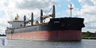
ATHENA
Bulk Carrier
Current Trip
C0STANTA
| Time Travelled | 5 days |
|---|---|
| Remaining Time | --- |
| Distance Travelled | 680.92 nm |
| Remaining Distance | --- |
| AVG Speed | 8.3 Noeuds |
| MAX Speed | 12.9 Noeuds |
| AVG Wind | 16.8 knots |
| MAX Wind | 26 knots |
| MIN Temp | 15.7°C / 60.26°F |
| MAX Temp | 26.2°C / 79.16°F |
| Tirant d eau | 7.4 m |
| Position reçue | 9 h, 42 m depuis |
Current Position
| Longitude | 29.29777° |
|---|---|
| Latitude | 41.41170° |
| Etat | Under way using engine |
| Vitesse | 11.2 Noeuds |
| Parcours | 358.8° |
| Zone | Black Sea |
| Station | T-AIS |
| Position reçue | 9 h, 42 m depuis |
Info
Information
The current position of ATHENA is in Black Sea with coordinates 41.41170° / 29.29777° as reported on 2024-06-29 01:56 by AIS to our vessel tracker app. The vessel's current speed is 11.2 Noeuds
The vessel ATHENA (IMO: 9497880, MMSI: 636021147) is a Bulk Carrier that was built in 2012 ( 12 Age ). It's sailing under the flag of [LR] Liberia.
In this page you can find informations about the vessels current position, last detected port calls, and current voyage information. If the vessels is not in coverage by AIS you will find the latest position.
The current position of ATHENA is detected by our AIS receivers and we are not responsible for the reliability of the data. The last position was recorded while the vessel was in Coverage by the Ais receivers of our vessel tracking app.
The current draught of ATHENA as reported by AIS is 7.4 meters
Weather
| Temperature | 24.5°C / 76.1°F |
|---|---|
| Wind Speed | 11 knots |
| Direction | 18° NNE |
| Pressure | 1016 hPa |
| Humidity | 75.7 % |
| Cloud Coverage | --- |
Featured Company
Last Port Calls
| Port | Arrival | Departure | Time In Port |
|---|---|---|---|
| 2024-06-15 18:59 | 2024-06-24 03:01 | 8 d | |
| 2024-05-17 17:22 | 2024-05-21 22:06 | 4 d | |
| 2024-05-04 00:26 | 2024-05-12 08:42 | 8 d | |
| 2024-04-03 01:05 | 2024-04-14 23:17 | 11 d |
Most Visited Ports (Last year)
| Port | Arrivals | |
|---|---|---|
| 3 | ||
| 2 | ||
| 2 | ||
| 1 | ||
| 1 | ||
| 1 |
Last Trips
| Origin | Departure | Destination | Arrival | Distance | |
|---|---|---|---|---|---|
| 2024-05-21 17:06 | 2024-06-15 21:59 | 6513.28 nm | |||
| 2024-05-12 03:42 | 2024-05-17 12:22 | 1510.34 nm | |||
| 2024-04-15 00:17 | 2024-05-03 19:26 | 4981.65 nm | |||
| 2024-03-13 13:46 | 2024-04-03 02:05 | 1085.39 nm |
Events
| Heure | Evenement | Détails | Position/ Destination | Info |
|---|---|---|---|---|
| 2024-06-29 02:01 | Etat Changé | Default Under way using engine |
41.42835 / 29.29696
C0STANTA
|
Vitesse: 11.2 kn Parcours: 358.8° |
| 2024-06-29 01:56 | Etat Changé | Under way using engine Default |
41.41170 / 29.29777
C0STANTA
|
Vitesse: 11.2 kn Parcours: 1° |
| 2024-06-29 01:56 | Hors de la zone couverte |
41.41170 / 29.29777
Black Sea
C0STANTA
|
Vitesse: 11.2 kn Parcours: 358.8° |
|
| 2024-06-29 01:50 | Etat Changé | Default Under way using engine |
41.39248 / 29.29722
C0STANTA
|
Vitesse: 11.1 kn Parcours: 19.6° |
| 2024-06-29 00:47 | Changement de zone | Turkish part of the Black Sea Turkish part of the Sea of Marmara |
41.23625 / 29.14802
Black Sea
C0STANTA
|
Vitesse: 11.2 kn Parcours: 40.7° |
| 2024-06-28 18:23 | Etat Changé | Under way using engine Default |
40.77103 / 28.51697
C0STANTA
|
Vitesse: 8.9 kn Parcours: 78° |
| 2024-06-28 18:17 | Etat Changé | Default Under way using engine |
40.76821 / 28.49898
C0STANTA
|
Vitesse: 8.9 kn Parcours: 77.4° |
| 2024-06-28 17:57 | Etat Changé | Under way using engine Default |
40.75875 / 28.43688
C0STANTA
|
Vitesse: 8.3 kn Parcours: 81° |
| 2024-06-28 17:50 | Etat Changé | Default Under way using engine |
40.75615 / 28.41565
C0STANTA
|
Vitesse: 8.3 kn Parcours: 81.5° |
| 2024-06-28 17:48 | Etat Changé | Under way using engine Default |
40.75534 / 28.40818
C0STANTA
|
Vitesse: 8.3 kn Parcours: 82° |