
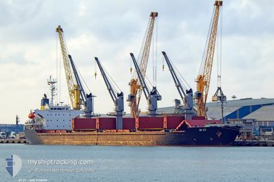
AT 27
Bulk Carrier
Current Trip
| Time Travelled | 5 days |
|---|---|
| Remaining Time | --- |
| Distance Travelled | 1262.56 nm |
| Remaining Distance | 3.70 nm |
| AVG Speed | 10.6 Knopen |
| MAX Speed | 13.9 Knopen |
| AVG Wind | 11 knots |
| MAX Wind | 38 knots |
| MIN Temp | 8.3°C / 46.94°F |
| MAX Temp | 16.7°C / 62.06°F |
| Diepgang | 8.1 M |
| Positie ontvangen | 2 m geleden |
Current Position
| Lengtegraad | --- |
|---|---|
| Breedtegraat | --- |
| Status | At anchor |
| Snelheid | |
| Koers | 206° |
| Gebied | Sea of Marmara |
| Station | T-AIS |
| Positie ontvangen | 2 m geleden |
Info
Information
The current position of AT 27 is in Sea of Marmara with coordinates 40.95996° / 28.91600° as reported on 2025-01-22 13:26 by AIS to our vessel tracker app. The vessel's current speed is 0 Knopen and is heading at the port of ISTANBUL. The estimated time of arrival as calculated by MyShipTracking vessel tracking app is 2025-01-22 14:00 LT
The vessel AT 27 (IMO: 9136539, MMSI: 511100611) is a Bulk Carrier that was built in 1997 ( 28 Jaar oud ). It's sailing under the flag of [PW] Palau.
In this page you can find informations about the vessels current position, last detected port calls, and current voyage information. If the vessels is not in coverage by AIS you will find the latest position.
The current position of AT 27 is detected by our AIS receivers and we are not responsible for the reliability of the data. The last position was recorded while the vessel was in Coverage by the Ais receivers of our vessel tracking app.
The current draught of AT 27 as reported by AIS is 8.1 meters
Weather
| Temperature | 11.3°C / 52.34°F |
|---|---|
| Wind Speed | 3 knots |
| Direction | 247° WSW |
| Pressure | 1018.2 hPa |
| Humidity | 75.1 % |
| Cloud Coverage | 68 % |
Featured Company
Last Port Calls
Most Visited Ports (Last year)
| Port | Arrivals | |
|---|---|---|
| 4 | ||
| 2 | ||
| 2 | ||
| 1 | ||
| 1 | ||
| 1 |
Last Trips
| Origin | Departure | Destination | Arrival | Distance | |
|---|---|---|---|---|---|
| 2025-01-08 17:16 | 2025-01-10 11:52 | 376.05 nm | |||
| 2024-12-23 16:56 | 2024-12-31 08:43 | 1037.22 nm | |||
| 2024-12-07 13:33 | 2024-12-23 15:22 | 1844.70 nm | |||
| 2024-11-14 06:42 | 2024-12-03 18:42 | 1724.42 nm | |||
| 2024-11-07 00:31 | 2024-11-14 05:12 | 1655.35 nm |
Events
| Tijd | Evenement | Details | Positie / Bestemming | Info |
|---|---|---|---|---|
| 2025-01-22 11:32 | Status Changed | At anchor Under way using engine |
40.96005 / 28.91599
TR/IST
|
Snelheid: Koers: 207° |
| 2025-01-22 10:47 | Stop beweging | 1.69 nm, South East of ZEYTINBURNU |
40.95726 / 28.91639
TR/IST
|
Snelheid: 0.3 kn Koers: 319° |
| 2025-01-22 08:16 | Status Changed | Under way using engine Default |
40.80631 / 28.44017
TR/IST
|
Snelheid: 12.6 kn Koers: 83° |
| 2025-01-22 08:06 | Status Changed | Default Under way using engine |
40.80168 / 28.39056
TR/IST
|
Snelheid: 12.6 kn Koers: 81.8° |
| 2025-01-22 07:55 | Status Changed | Under way using engine Default |
40.79612 / 28.34087
TR/IST
|
Snelheid: 12.5 kn Koers: 81° |
| 2025-01-22 07:49 | Status Changed | Default Under way using engine |
40.79304 / 28.31293
TR/IST
|
Snelheid: 12.6 kn Koers: 81.3° |
| 2025-01-22 07:47 | Status Changed | Under way using engine Default |
40.79215 / 28.30521
TR/IST
|
Snelheid: 12.8 kn Koers: 80° |
| 2025-01-22 07:32 | Status Changed | Default Under way using engine |
40.78328 / 28.23627
TR/IST
|
Snelheid: 13 kn Koers: 79.9° |
| 2025-01-22 06:35 | Status Changed | Under way using engine Default |
40.74636 / 27.96081
TR/IST
|
Snelheid: 12.9 kn Koers: 82° |
| 2025-01-22 06:25 | Status Changed | Default Under way using engine |
40.74150 / 27.91149
TR/IST
|
Snelheid: 12.6 kn Koers: 82.8° |