
ANTONIS I.ANGELICOUS
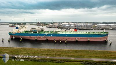
Tanker
Current Trip
| Time Travelled | --- |
|---|---|
| Remaining Time | --- |
| Distance Travelled | 6390.54 nm |
| Remaining Distance | --- |
| AVG Speed | 14.1 Knopen |
| MAX Speed | 18.4 Knopen |
| AVG Wind | 14.9 knots |
| MAX Wind | 34.3 knots |
| MIN Temp | 20.9°C / 69.62°F |
| MAX Temp | 29.4°C / 84.92°F |
| Diepgang | 20.6 M |
| Positie ontvangen | 3 d geleden |
Current Position
| Lengtegraad | 57.30658° |
|---|---|
| Breedtegraat | 24.94077° |
| Status | Constrained by her draught |
| Snelheid | 14.5 Knopen |
| Koers | 126.4° |
| Gebied | Gulf of Oman |
| Station | T-AIS |
| Positie ontvangen | 3 d geleden |
Info
Information
The current position of ANTONIS I.ANGELICOUS is in Gulf of Oman with coordinates 24.94077° / 57.30658° as reported on 2024-06-07 00:41 by AIS to our vessel tracker app. The vessel's current speed is 14.5 Knopen and is heading at the port of PENGERANG. The estimated time of arrival as calculated by MyShipTracking vessel tracking app is 2024-06-18 20:00 LT
The vessel ANTONIS I.ANGELICOUS (IMO: 9930777, MMSI: 241809000) is a Tanker It's sailing under the flag of [GR] Greece.
In this page you can find informations about the vessels current position, last detected port calls, and current voyage information. If the vessels is not in coverage by AIS you will find the latest position.
The current position of ANTONIS I.ANGELICOUS is detected by our AIS receivers and we are not responsible for the reliability of the data. The last position was recorded while the vessel was in Coverage by the Ais receivers of our vessel tracking app.
The current draught of ANTONIS I.ANGELICOUS as reported by AIS is 20.6 meters
Weather
| Temperature | 29.3°C / 84.74°F |
|---|---|
| Wind Speed | 17 knots |
| Direction | 291° WNW |
| Pressure | 1009.9 hPa |
| Humidity | 77.8 % |
| Cloud Coverage | 100 % |
Featured Company
Last Port Calls
Most Visited Ports (Last year)
| Port | Arrivals | |
|---|---|---|
| 1 | ||
| 1 | ||
| 1 | ||
| 1 | ||
| 1 |
Last Trips
| Origin | Departure | Destination | Arrival | Distance |
|---|
Events
| Tijd | Evenement | Details | Positie / Bestemming | Info |
|---|---|---|---|---|
| 2024-06-07 01:21 | Status Changed | Default Constrained by her draught |
24.83811 / 57.44938
IQBSR>MYPGG
|
Snelheid: 14.5 kn Koers: 126.4° |
| 2024-06-07 00:41 | Buitenbereik |
24.94077 / 57.30658
Gulf of Oman
IQBSR>MYPGG
|
Snelheid: 14.5 kn Koers: 126.4° |
|
| 2024-06-06 23:34 | Wijzig zee gebeid | Omani part of the Gulf of Oman United Arab Emirates part of the Gulf of Oman |
25.10008 / 57.07391
Gulf of Oman
IQBSR>MYPGG
|
Snelheid: 13.9 kn Koers: 127.2° |
| 2024-06-06 22:22 | Wijzig zee gebeid | United Arab Emirates part of the Gulf of Oman Iranian part of the Gulf of Oman |
25.35924 / 56.95652
Gulf of Oman
IQBSR>MYPGG
|
Snelheid: 14.5 kn Koers: 164.1° |
| 2024-06-06 21:49 | Wijzig zee gebeid | Iranian part of the Gulf of Oman United Arab Emirates part of the Gulf of Oman |
25.48115 / 56.90174
Gulf of Oman
IQBSR>MYPGG
|
Snelheid: 14.7 kn Koers: 145.4° |
| 2024-06-06 21:01 | Wijzig zee gebeid | United Arab Emirates part of the Gulf of Oman Omani part of the Gulf of Oman |
25.66192 / 56.81415
Gulf of Oman
IQBSR>MYPGG
|
Snelheid: 14.6 kn Koers: 167.8° |
| 2024-06-06 19:58 | Wijzig zee gebeid | Omani part of the Gulf of Oman Omani part of the Persian Gulf |
25.91015 / 56.73889
Gulf of Oman
IQBSR>MYPGG
|
Snelheid: 14.2 kn Koers: 165.7° |
| 2024-06-06 19:56 | Binnenbereik |
25.91015 / 56.73889
Gulf of Oman
IQBSR>MYPGG
|
Snelheid: 14.2 kn Koers: 165.7° |
|
| 2024-06-06 13:59 | Buitenbereik |
26.21976 / 55.93411
Persian Gulf
IQBSR>MYPGG
|
Snelheid: 11.8 kn Koers: 70.8° |
|
| 2024-06-06 13:40 | Wijzig zee gebeid | Omani part of the Persian Gulf United Arab Emirates part of the Persian Gulf |
26.20466 / 55.86538
Persian Gulf
IQBSR>MYPGG
|
Snelheid: 12 kn Koers: 74.6° |