
ANTONIS I.ANGELICOUS
Tanker
Current Trip
AEFJR>IQBSR
| Time Travelled | --- |
|---|---|
| Remaining Time | --- |
| Distance Travelled | 6390.54 nm |
| Remaining Distance | --- |
| AVG Speed | 14.1 Knots |
| MAX Speed | 18.4 Knots |
| AVG Wind | 14.9 knots |
| MAX Wind | 34.3 knots |
| MIN Temp | 20.9°C / 69.62°F |
| MAX Temp | 29.4°C / 84.92°F |
| Dybgang | 11.3 m |
| Position Modtaget | Nu |
Current Position
| Longitude | 50.76640° |
|---|---|
| Latitude | 27.67903° |
| Status | Under way using engine |
| Fart | 14.7 Knots |
| Kurs | 336.2° |
| Område | Persian Gulf |
| Station | T-AIS |
| Position Modtaget | Nu |
Info
Information
The current position of ANTONIS I.ANGELICOUS is in Persian Gulf with coordinates 27.67903° / 50.76640° as reported on 2024-05-31 00:40 by AIS to our vessel tracker app. The vessel's current speed is 14.7 Knots
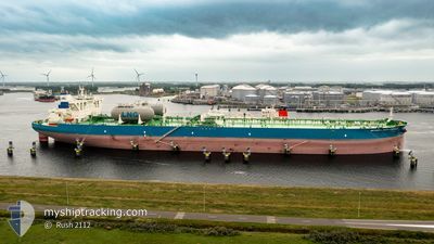
The vessel ANTONIS I.ANGELICOUS (IMO: 9930777, MMSI: 241809000) is a Tanker It's sailing under the flag of [GR] Greece.
In this page you can find informations about the vessels current position, last detected port calls, and current voyage information. If the vessels is not in coverage by AIS you will find the latest position.
The current position of ANTONIS I.ANGELICOUS is detected by our AIS receivers and we are not responsible for the reliability of the data. The last position was recorded while the vessel was in Coverage by the Ais receivers of our vessel tracking app.
The current draught of ANTONIS I.ANGELICOUS as reported by AIS is 11.3 meters
Weather
| Temperature | 29.3°C / 84.74°F |
|---|---|
| Wind Speed | 2 knots |
| Direction | 70° ENE |
| Pressure | 1002.7 hPa |
| Humidity | 75.3 % |
| Cloud Coverage | --- |
Featured Company
Last Port Calls
Most Visited Ports (Last year)
| Port | Arrivals | |
|---|---|---|
| 1 | ||
| 1 | ||
| 1 | ||
| 1 | ||
| 1 |
Last Trips
| Origin | Departure | Destination | Arrival | Distance |
|---|
Events
| Tid | Hændelsen | Detaljer | Position / Dest | Info |
|---|---|---|---|---|
| 2024-05-30 21:24 | Status er ændret | Under way using engine Default |
27.05824 / 51.24930
AEFJR>IQBSR
|
Fart: 14.2 kn Kurs: 285° |
| 2024-05-30 21:14 | Status er ændret | Default Under way using engine |
27.04819 / 51.29124
AEFJR>IQBSR
|
Fart: 14.2 kn Kurs: 279.8° |
| 2024-05-30 21:09 | Status er ændret | Under way using engine Default |
27.04478 / 51.31358
AEFJR>IQBSR
|
Fart: 14.1 kn Kurs: 273° |
| 2024-05-30 20:59 | Status er ændret | Default Under way using engine |
27.04188 / 51.36013
AEFJR>IQBSR
|
Fart: 14.1 kn Kurs: 272.9° |
| 2024-05-30 20:22 | Status er ændret | Under way using engine Default |
27.03542 / 51.52064
AEFJR>IQBSR
|
Fart: 13.9 kn Kurs: 270° |
| 2024-05-30 20:12 | Status er ændret | Default Under way using engine |
27.03498 / 51.56283
AEFJR>IQBSR
|
Fart: 13.8 kn Kurs: 269.9° |
| 2024-05-30 18:56 | Status er ændret | Under way using engine Default |
27.03981 / 51.88891
AEFJR>IQBSR
|
Fart: 13.6 kn Kurs: 248° |
| 2024-05-30 18:51 | Status er ændret | Default Under way using engine |
27.04652 / 51.90727
AEFJR>IQBSR
|
Fart: 13.3 kn Kurs: 248.7° |
| 2024-05-30 18:42 | Status er ændret | Under way using engine Default |
27.05687 / 51.94199
AEFJR>IQBSR
|
Fart: 13.4 kn Kurs: 272° |
| 2024-05-30 18:26 | Status er ændret | Default Under way using engine |
27.05589 / 52.00823
AEFJR>IQBSR
|
Fart: 13.2 kn Kurs: 271° |