
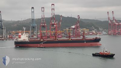
AM BREMEN
Bulk Carrier
Current Trip
PE CLL
| Time Travelled | 9 days |
|---|---|
| Remaining Time | --- |
| Distance Travelled | 796.41 nm |
| Remaining Distance | --- |
| AVG Speed | 10.4 Knopen |
| MAX Speed | 13.6 Knopen |
| AVG Wind | 10.4 knots |
| MAX Wind | 16.9 knots |
| MIN Temp | 12.3°C / 54.14°F |
| MAX Temp | 21°C / 69.8°F |
| Diepgang | 10.7 M |
| Positie ontvangen | 24 d geleden |
Current Position
| Lengtegraad | -112.88028° |
|---|---|
| Breedtegraat | 14.78885° |
| Status | Under way using engine |
| Snelheid | 11.6 Knopen |
| Koers | 107.6° |
| Gebied | North Pacific Ocean |
| Station | T-AIS |
| Positie ontvangen | 24 d geleden |
Info
Information
The current position of AM BREMEN is in North Pacific Ocean with coordinates 14.78885° / -112.88028° as reported on 2024-04-20 07:00 by AIS to our vessel tracker app. The vessel's current speed is 11.6 Knopen
The vessel AM BREMEN (IMO: 9566473, MMSI: 373724000) is a Bulk Carrier that was built in 2012 ( 12 Jaar oud ). It's sailing under the flag of [PA] Panama.
In this page you can find informations about the vessels current position, last detected port calls, and current voyage information. If the vessels is not in coverage by AIS you will find the latest position.
The current position of AM BREMEN is detected by our AIS receivers and we are not responsible for the reliability of the data. The last position was recorded while the vessel was in Coverage by the Ais receivers of our vessel tracking app.
The current draught of AM BREMEN as reported by AIS is 10.7 meters
Weather
| Temperature | 18.4°C / 65.12°F |
|---|---|
| Wind Speed | 7 knots |
| Direction | 155° SSE |
| Pressure | 1013.9 hPa |
| Humidity | 70.1 % |
| Cloud Coverage | 92 % |
Featured Company
Events
| Tijd | Evenement | Details | Positie / Bestemming | Info |
|---|---|---|---|---|
| 2024-05-14 07:28 | Stop beweging | 0.47 nm, West of MATARANI |
-16.99833 / -72.11500
PE CLL
|
Snelheid: Koers: -1° |
| 2024-05-14 02:13 | Start beweging | 2.67 nm, North West of ILO |
-17.60953 / -71.37342
PE CLL
|
Snelheid: 4.3 kn Koers: 230° |
| 2024-05-13 22:52 | Stop beweging | 2.82 nm, North of ILO |
-17.60667 / -71.37334
PE CLL
|
Snelheid: Koers: -1° |
| 2024-05-13 20:04 | Start beweging | 11.7 nm, South East of ILO |
-17.78500 / -71.20667
PE CLL
|
Snelheid: 4 kn Koers: -1° |
| 2024-05-11 11:37 | Stop beweging | 12.05 nm, South East of ILO |
-17.78500 / -71.19833
PE CLL
|
Snelheid: Koers: -1° |
| 2024-05-11 07:25 | Start beweging | 1.94 nm, North West of ILO |
-17.62258 / -71.37221
PE CLL
|
Snelheid: 5.8 kn Koers: 267° |
| 2024-05-08 17:55 | Stop beweging | 2.04 nm, North of ILO |
-17.61833 / -71.36667
PE CLL
|
Snelheid: Koers: -1° |
| 2024-05-08 11:21 | Start beweging | 19.99 nm, South West of MATARANI |
-17.29230 / -72.27065
PE CLL
|
Snelheid: 4 kn Koers: 208° |
| 2024-05-07 16:58 | Stop beweging | 21.14 nm, West of ILO |
-17.55333 / -71.71000
PE CLL
|
Snelheid: Koers: -1° |
| 2024-05-07 14:57 | Start beweging | 2.06 nm, North West of ILO |
-17.62677 / -71.38117
PE CLL
|
Snelheid: 9 kn Koers: 255° |