

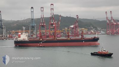
AM BREMEN
Bulk Carrier

Current Trip
| Trip Time | 18 h, 32 mins |
|---|---|
| Trip Distance | 145.29 nm |
| AVG Speed | 8 Knots |
| MAX Speed | 11.2 Knots |
| Dybgang | 6.6 m |
| AVG Wind | 7 knots |
| MAX Wind | 11 knots |
| MIN Temp | 18.5°C / 65.3°F |
| MAX Temp | 21.5°C / 70.7°F |
| Position Modtaget | 2024-12-13 12:27 |
Current Position
| Longitude | --- |
|---|---|
| Latitude | --- |
| Status | Under way using engine |
| Fart | 13.2 Knots |
| Kurs | 145.6° |
| Område | North Pacific Ocean |
| Station | T-AIS |
| Position Modtaget | 2024-12-13 12:27 |
Information
The current position of AM BREMEN is in North Pacific Ocean with coordinates 35.27858° / 139.75393° as reported on 2024-12-13 12:27 by AIS to our vessel tracker app. The vessel's current speed is 13.2 Knots and is currently inside the port of MEJILLONES.
The vessel AM BREMEN (IMO: 9566473, MMSI: 373724000) is a Bulk Carrier that was built in 2012 ( 13 år gamle ). It's sailing under the flag of [PA] Panama.
In this page you can find informations about the vessels current position, last detected port calls, and current voyage information. If the vessels is not in coverage by AIS you will find the latest position.
The current position of AM BREMEN is detected by our AIS receivers and we are not responsible for the reliability of the data. The last position was recorded while the vessel was in Coverage by the Ais receivers of our vessel tracking app.
The current draught of AM BREMEN as reported by AIS is 6.6 meters
Weather
| Temperature | 19.9°C / 67.82°F |
|---|---|
| Wind Speed | 13 knots |
| Direction | 215° SW |
| Pressure | 1014.2 hPa |
| Humidity | 81.1 % |
| Cloud Coverage | 8 % |


Featured Company
Last Port Calls
| Port | Arrival | Departure | Time In Port |
|---|---|---|---|
| 2025-03-26 08:23 | |||
| 2025-03-21 08:22 | 2025-03-25 13:51 | 4 d | |
| 2025-03-07 17:14 | 2025-03-15 23:11 | 8 d |
Most Visited Ports (Last year)
| Port | Arrivals | |
|---|---|---|
| 2 | ||
| 2 | ||
| 2 | ||
| 1 | ||
| 1 | ||
| 1 |
Last Trips
| Origin | Departure | Destination | Arrival | Distance | |
|---|---|---|---|---|---|
| 2025-03-25 13:51 | 2025-03-26 08:23 | 145.29 nm | |||
| 2025-03-15 23:11 | 2025-03-21 08:22 | 711.43 nm | |||
| 2024-12-12 07:52 | 2025-03-07 17:14 | 3001.60 nm |
Events
| Tid | Hændelsen | Detaljer | Position / Dest | Info |
|---|---|---|---|---|
| 2025-03-26 11:34 | STOP Sejllads |
-23.07465 / -70.43738
[CL] MEJILLONES
|
Fart: 0.2 kn Kurs: 244° |
|
| 2025-03-26 11:23 | Skibe i havn |
|
-23.07378 / -70.43669
[CL] MEJILLONES
|
Fart: 2.5 kn Kurs: 205° |
| 2025-03-26 10:09 | START Sejllads | 3.66 nm, North West of MEJILLONES |
-23.02363 / -70.45431
FOR ORDERS
|
Fart: 3.4 kn Kurs: 140° |
| 2025-03-26 09:13 | STOP Sejllads | 5.79 nm, North West of MEJILLONES |
-22.99440 / -70.47611
FOR ORDERS
|
Fart: 0.3 kn Kurs: 150° |
| 2025-03-25 16:51 | Afsejlet fra sidste havn |
|
-20.79331 / -70.21874
FOR ORDERS
|
Fart: 5.9 kn Kurs: 295° |
| 2025-03-25 16:44 | START Sejllads |
-20.79207 / -70.20411
[CL] PATACHE
|
Fart: 5.9 kn Kurs: 295° |
|
| 2025-03-21 11:22 | STOP Sejllads |
-20.79649 / -70.20348
[CL] PATACHE
|
Fart: 0.3 kn Kurs: 204° |
|
| 2025-03-21 11:22 | Skibe i havn |
|
-20.79649 / -70.20348
[CL] PATACHE
|
Fart: 0.6 kn Kurs: 195° |
| 2025-03-21 11:02 | START Sejllads | 0.57 nm, North West of PATACHE |
-20.79080 / -70.20360
FOR ORDERS
|
Fart: 3.5 kn Kurs: 190° |
| 2025-03-21 10:29 | STOP Sejllads | 1.12 nm, North West of PATACHE |
-20.78231 / -70.20788
FOR ORDERS
|
Fart: 0.3 kn Kurs: 160° |