
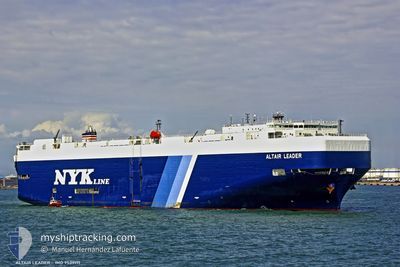
ALTAIR LEADER
Vehicles Carrier
Current Trip
| Time Travelled | 4 days |
|---|---|
| Remaining Time | --- |
| Distance Travelled | 1846.53 nm |
| Remaining Distance | --- |
| AVG Speed | 14.8 Knopen |
| MAX Speed | 18.3 Knopen |
| AVG Wind | 19.9 knots |
| MAX Wind | 39.6 knots |
| MIN Temp | 10.8°C / 51.44°F |
| MAX Temp | 28°C / 82.4°F |
| Diepgang | 9.3 M |
| Positie ontvangen | 4 d geleden |
Current Position
| Lengtegraad | --- |
|---|---|
| Breedtegraat | --- |
| Status | Under way using engine |
| Snelheid | 17 Knopen |
| Koers | 187° |
| Gebied | North Pacific Ocean |
| Station | T-AIS |
| Positie ontvangen | 4 d geleden |
Info
Information
The current position of ALTAIR LEADER is in North Pacific Ocean with coordinates 34.91313° / 139.69951° as reported on 2025-02-12 10:46 by AIS to our vessel tracker app. The vessel's current speed is 17 Knopen and is heading at the port of MELBOURNE. The estimated time of arrival as calculated by MyShipTracking vessel tracking app is 2025-02-26 16:00 LT
The vessel ALTAIR LEADER (IMO: 9539171, MMSI: 432817000) is a Vehicles Carrier that was built in 2011 ( 14 Jaar oud ). It's sailing under the flag of [JP] Japan.
In this page you can find informations about the vessels current position, last detected port calls, and current voyage information. If the vessels is not in coverage by AIS you will find the latest position.
The current position of ALTAIR LEADER is detected by our AIS receivers and we are not responsible for the reliability of the data. The last position was recorded while the vessel was in Coverage by the Ais receivers of our vessel tracking app.
The current draught of ALTAIR LEADER as reported by AIS is 9.3 meters
Weather
| Temperature | 28°C / 82.4°F |
|---|---|
| Wind Speed | 14 knots |
| Direction | 86° E |
| Pressure | 1010.8 hPa |
| Humidity | 71.4 % |
| Cloud Coverage | 57 % |
Featured Company
Last Port Calls
| Port | Arrival | Departure | Time In Port |
|---|---|---|---|
| 2025-02-11 22:05 | 2025-02-12 08:07 | 10 h | |
| 2025-02-10 21:33 | 2025-02-11 05:17 | 7 h | |
| 2025-02-09 22:56 | 2025-02-10 05:05 | 6 h | |
| 2025-02-07 06:17 | 2025-02-09 08:53 | 2 d | |
| 2025-02-06 21:37 | 2025-02-07 06:13 | 8 h | |
| 2025-02-04 23:33 | 2025-02-05 09:29 | 9 h | |
| 2025-01-29 21:37 | 2025-01-30 05:13 | 7 h | |
| 2024-12-27 10:12 | 2024-12-27 22:42 | 12 h | |
| 2024-12-26 11:34 | 2024-12-26 23:05 | 11 h | |
| 2024-12-23 16:45 | 2024-12-24 09:51 | 17 h |
Last Trips
| Origin | Departure | Destination | Arrival | Distance | |
|---|---|---|---|---|---|
| 2025-02-11 14:17 | 2025-02-12 07:05 | 209.64 nm | |||
| 2025-02-10 14:05 | 2025-02-11 06:33 | 248.45 nm | |||
| 2025-02-09 17:53 | 2025-02-10 07:56 | 181.05 nm | |||
| 2025-02-05 18:29 | 2025-02-07 15:17 | 121.14 nm | |||
| 2025-02-05 18:29 | 2025-02-07 06:37 | 115.92 nm | |||
| 2025-01-30 14:13 | 2025-02-05 08:33 | 870.83 nm | |||
| 2024-12-27 17:42 | 2025-01-30 06:37 | 10883.19 nm | |||
| 2024-12-26 18:05 | 2024-12-27 05:12 | 117.32 nm | |||
| 2024-12-24 04:51 | 2024-12-26 06:34 | 435.12 nm | |||
| 2024-12-21 11:31 | 2024-12-23 11:45 | 694.13 nm |
Events
| Tijd | Evenement | Details | Positie / Bestemming | Info |
|---|---|---|---|---|
| 2025-02-12 10:53 | Status Changed | Default Under way using engine |
34.88147 / 139.69203
AU MEL
|
Snelheid: 17 kn Koers: 187° |
| 2025-02-12 10:46 | Buitenbereik |
34.91313 / 139.69951
North Pacific Ocean
AU MEL
|
Snelheid: 17 kn Koers: 187° |
|
| 2025-02-12 10:36 | Status Changed | Under way using engine Default |
34.96416 / 139.70736
AU MEL
|
Snelheid: 17 kn Koers: 188° |
| 2025-02-12 10:33 | Status Changed | Default Under way using engine |
34.97507 / 139.70906
AU MEL
|
Snelheid: 16.3 kn Koers: 188.1° |
| 2025-02-12 08:25 | Status Changed | Under way using engine Moored |
35.39196 / 139.70627
AU MEL
|
Snelheid: 12.5 kn Koers: 197.2° |
| 2025-02-12 08:07 | Vertrekhaven |
|
35.44978 / 139.71710
AU MEL
|
Snelheid: 10.4 kn Koers: 155° |
| 2025-02-12 07:54 | Start beweging |
35.46161 / 139.69583
[JP] YOKOHAMA
|
Snelheid: 3.2 kn Koers: 58° |
|
| 2025-02-12 07:03 | Draught Changed | 9.3 8.5 |
35.46000 / 139.69414
[JP] YOKOHAMA
|
Snelheid: Koers: 59° |
| 2025-02-12 07:03 | Destination Changed | AU MEL JP YOK DE |
35.46000 / 139.69414
[JP] YOKOHAMA
|
Snelheid: Koers: 59° |
| 2025-02-12 07:03 | ETA Changed | 2025/02/26 16:00 2025/02/11 20:05 |
35.46000 / 139.69414
[JP] YOKOHAMA
|
Snelheid: Koers: 59° |